

|
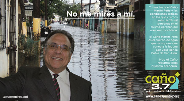
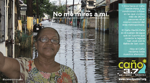
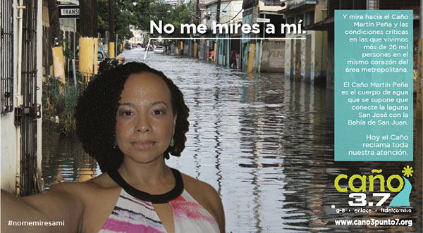
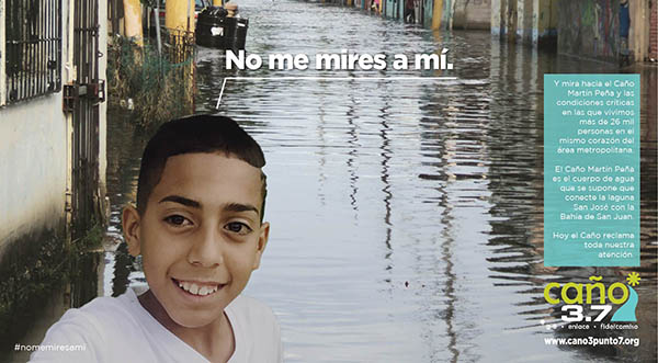
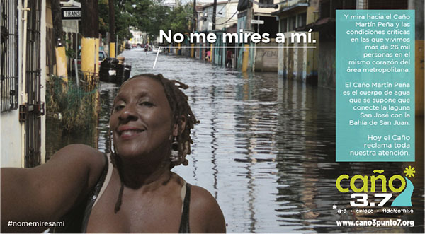
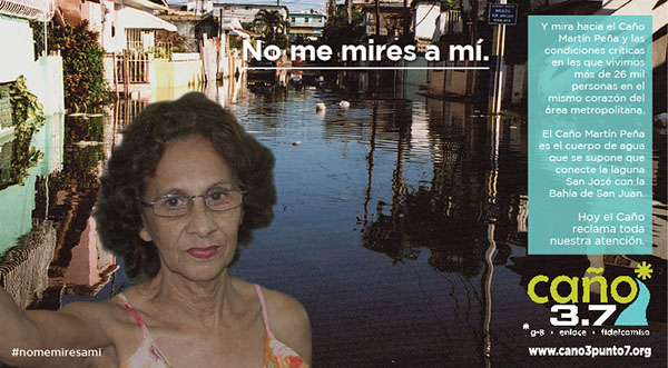
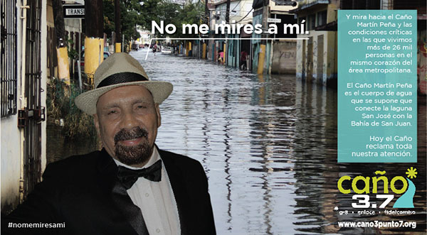
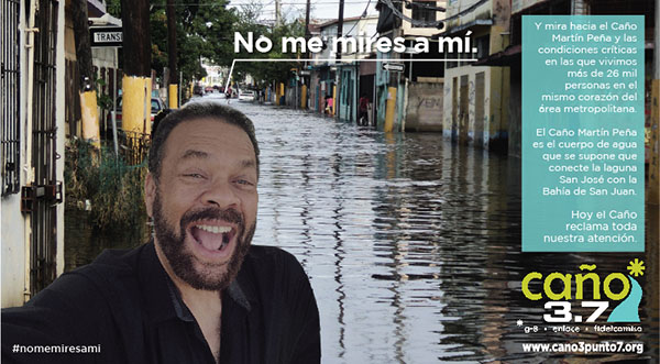
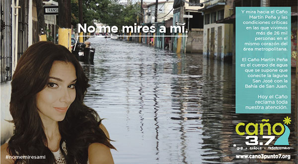
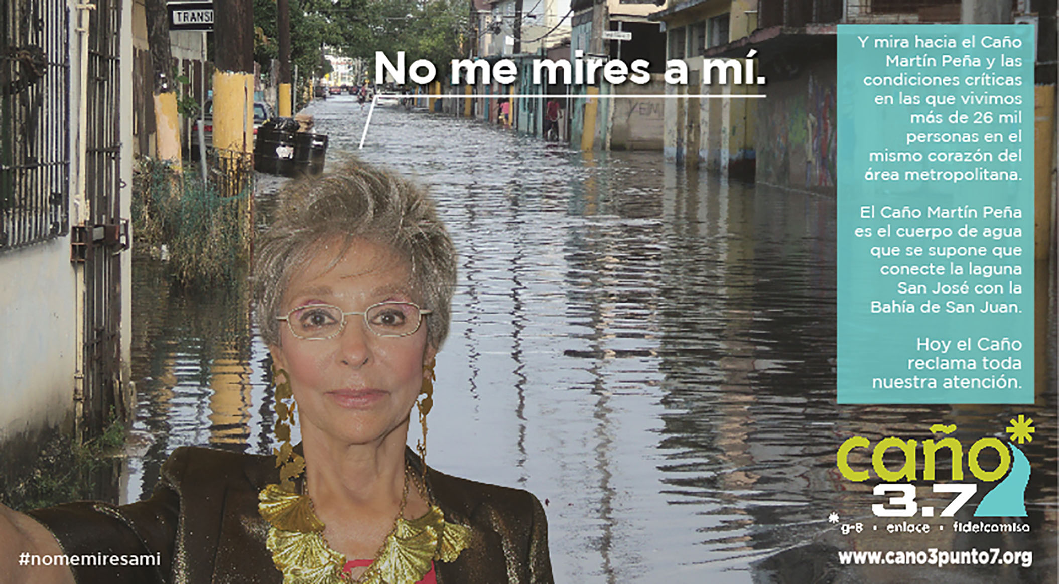
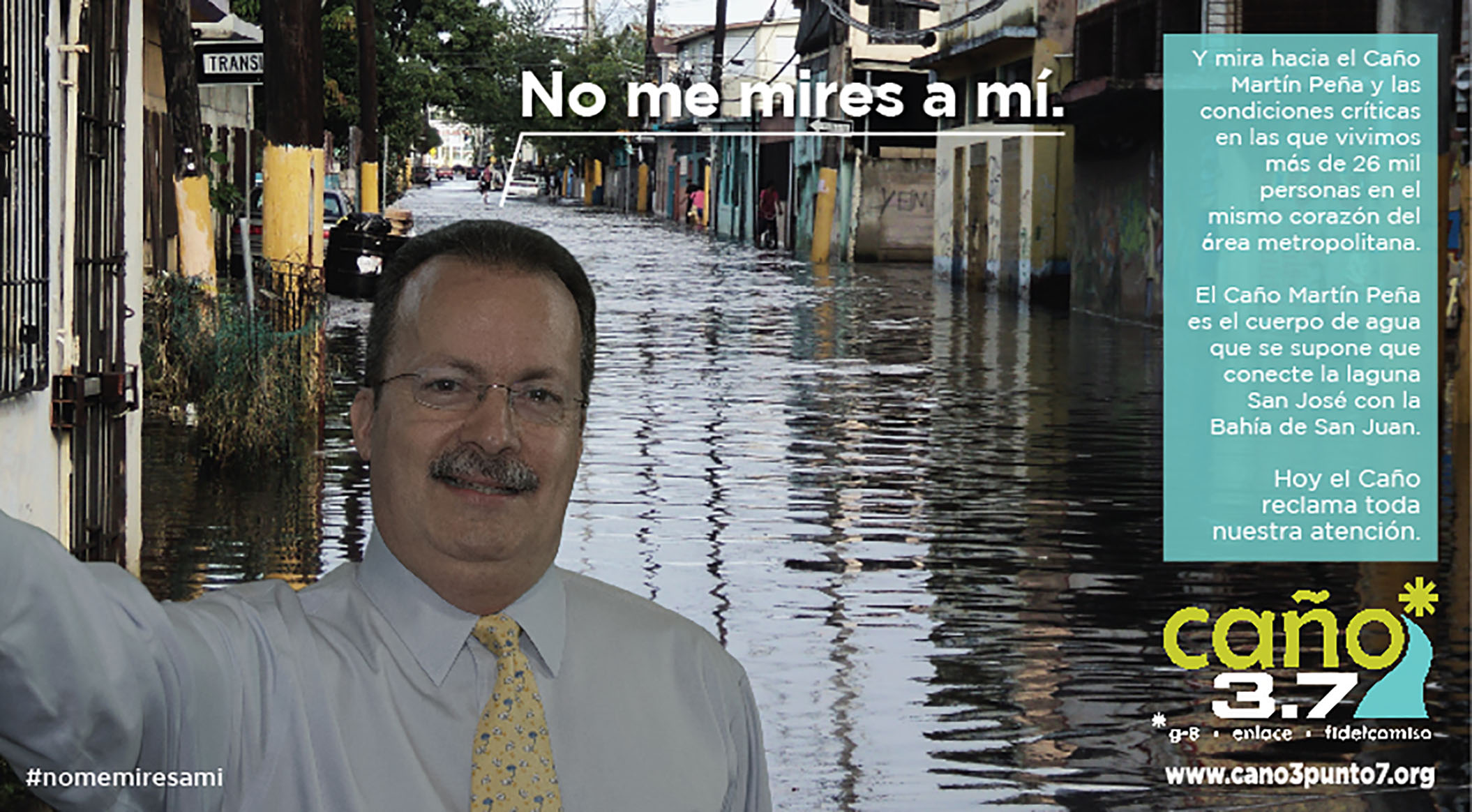
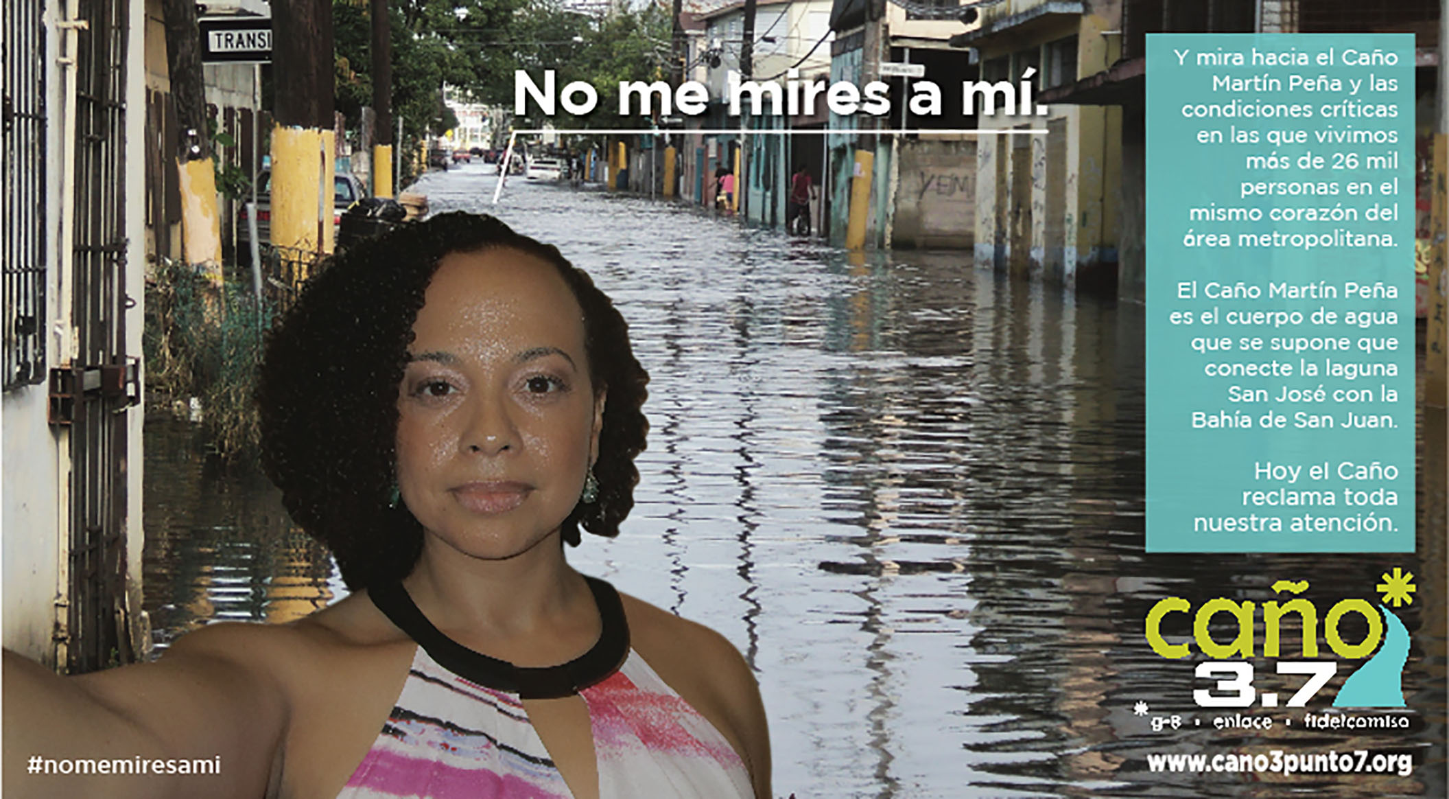
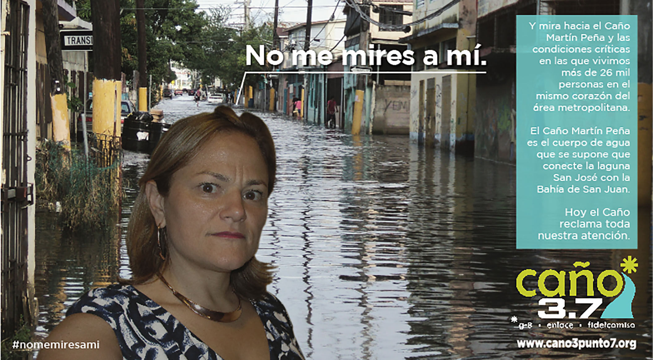
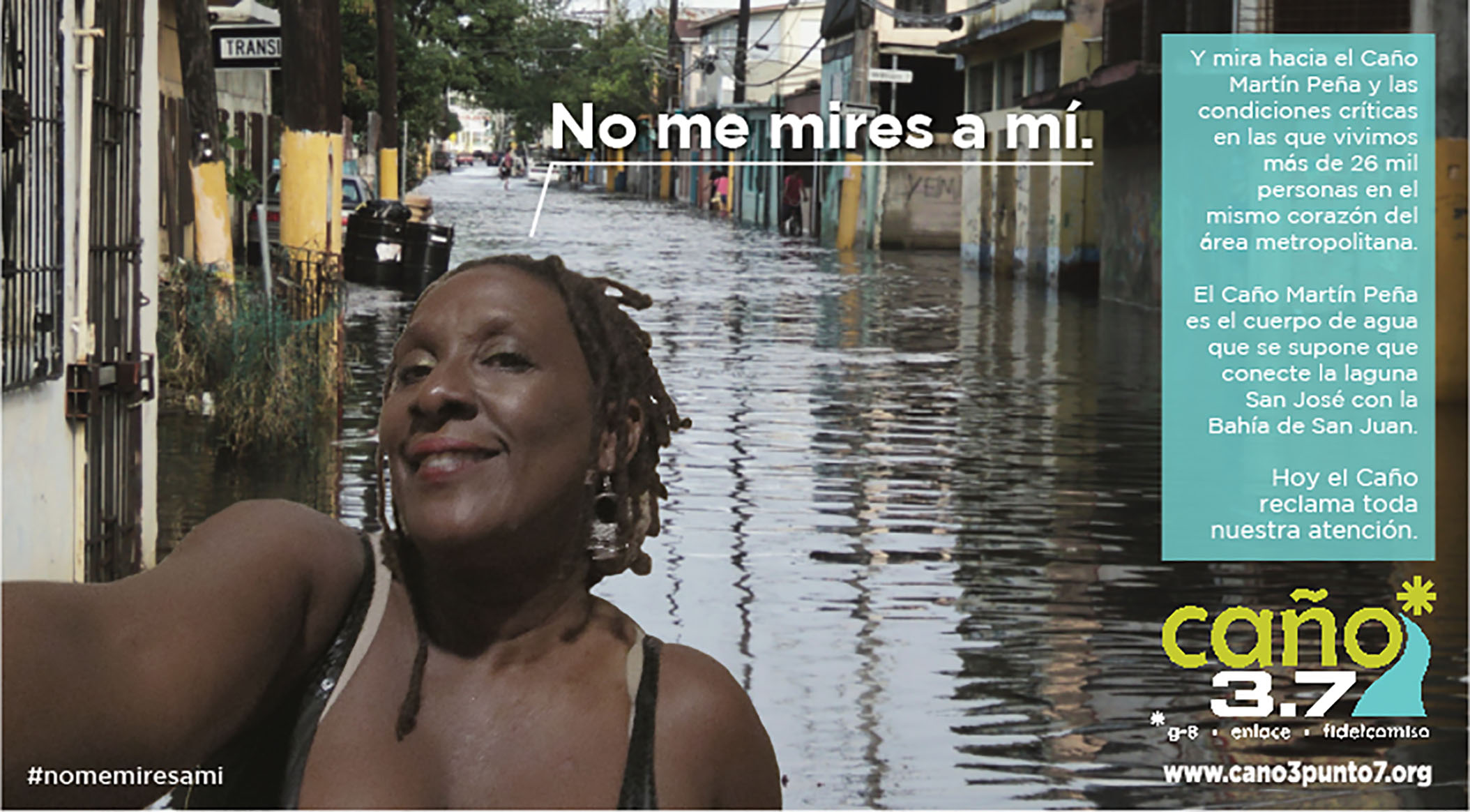
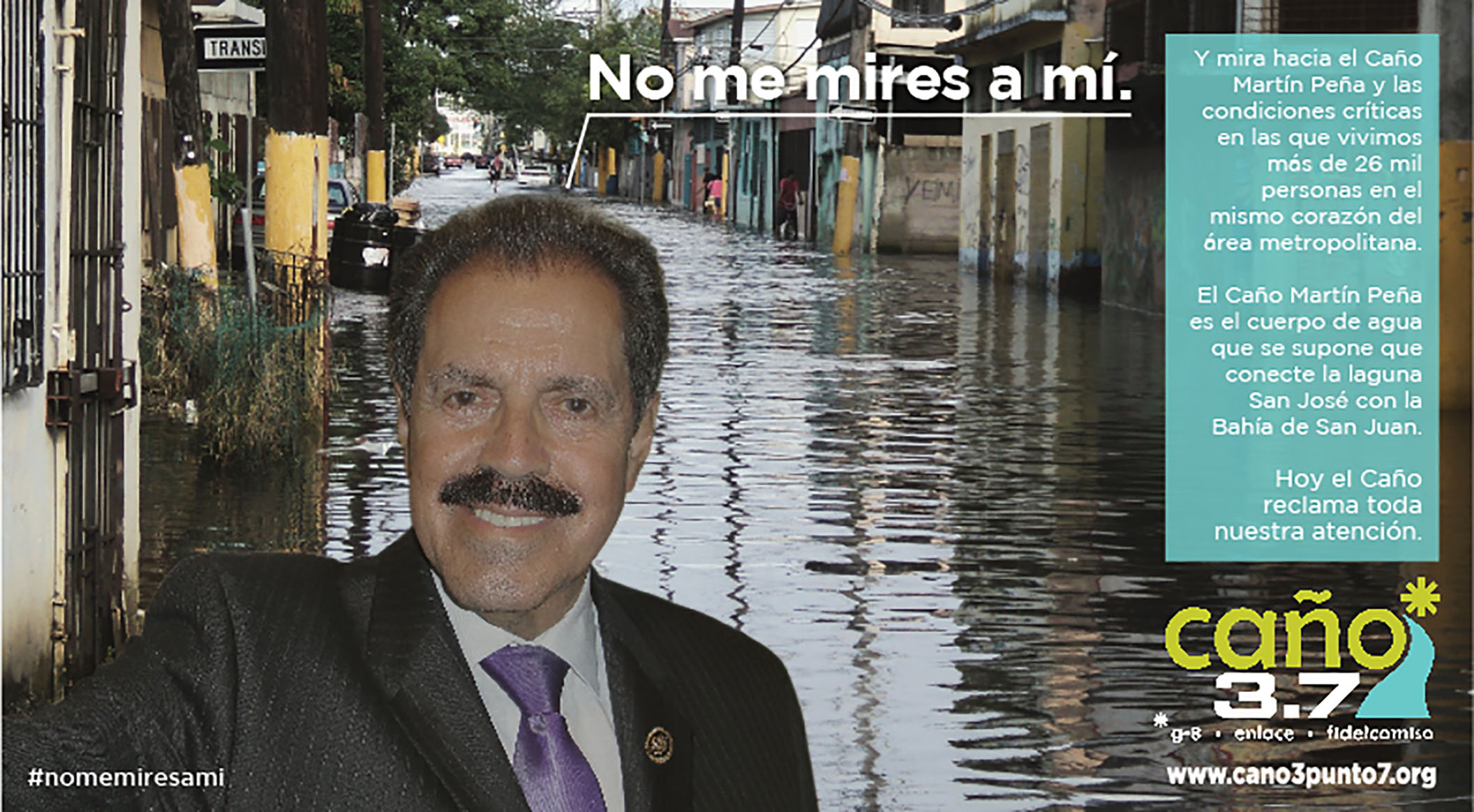
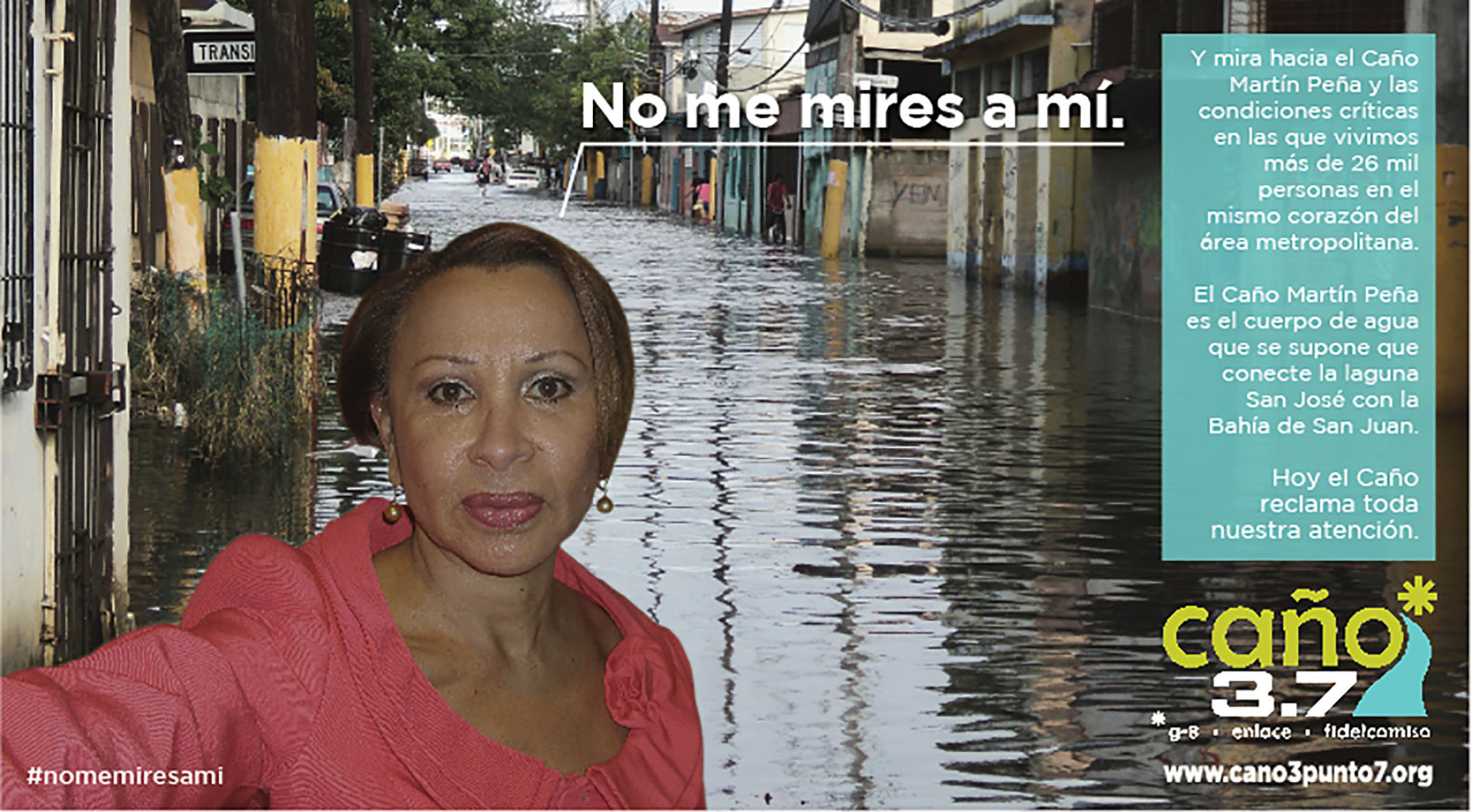
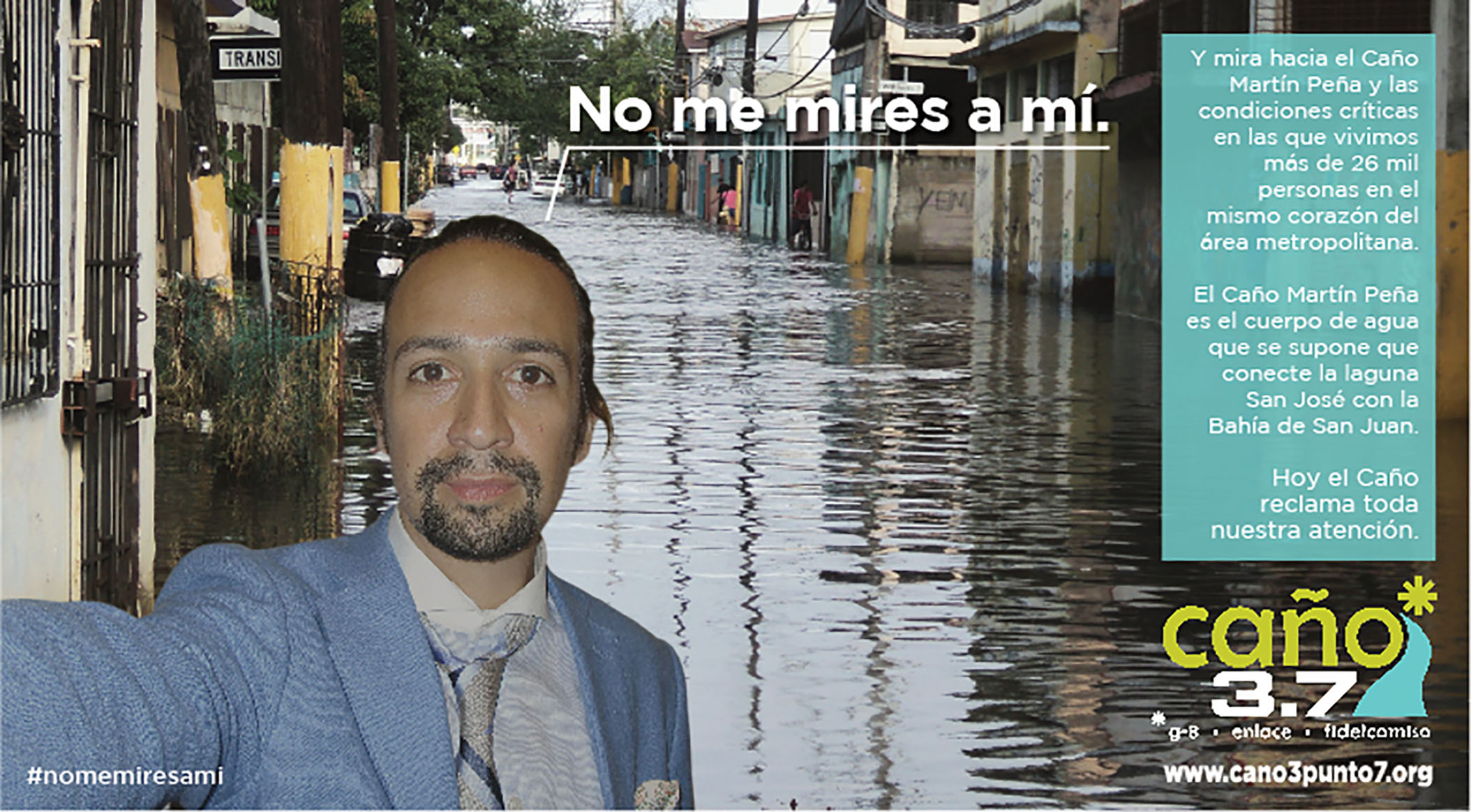
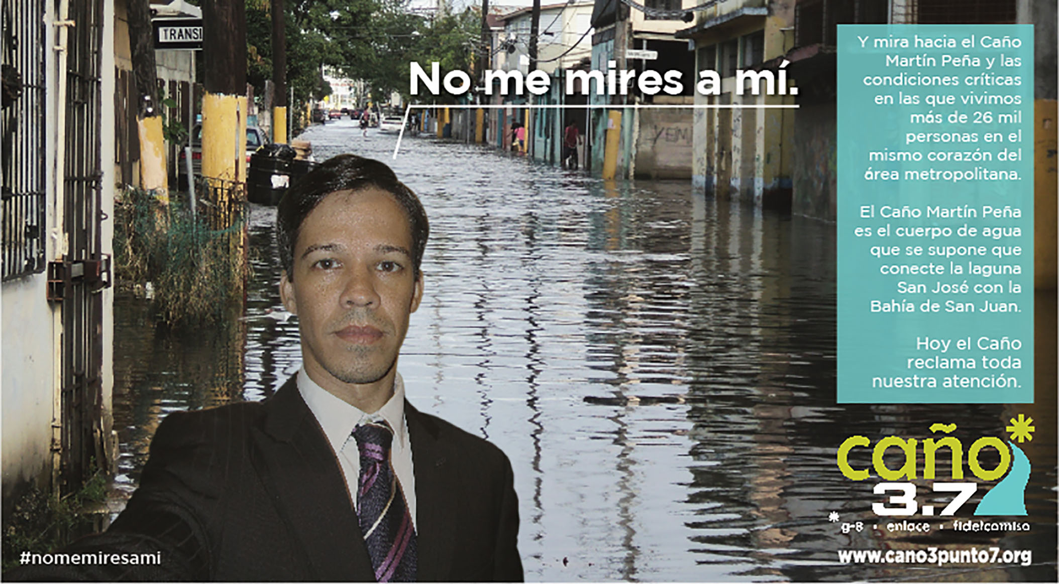
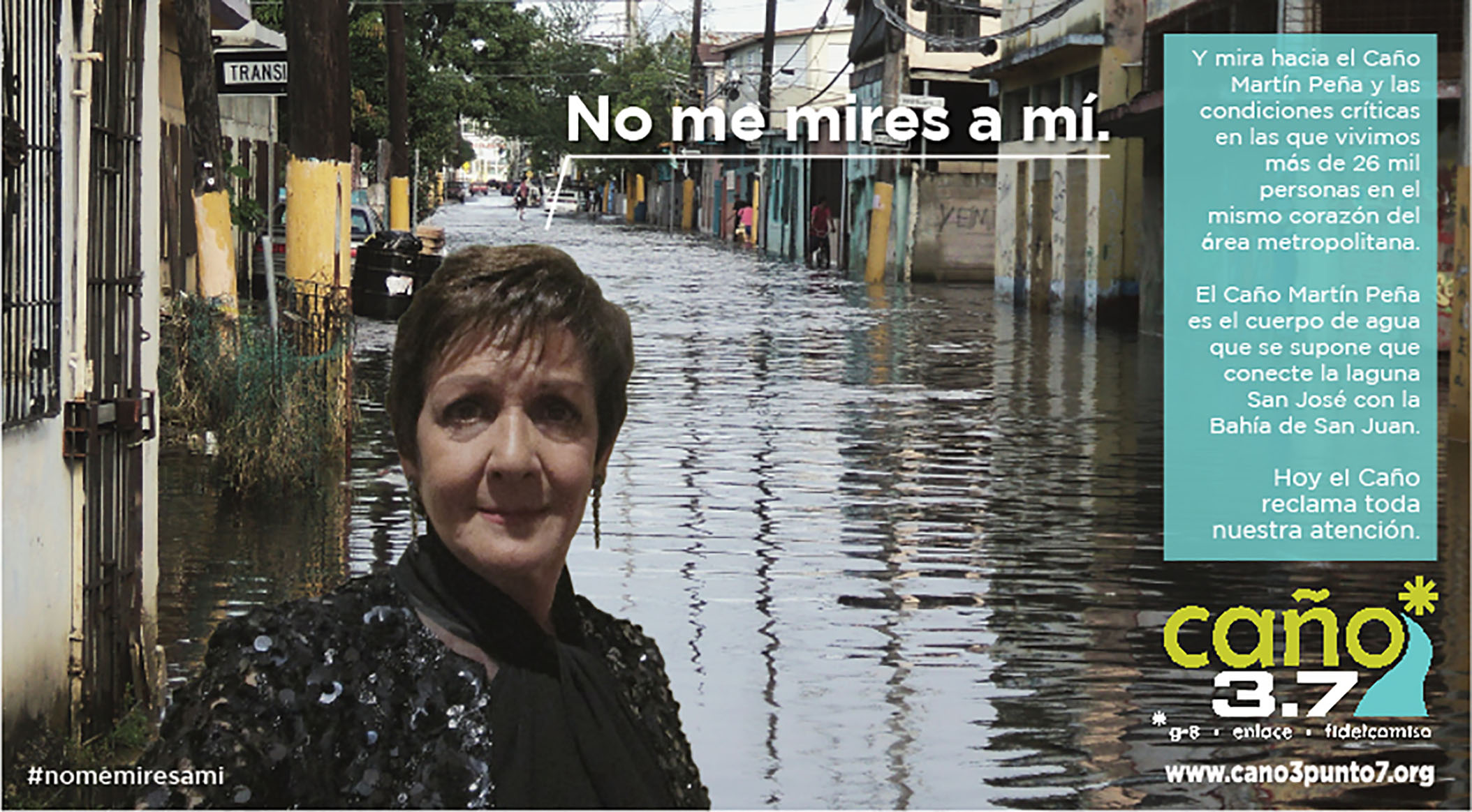
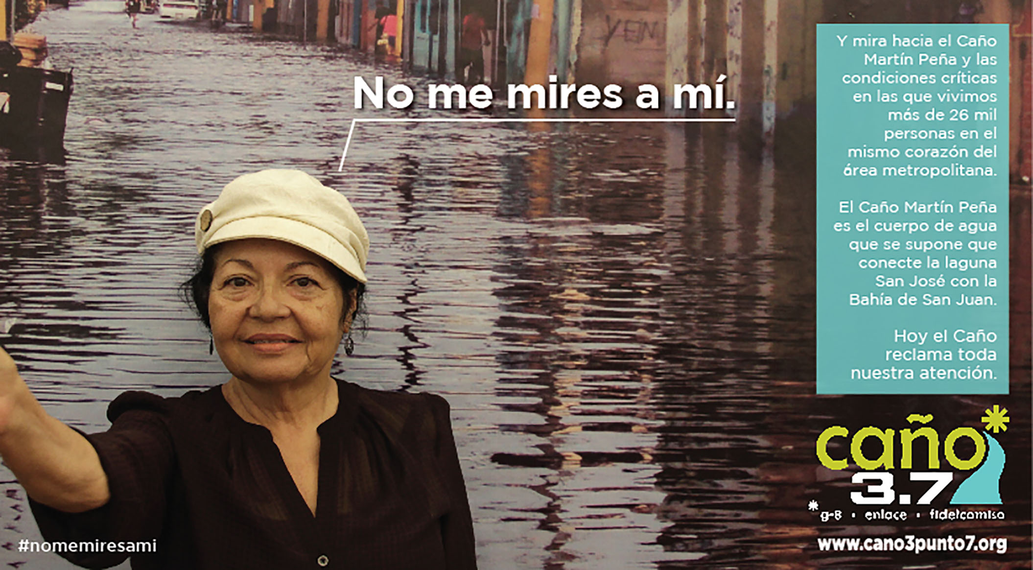
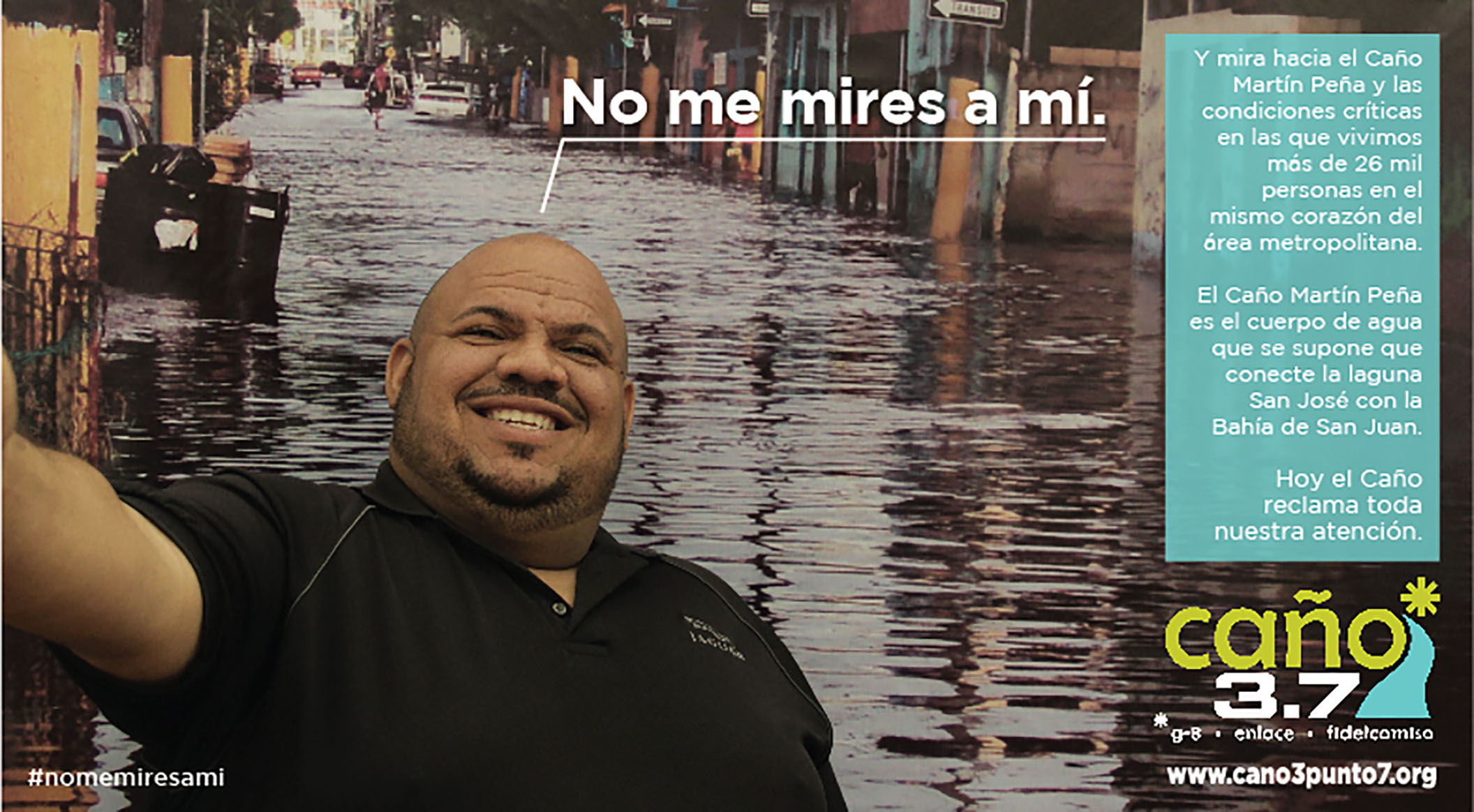
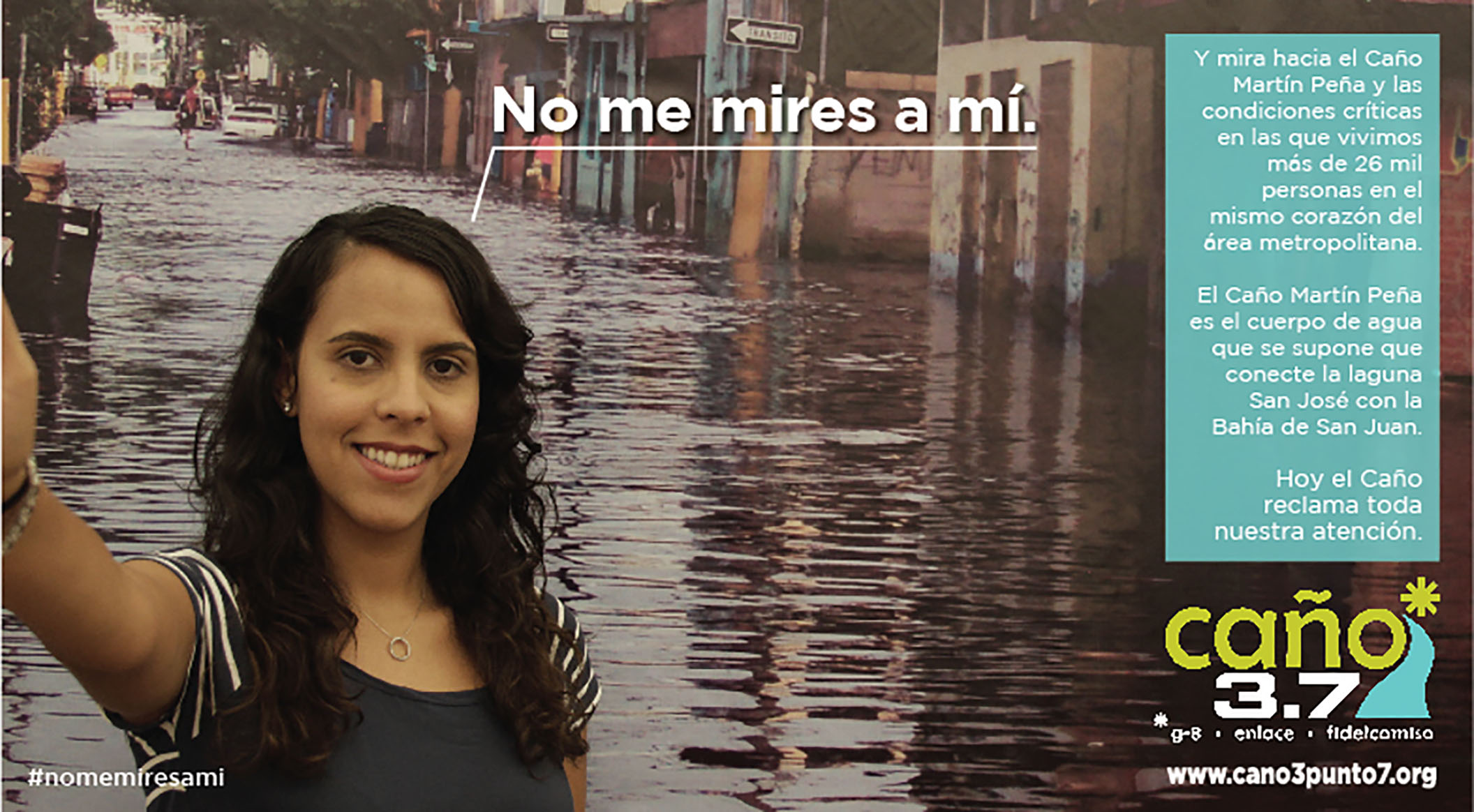
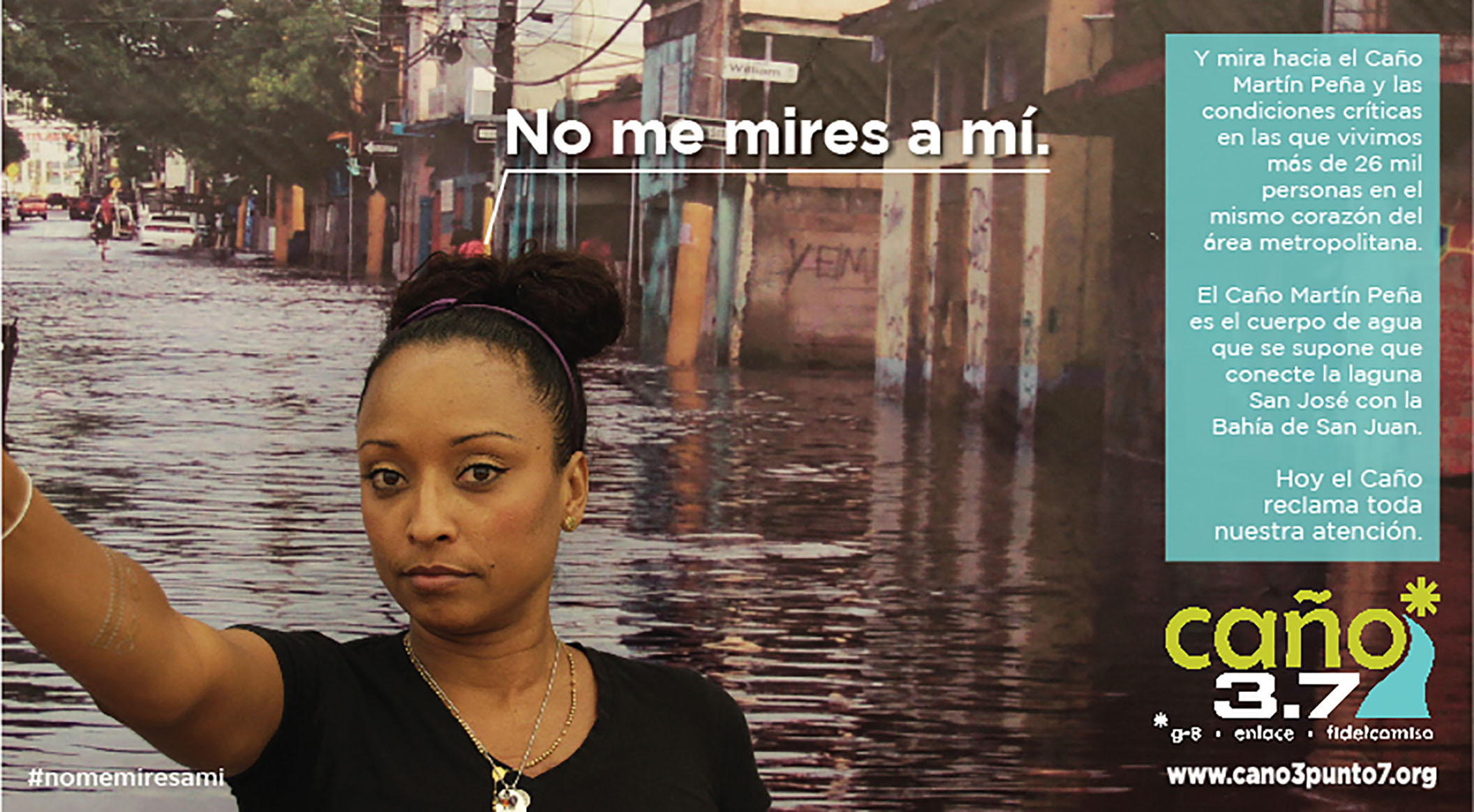
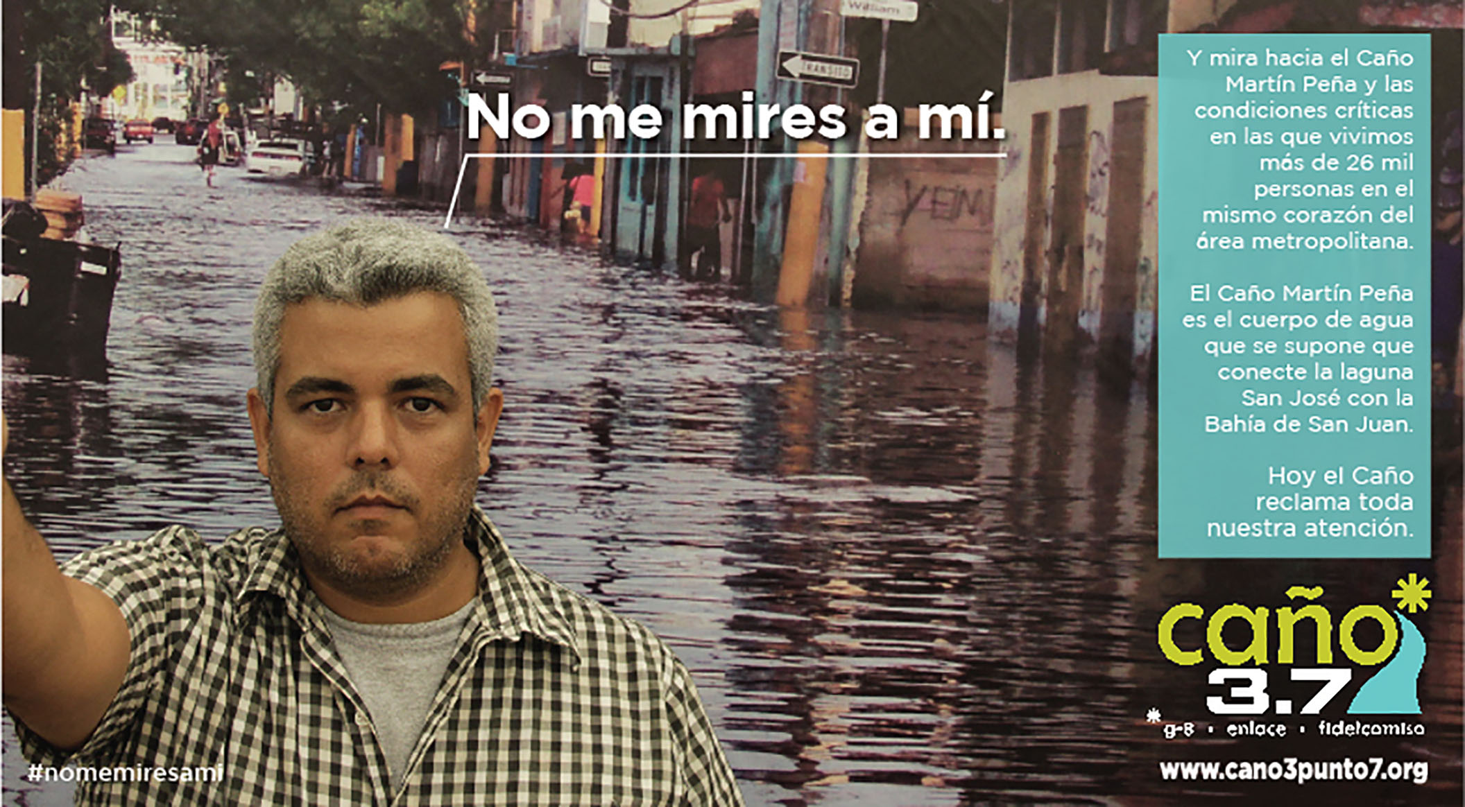
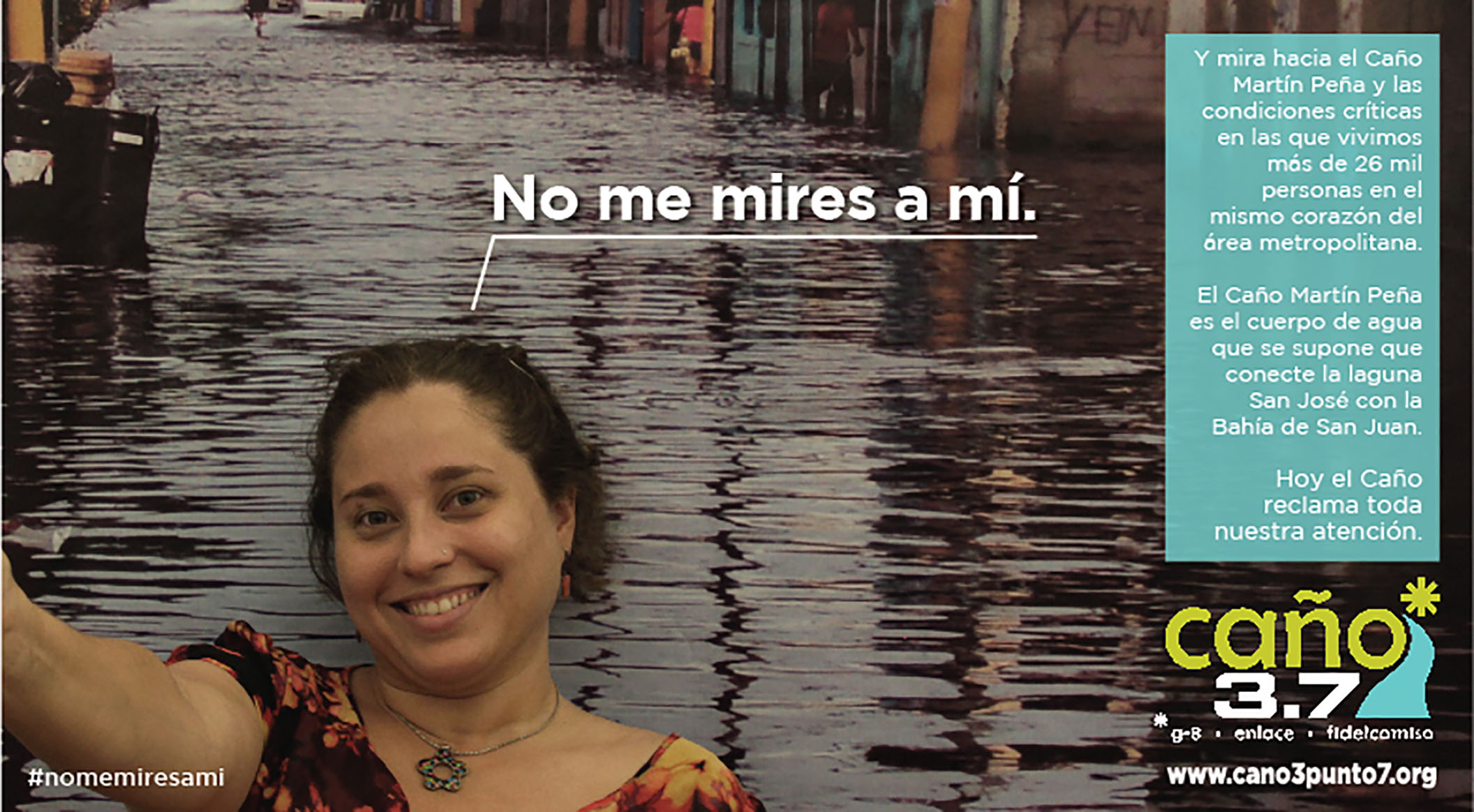
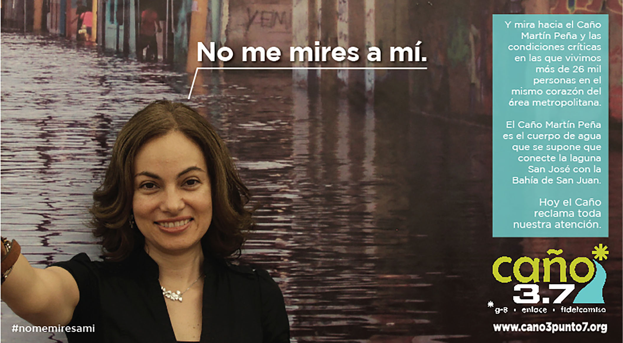
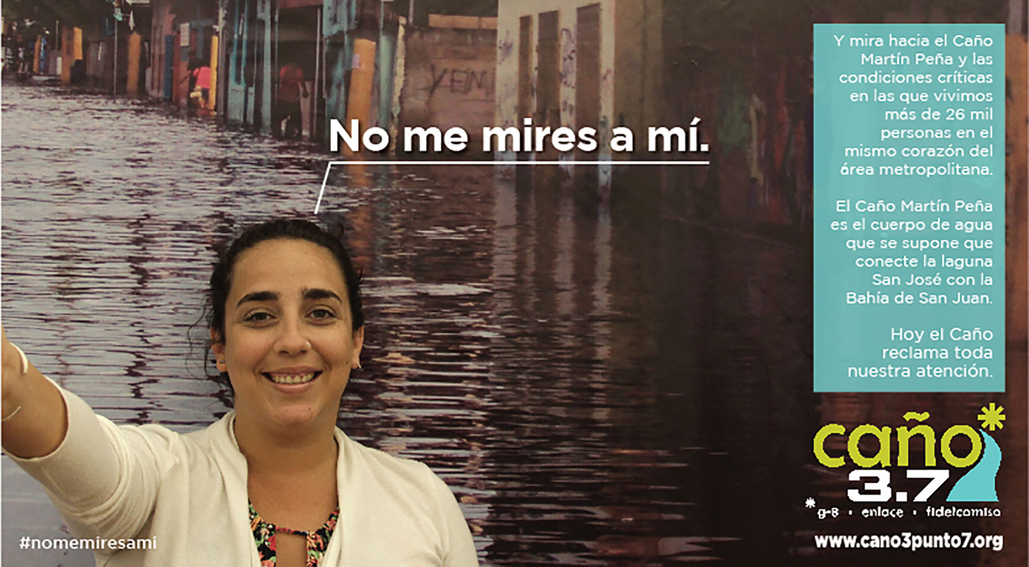
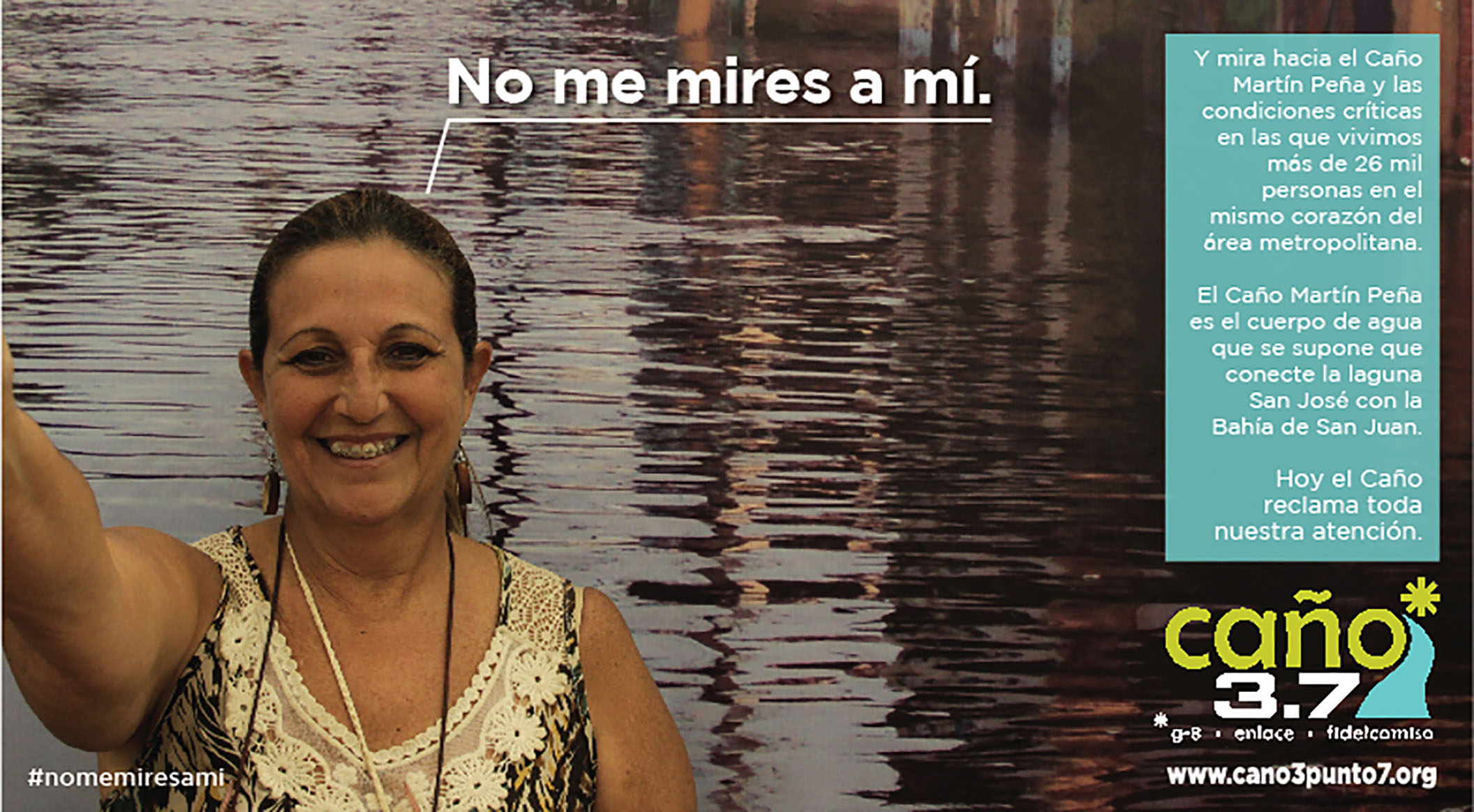
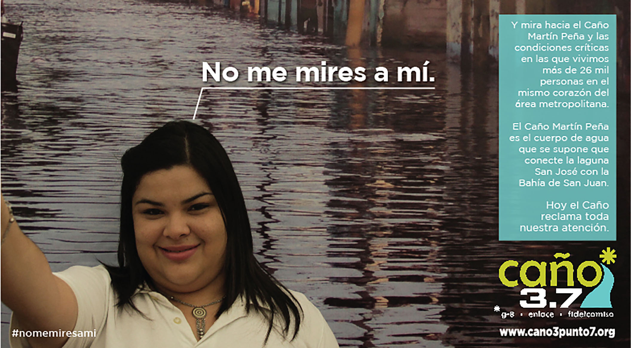
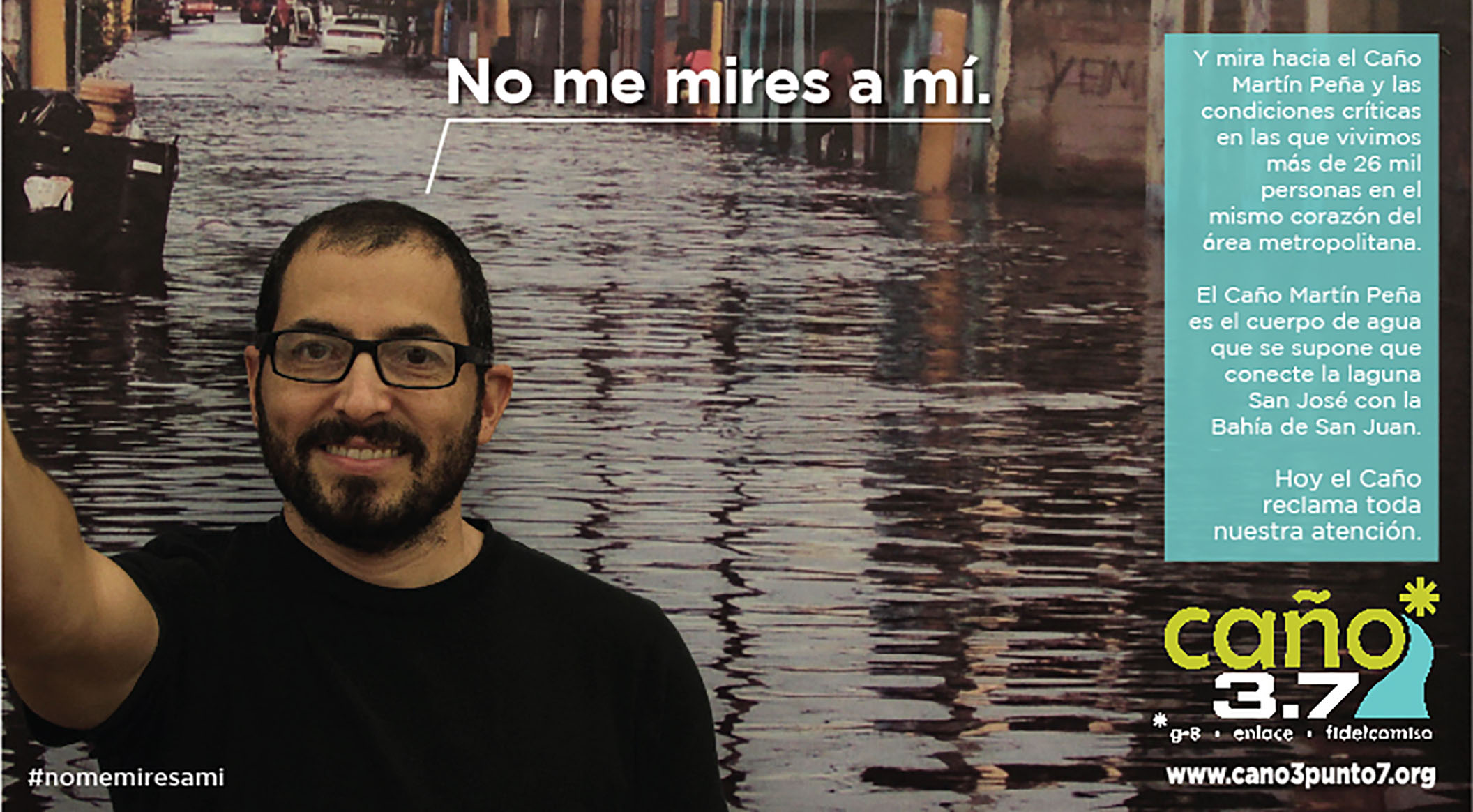
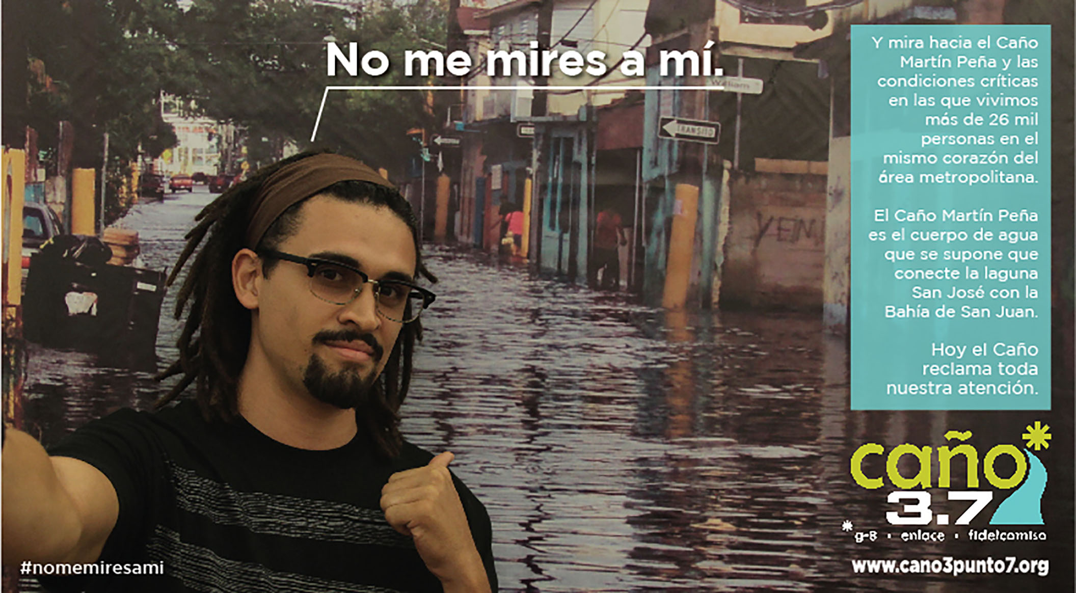
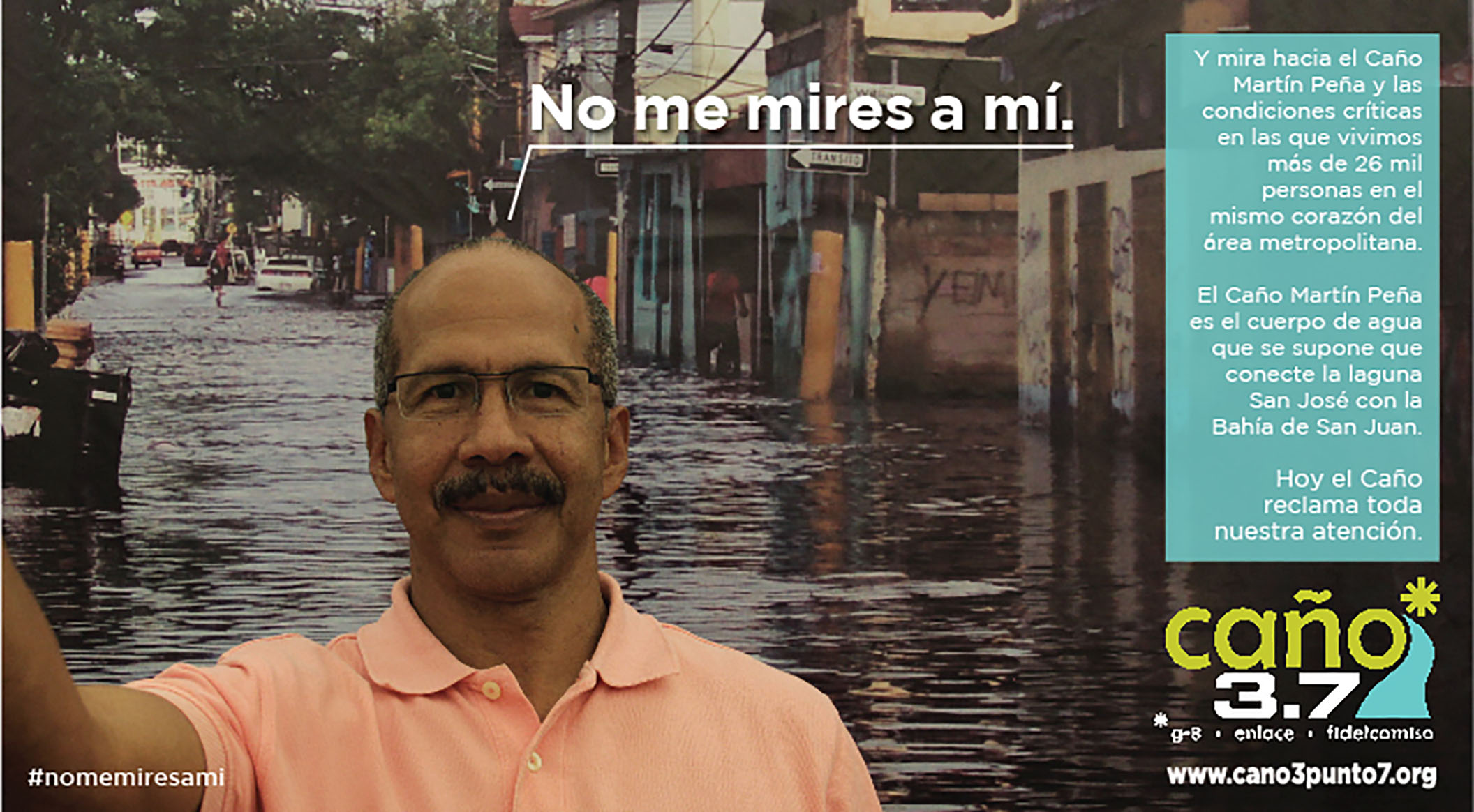
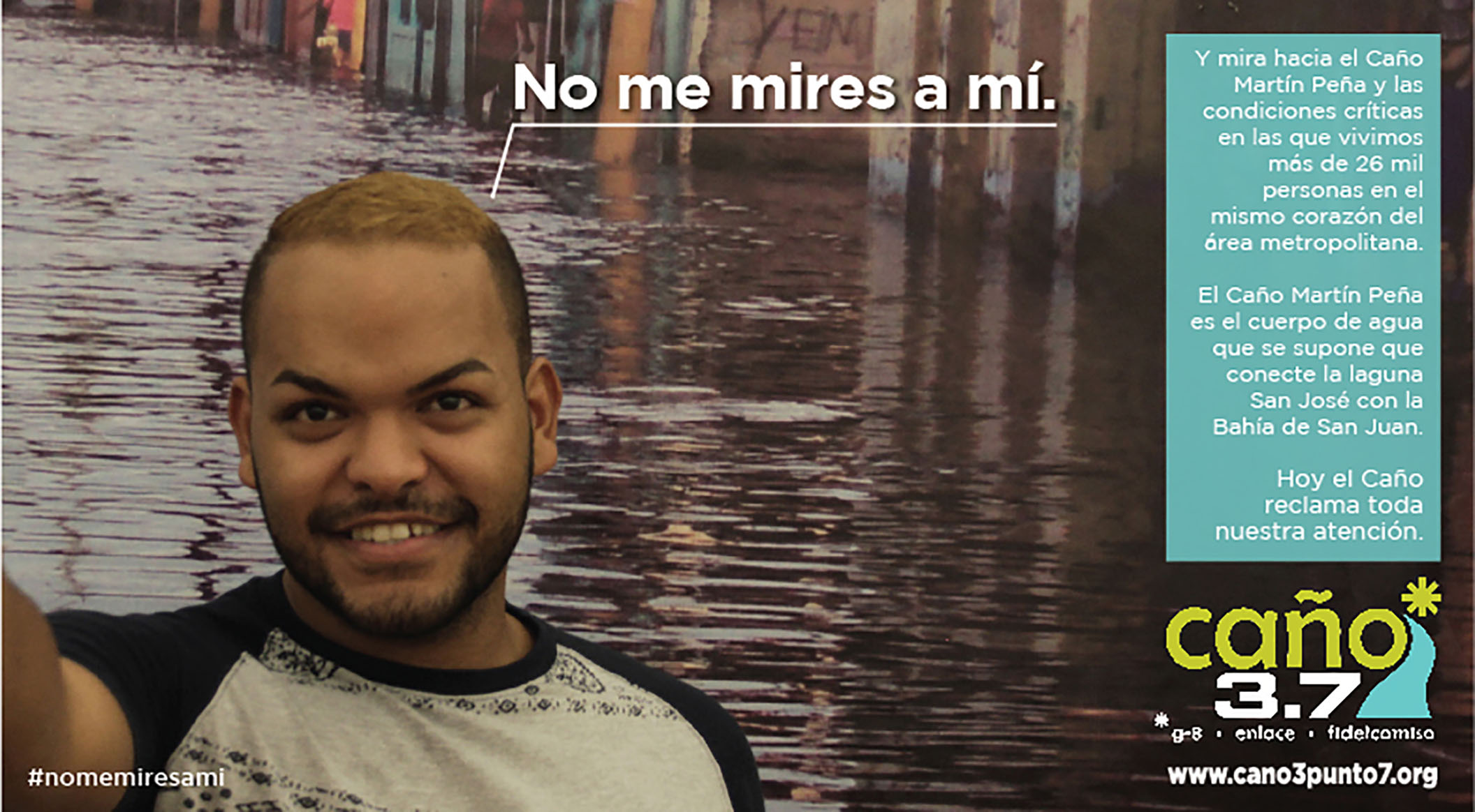
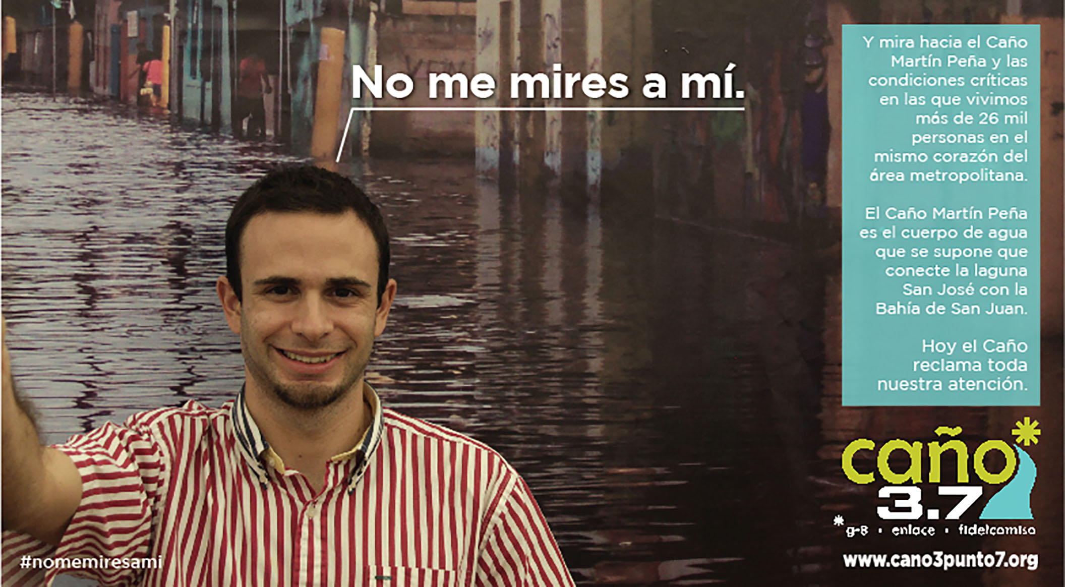
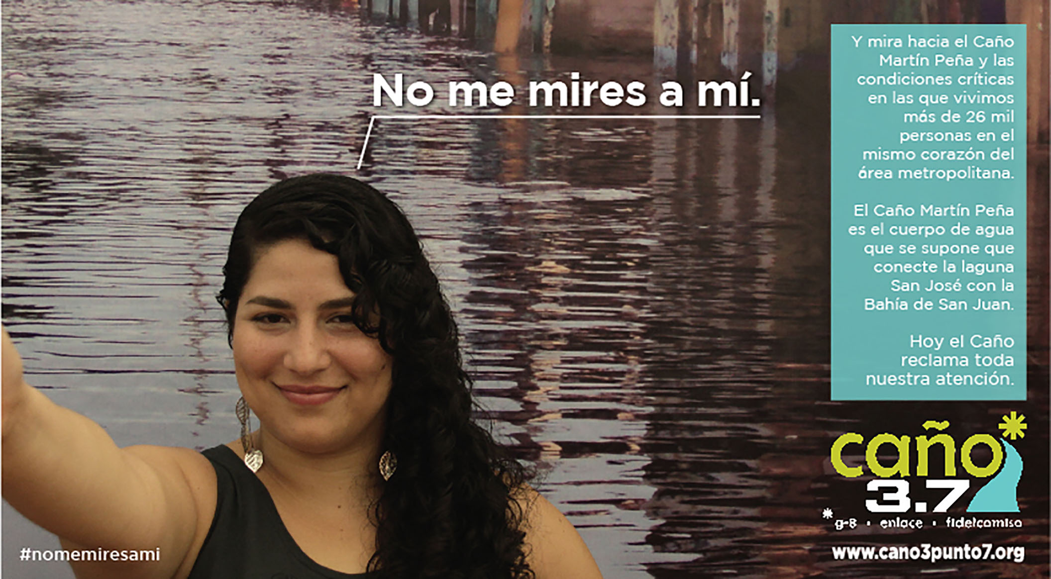
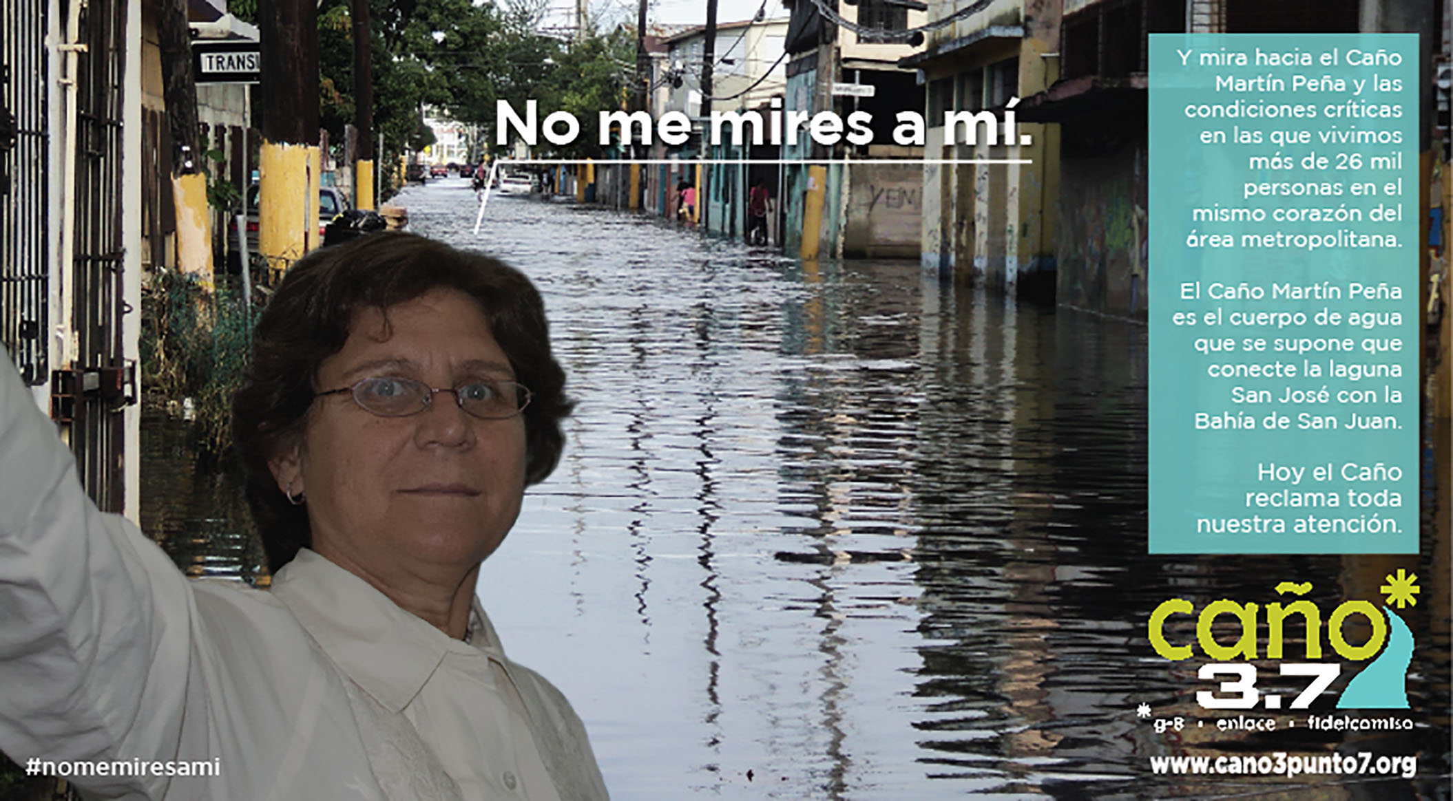
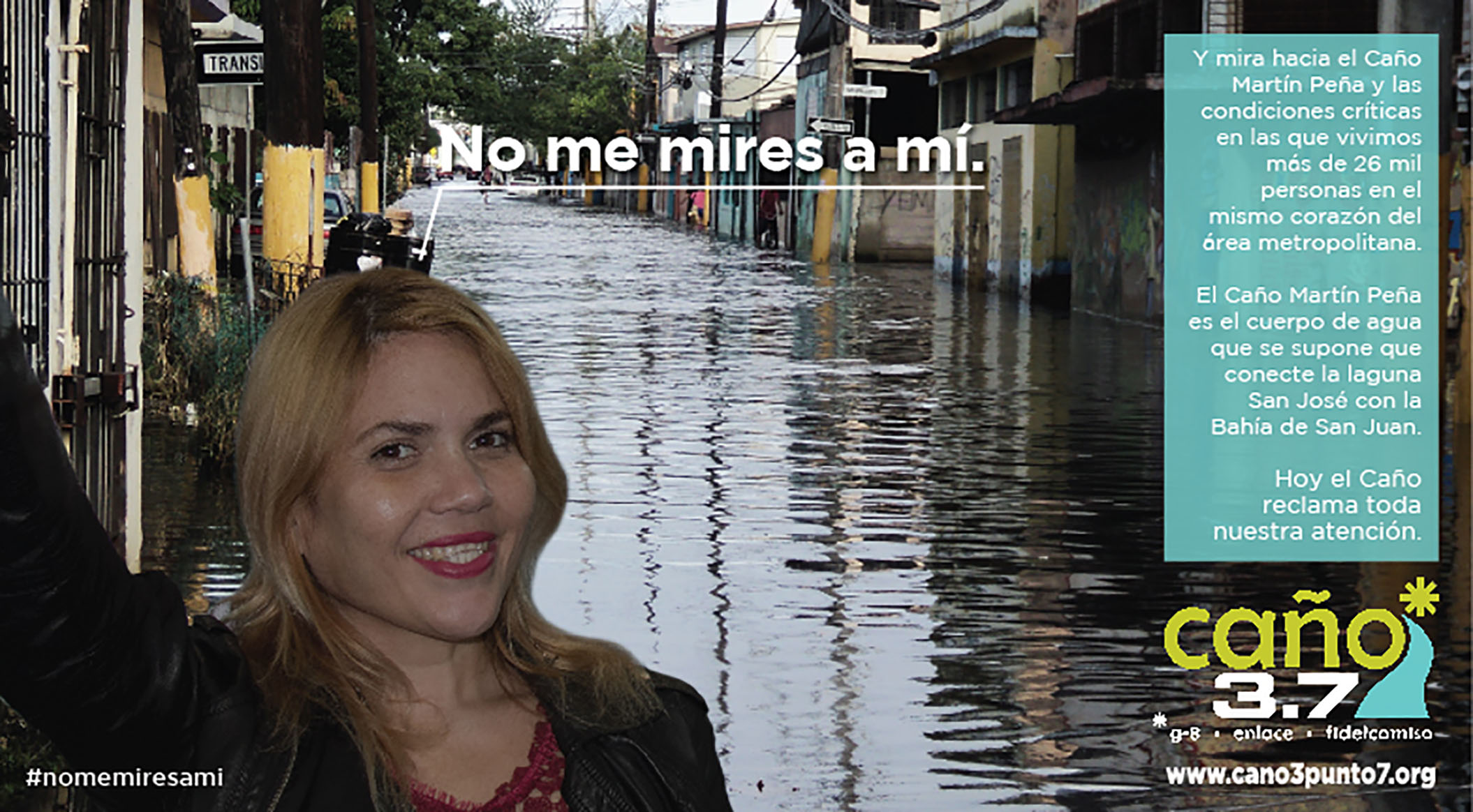
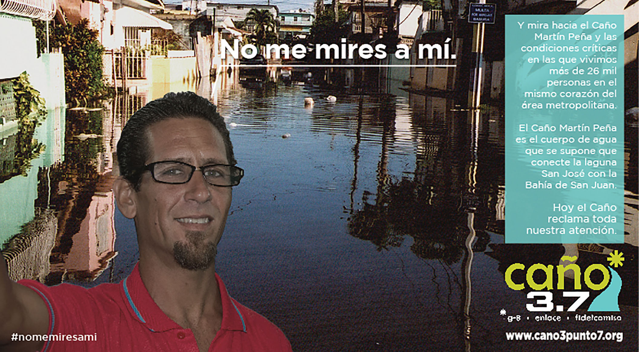
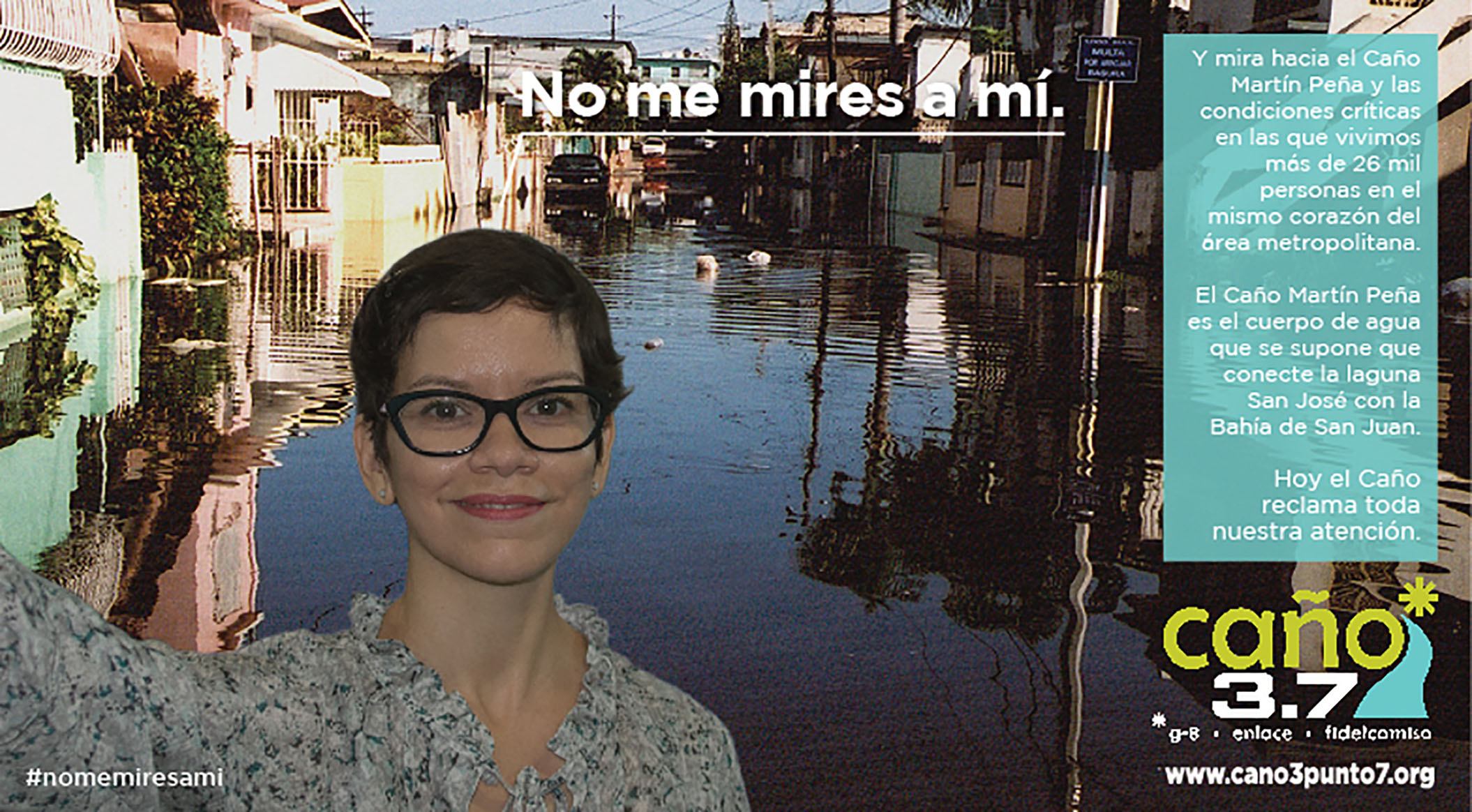
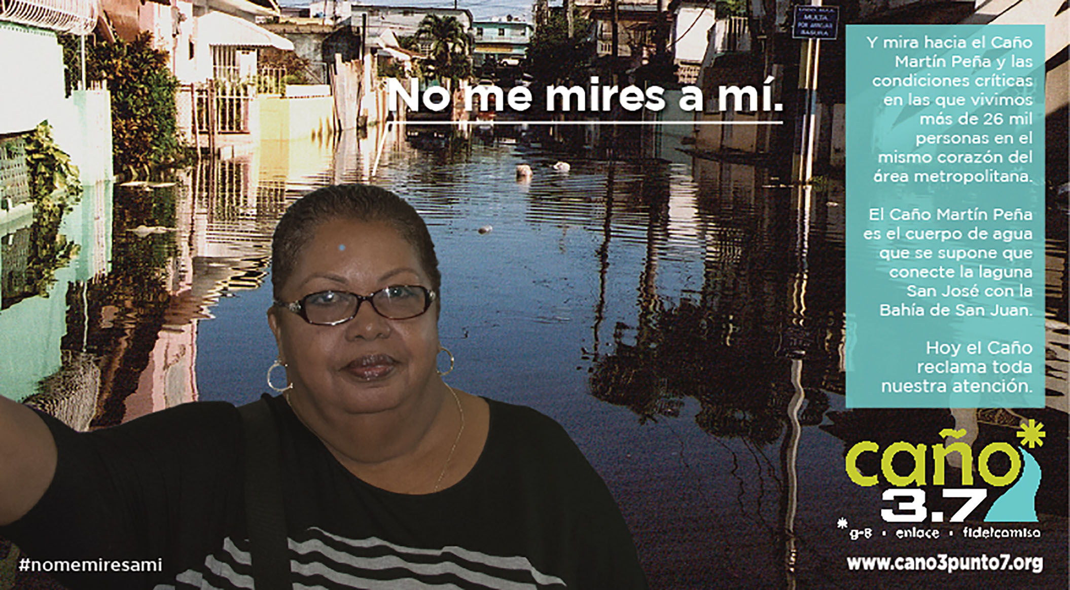
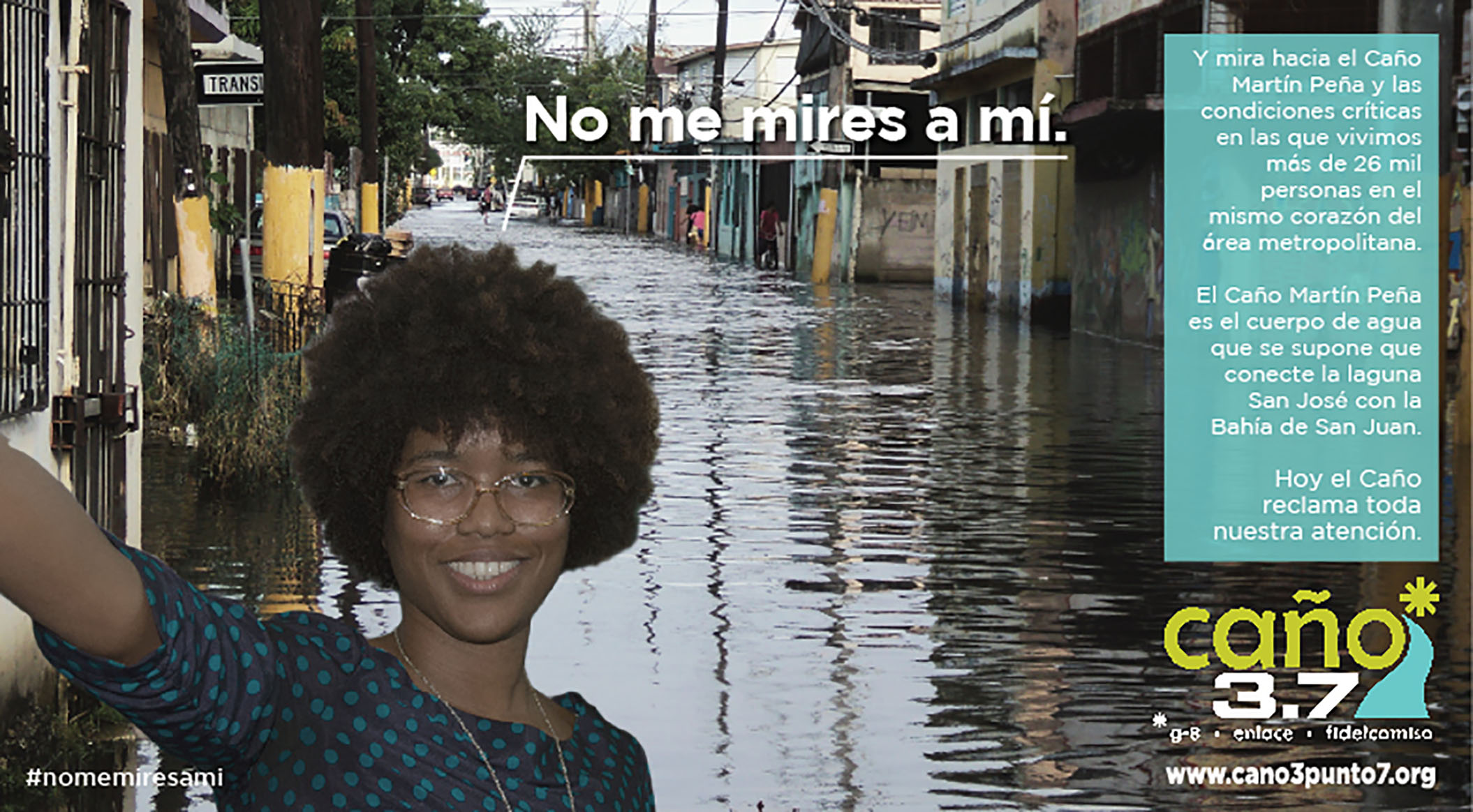
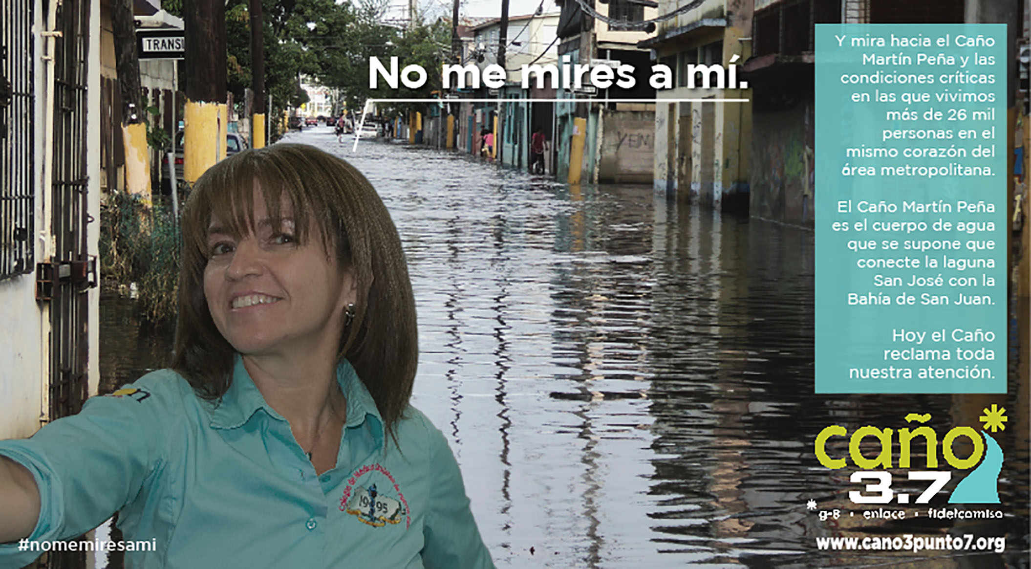
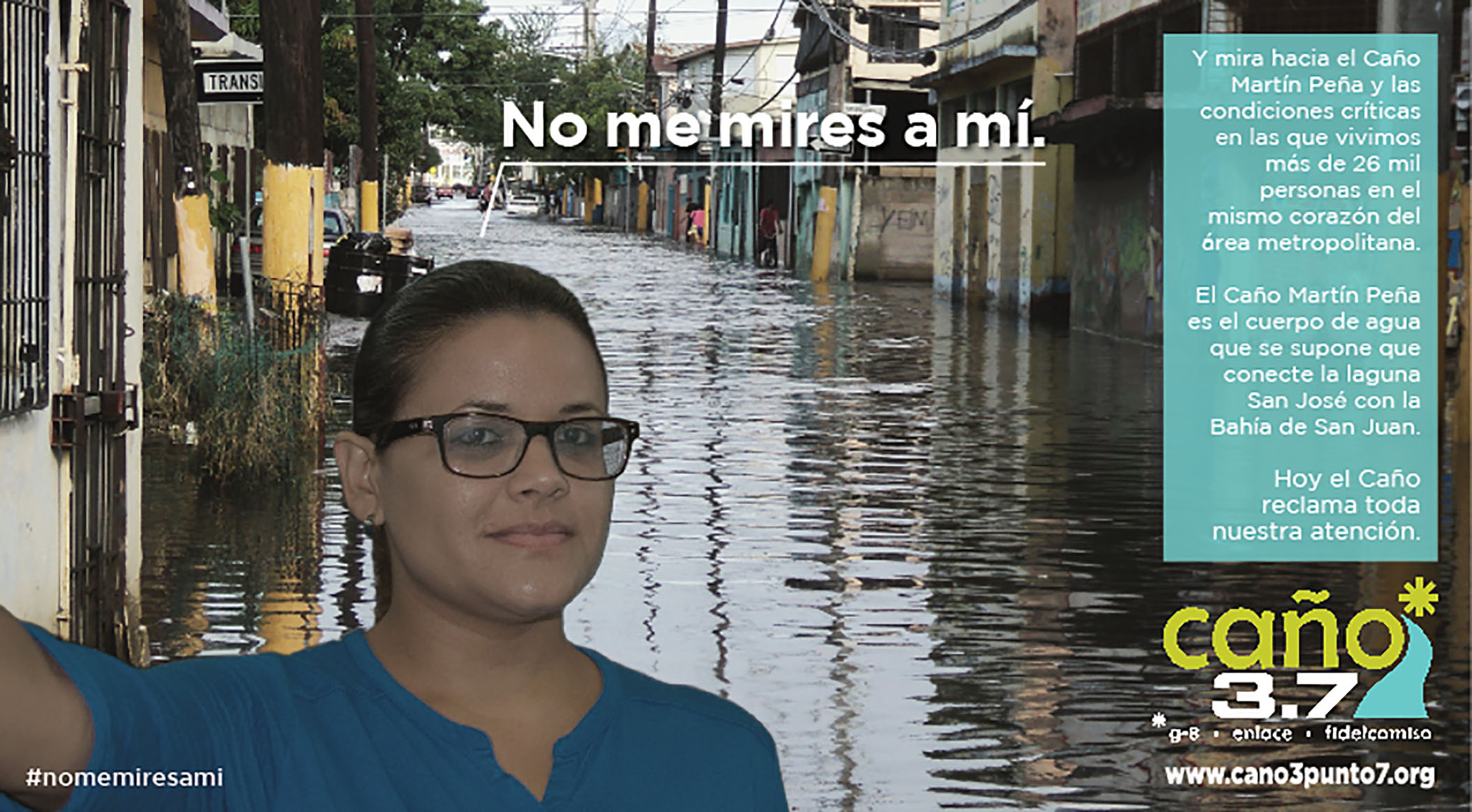
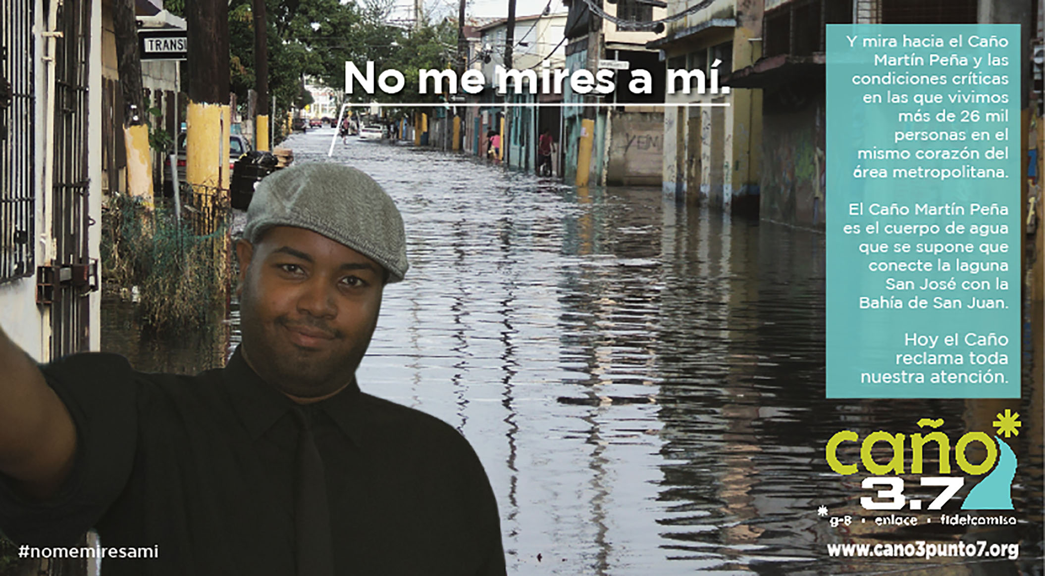
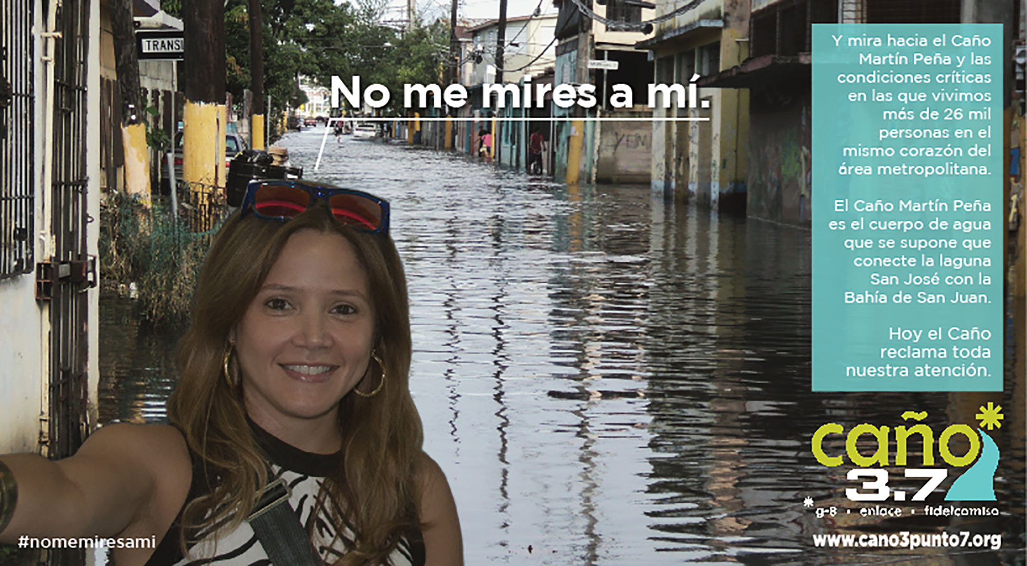
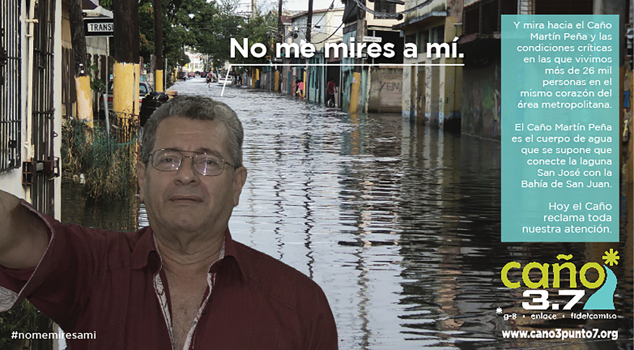
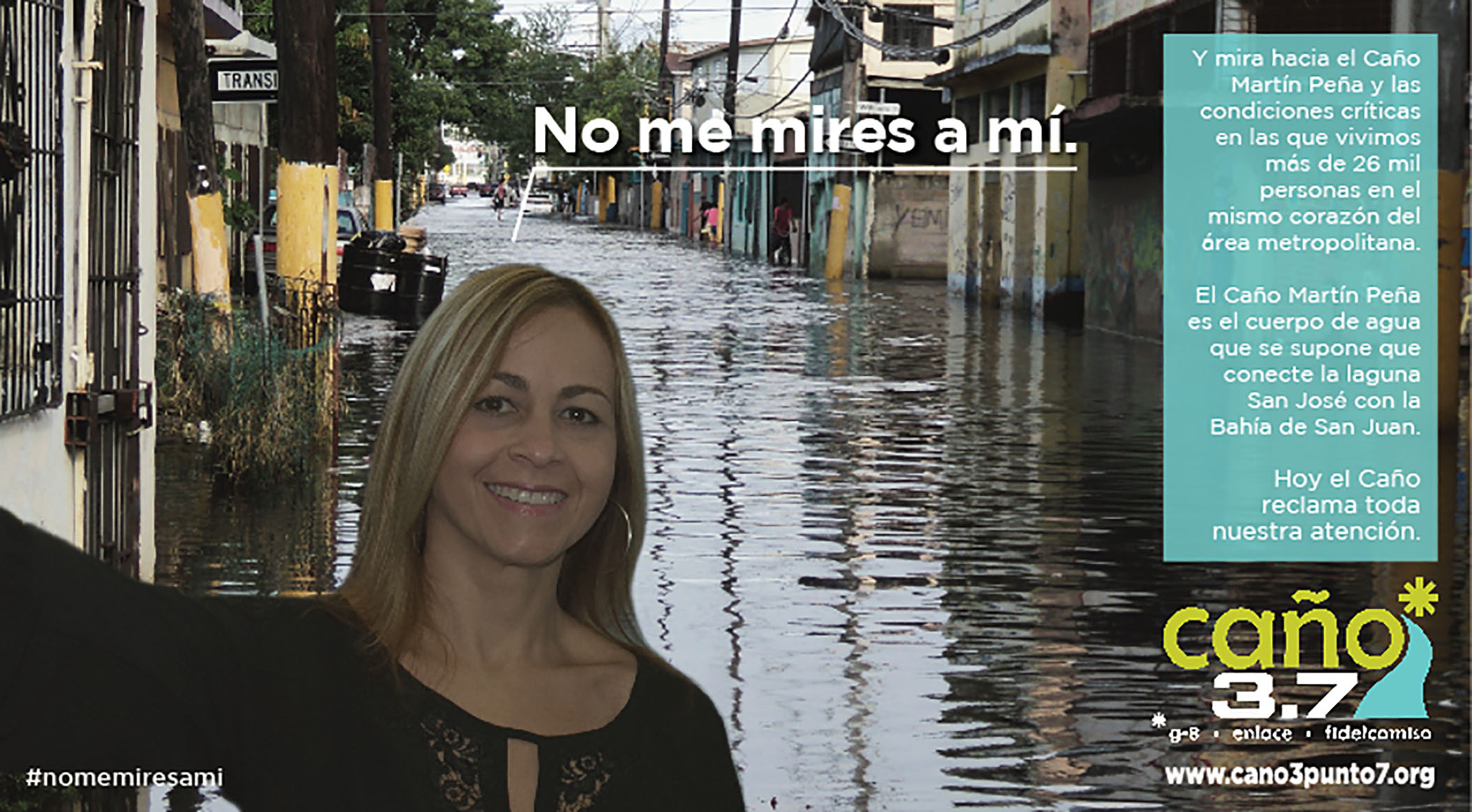
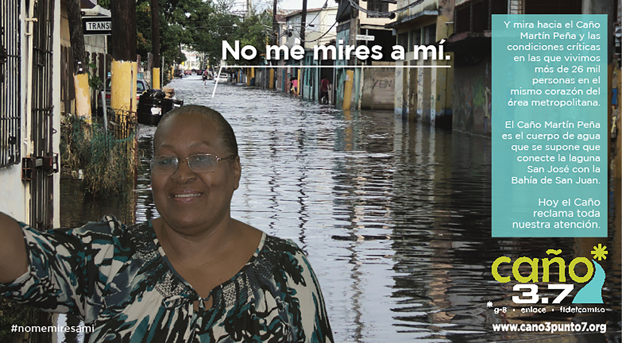
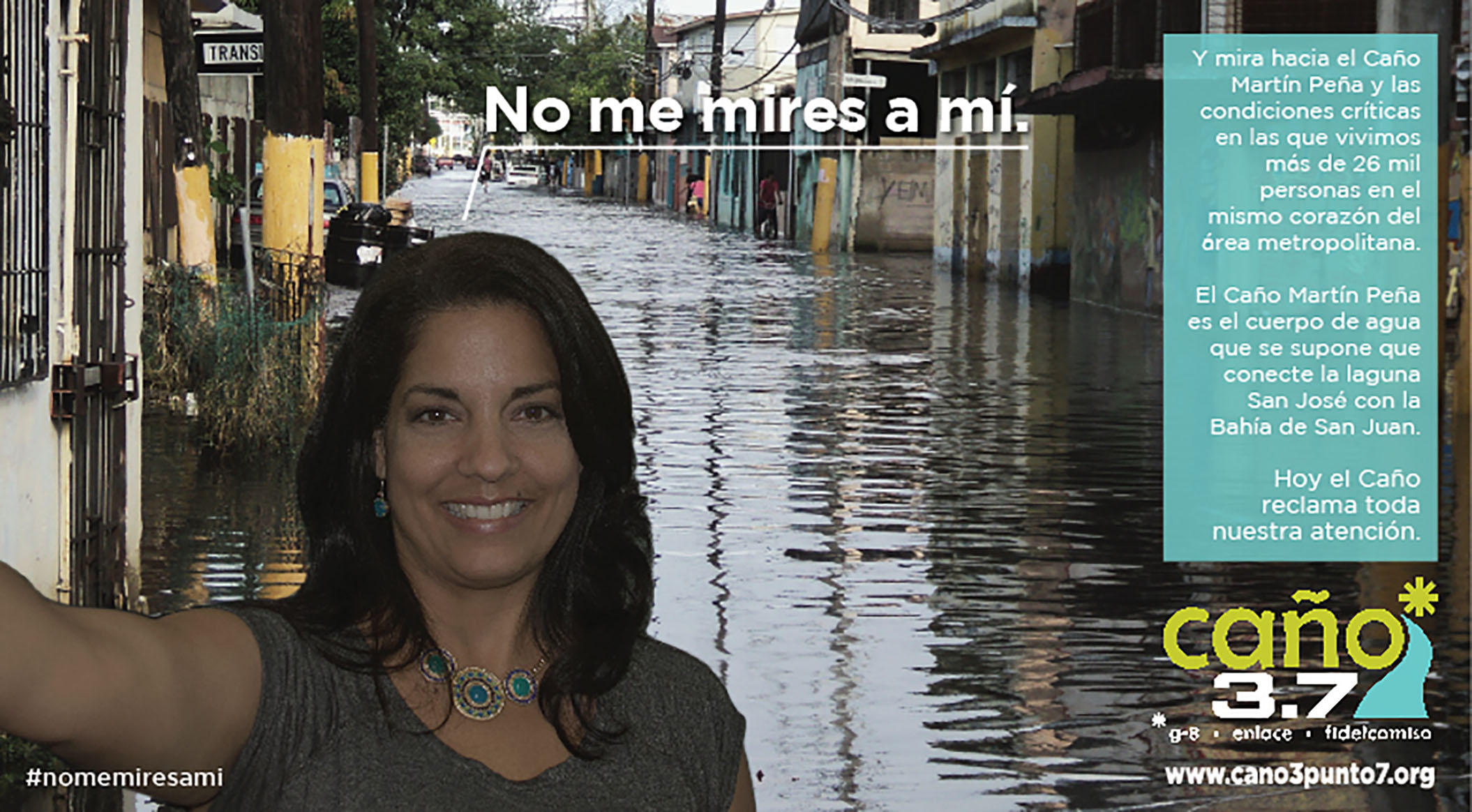
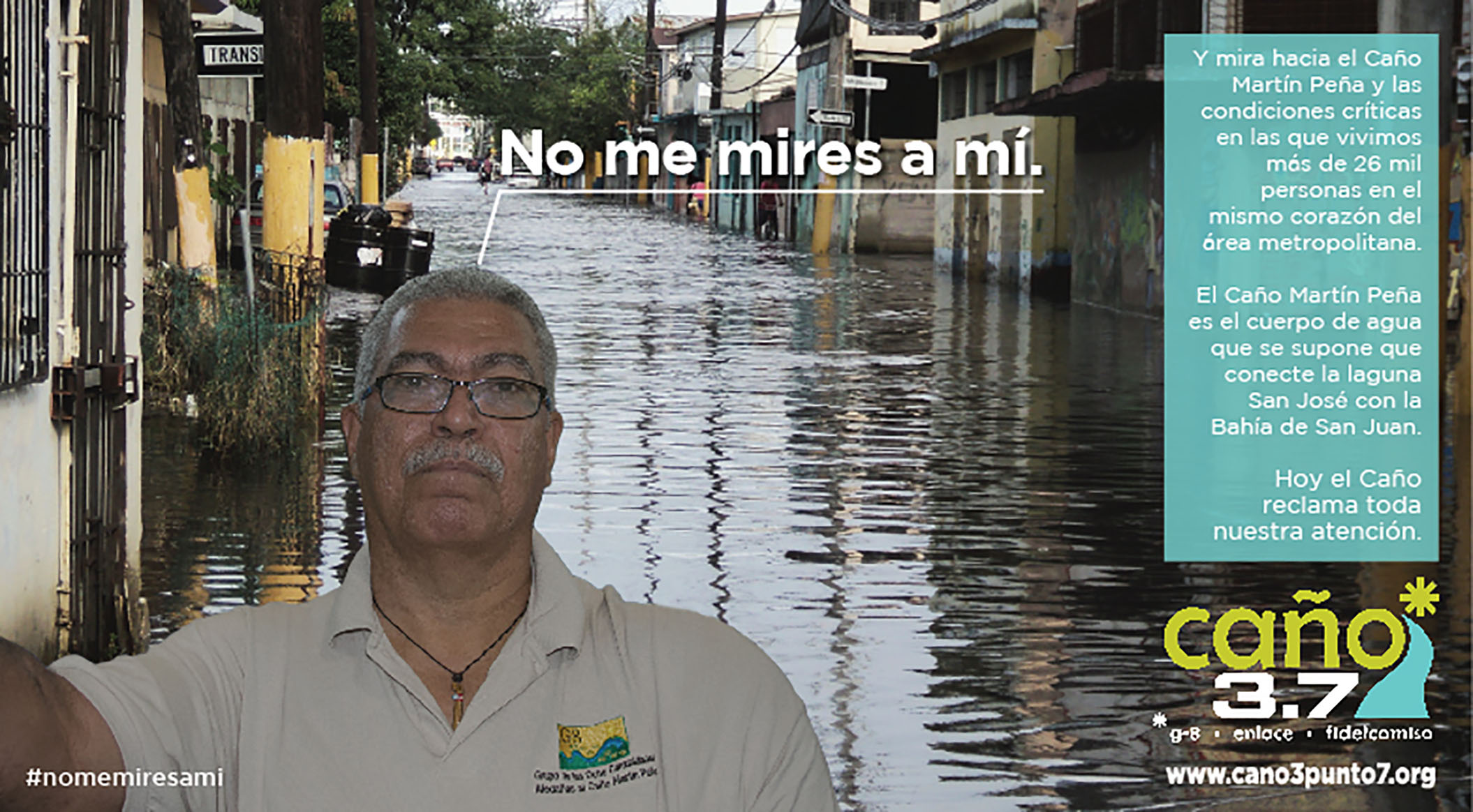
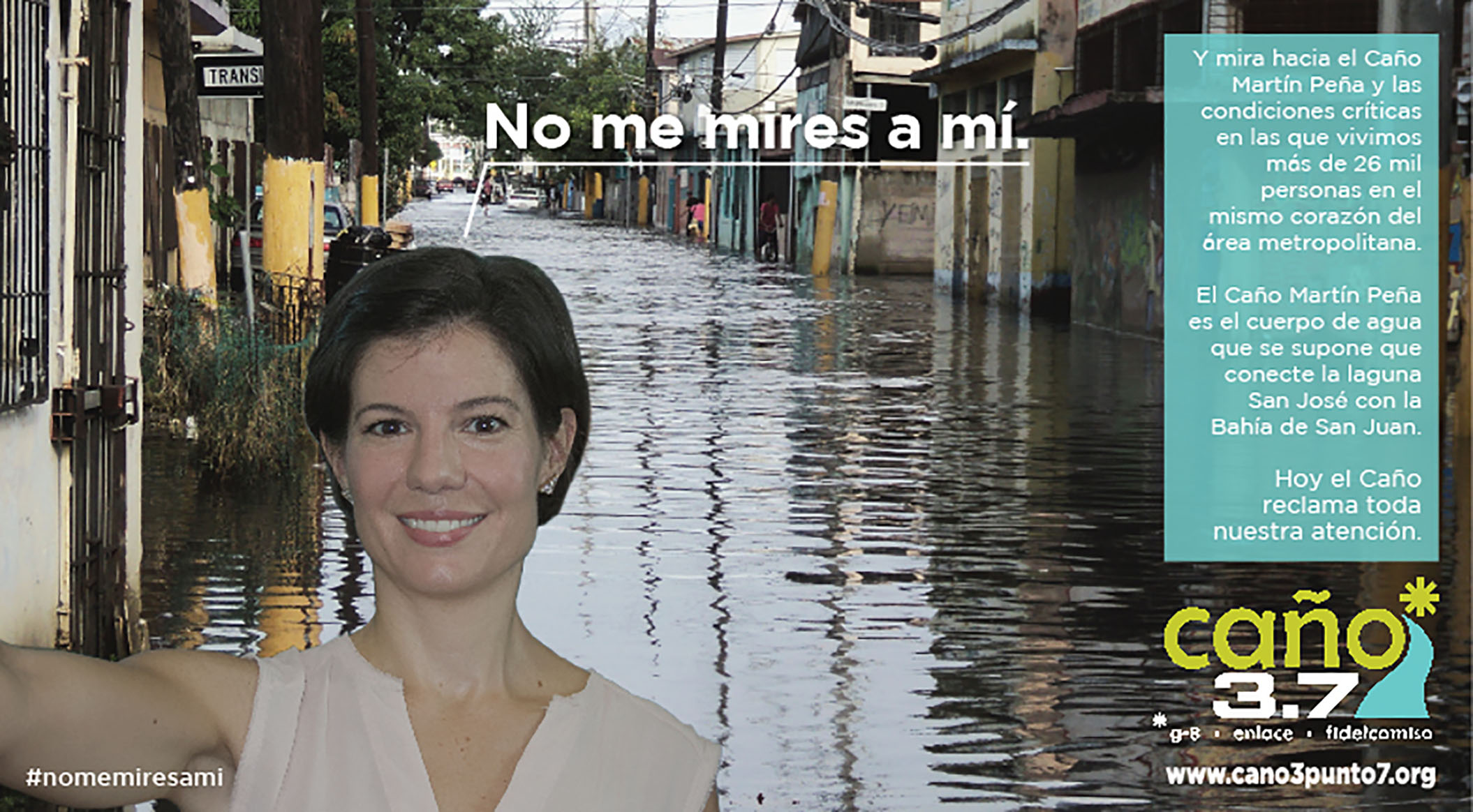
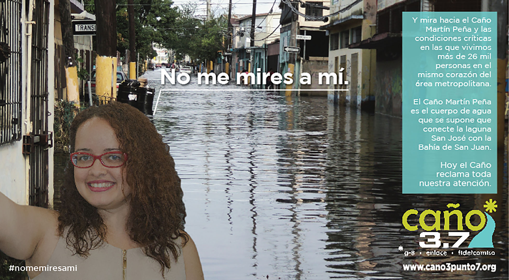
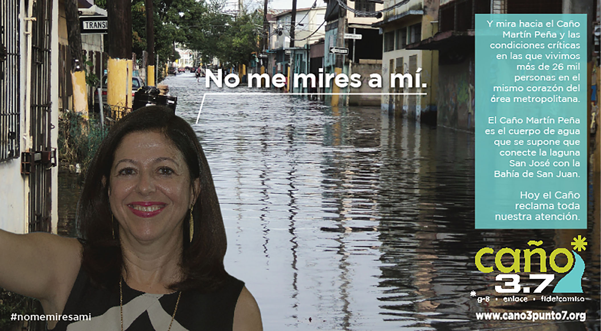
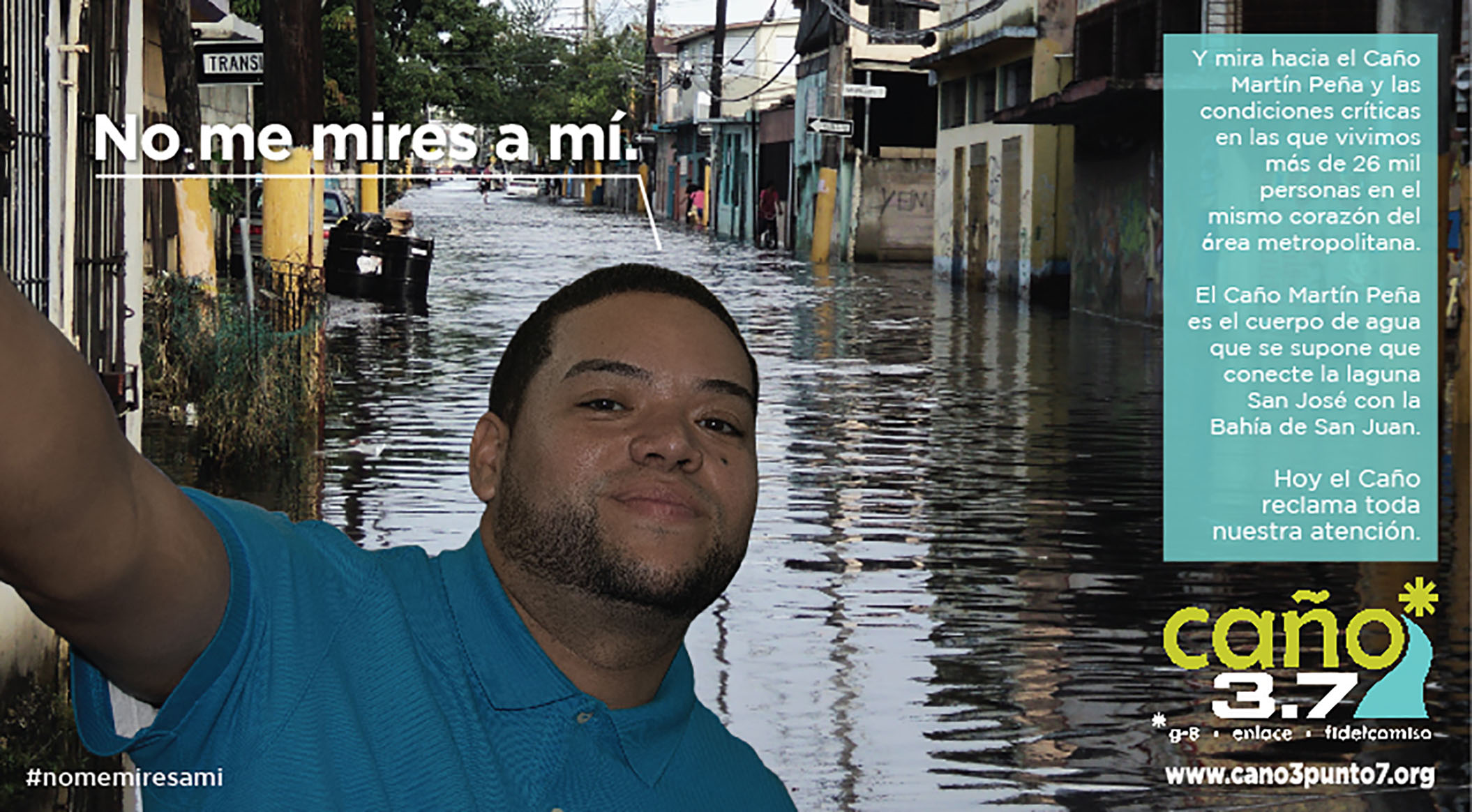
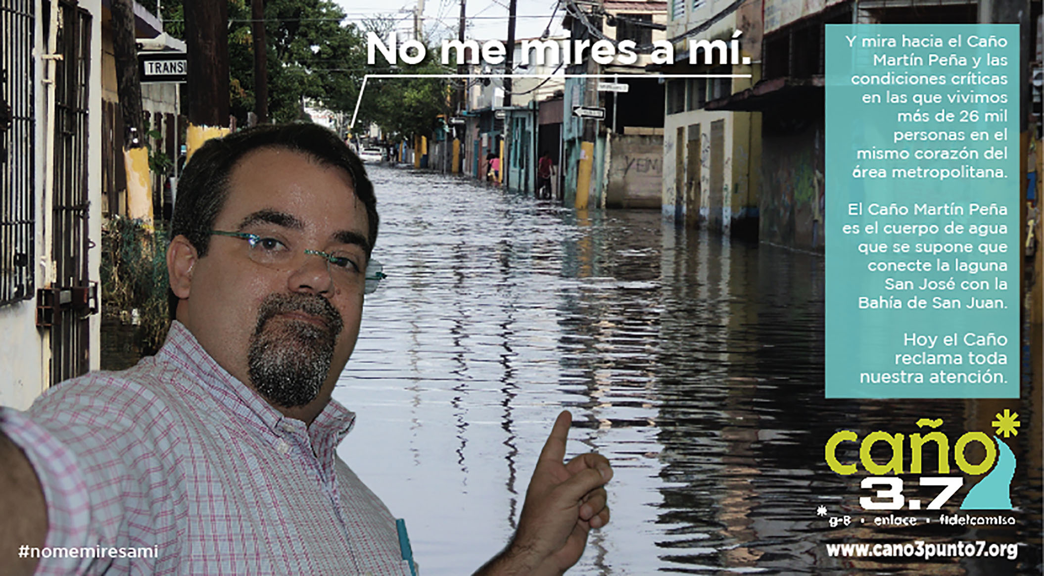
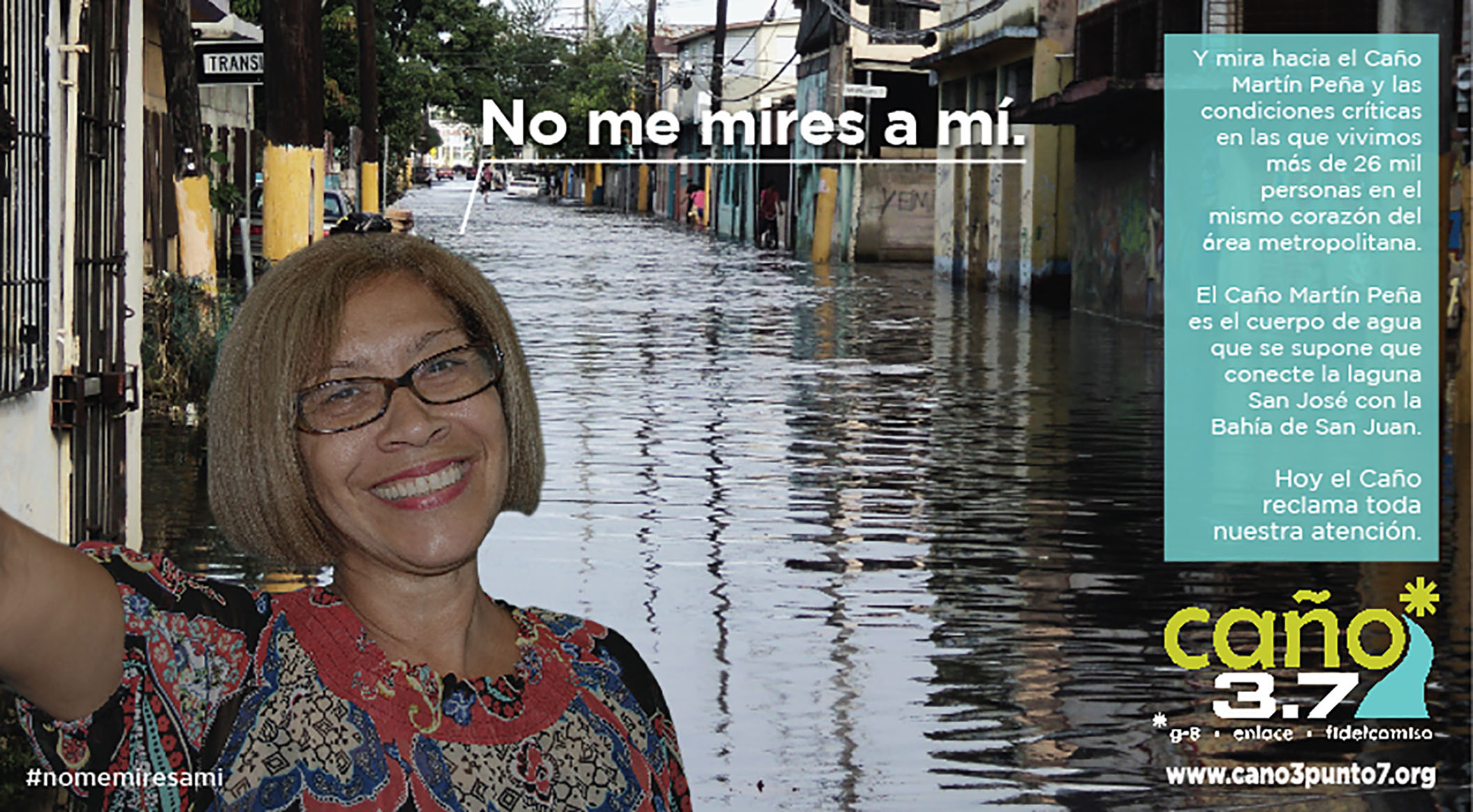
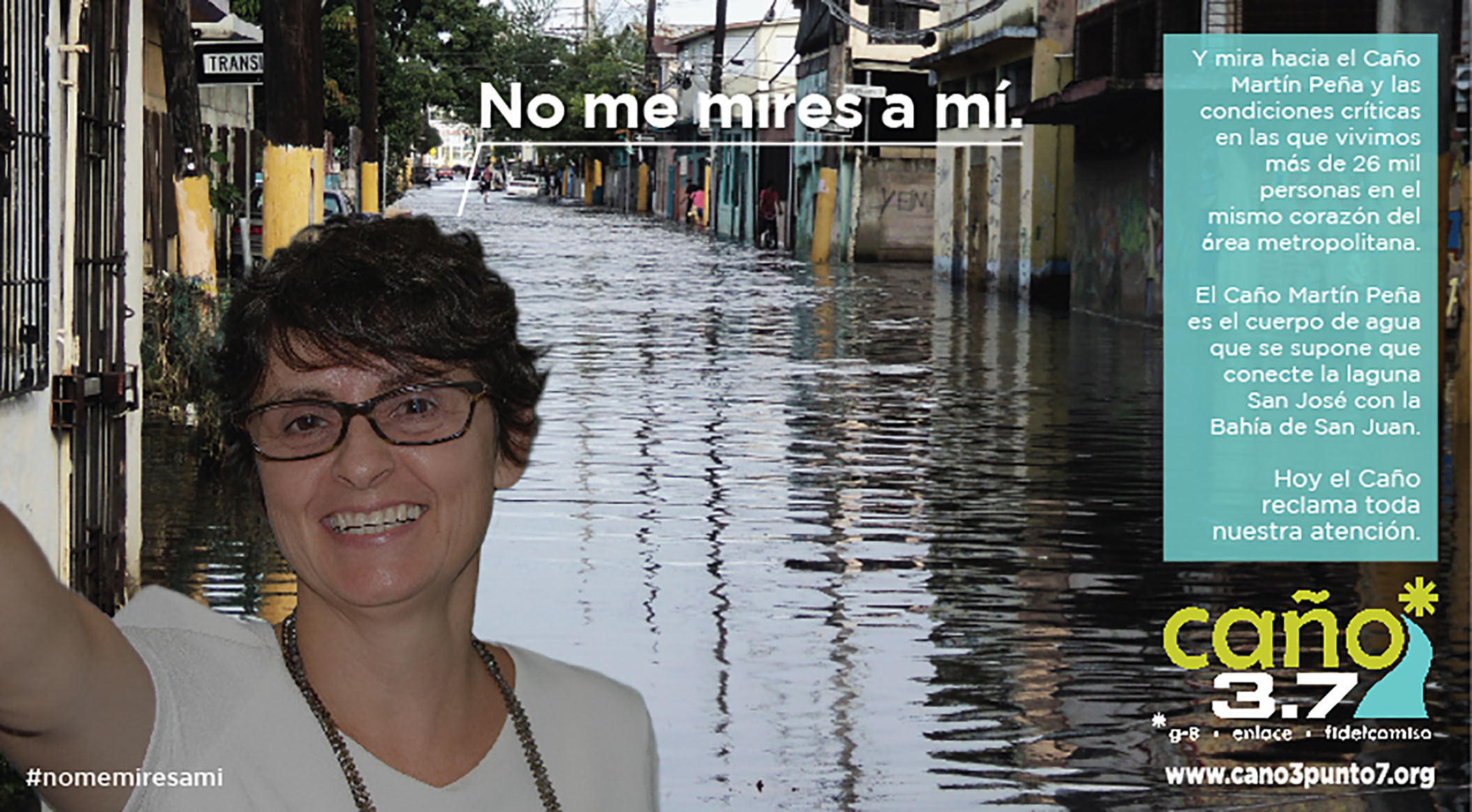
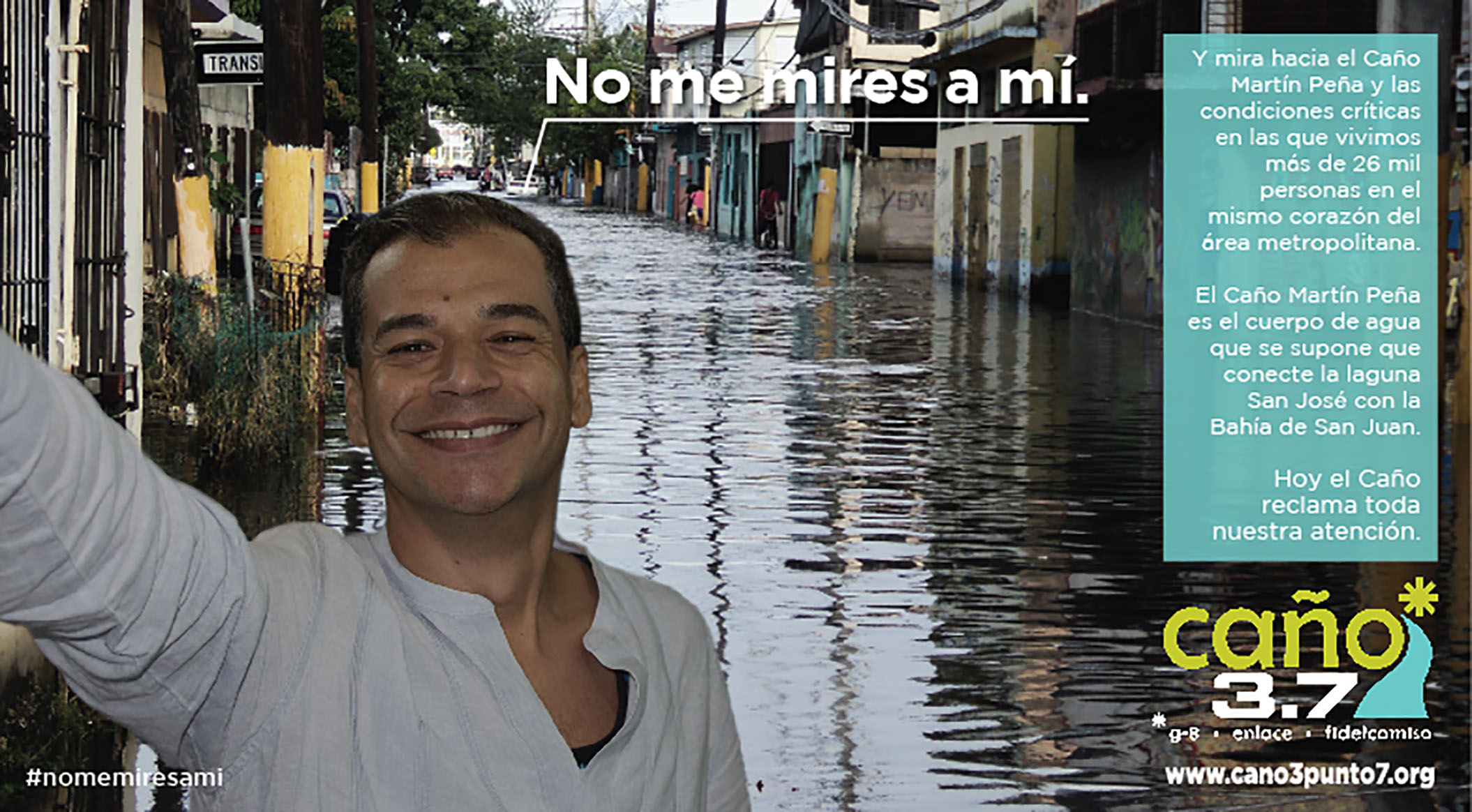
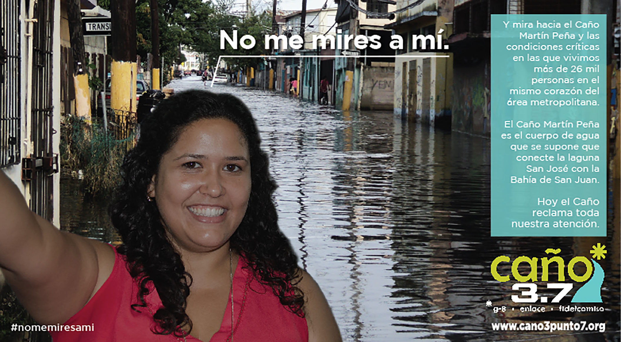
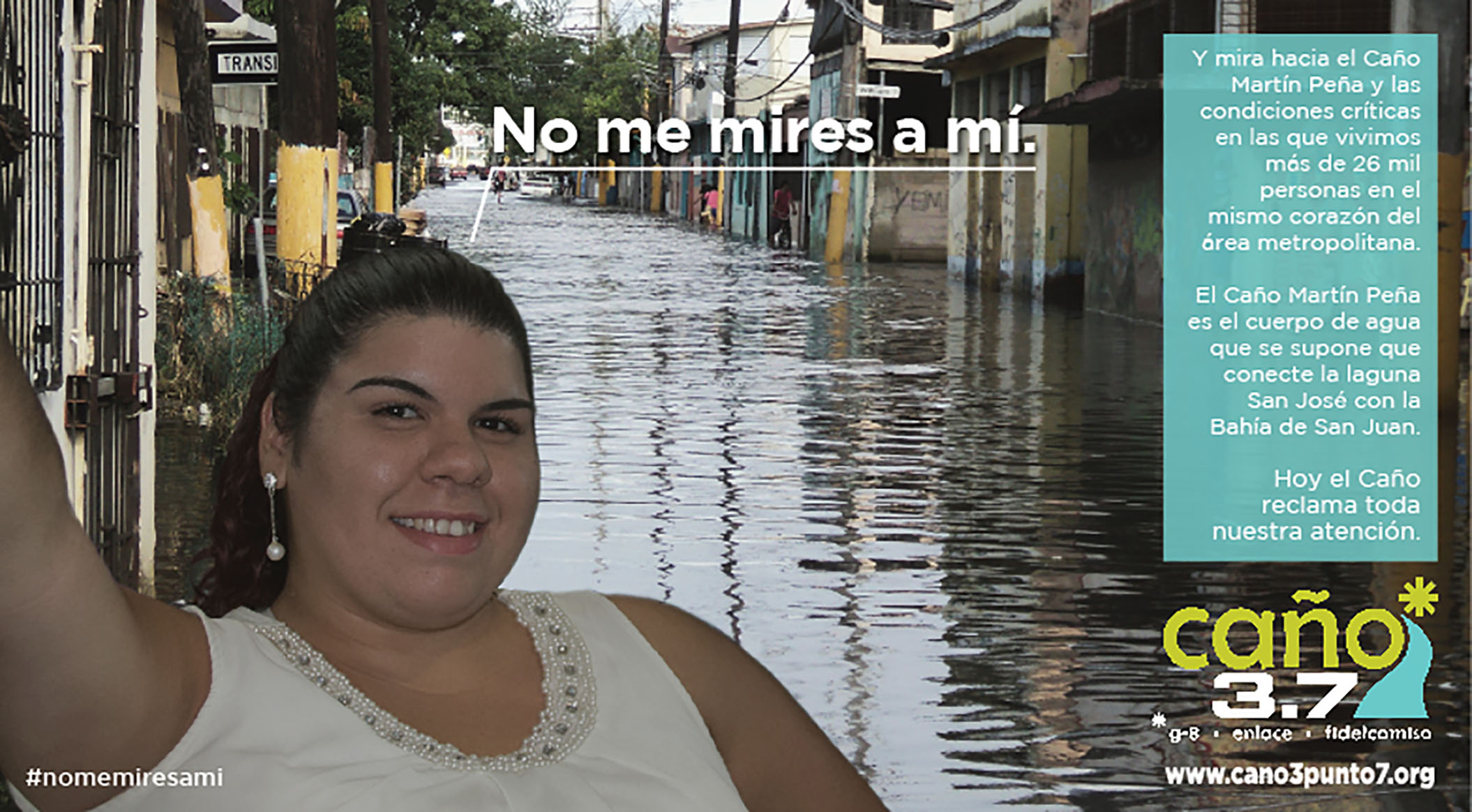
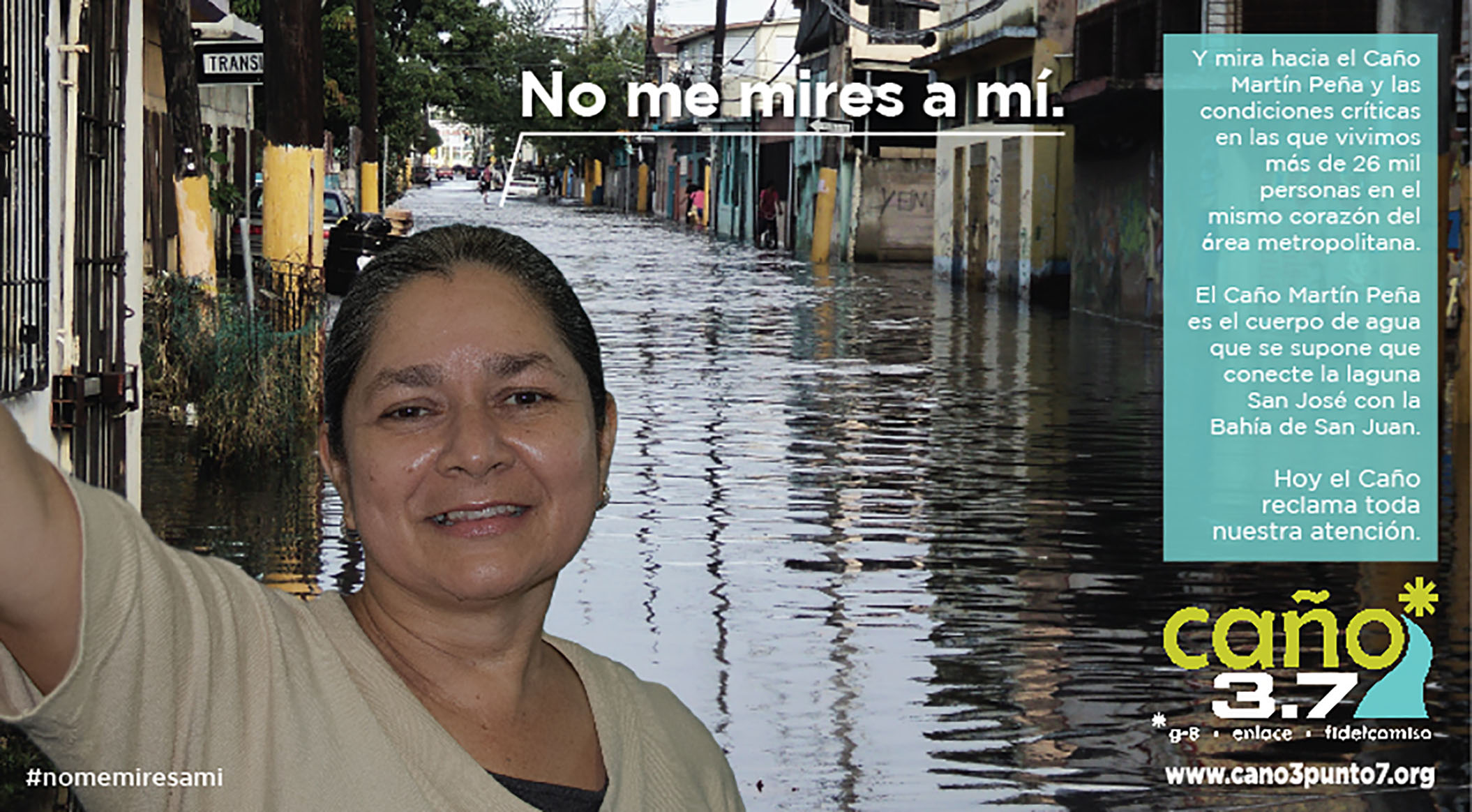
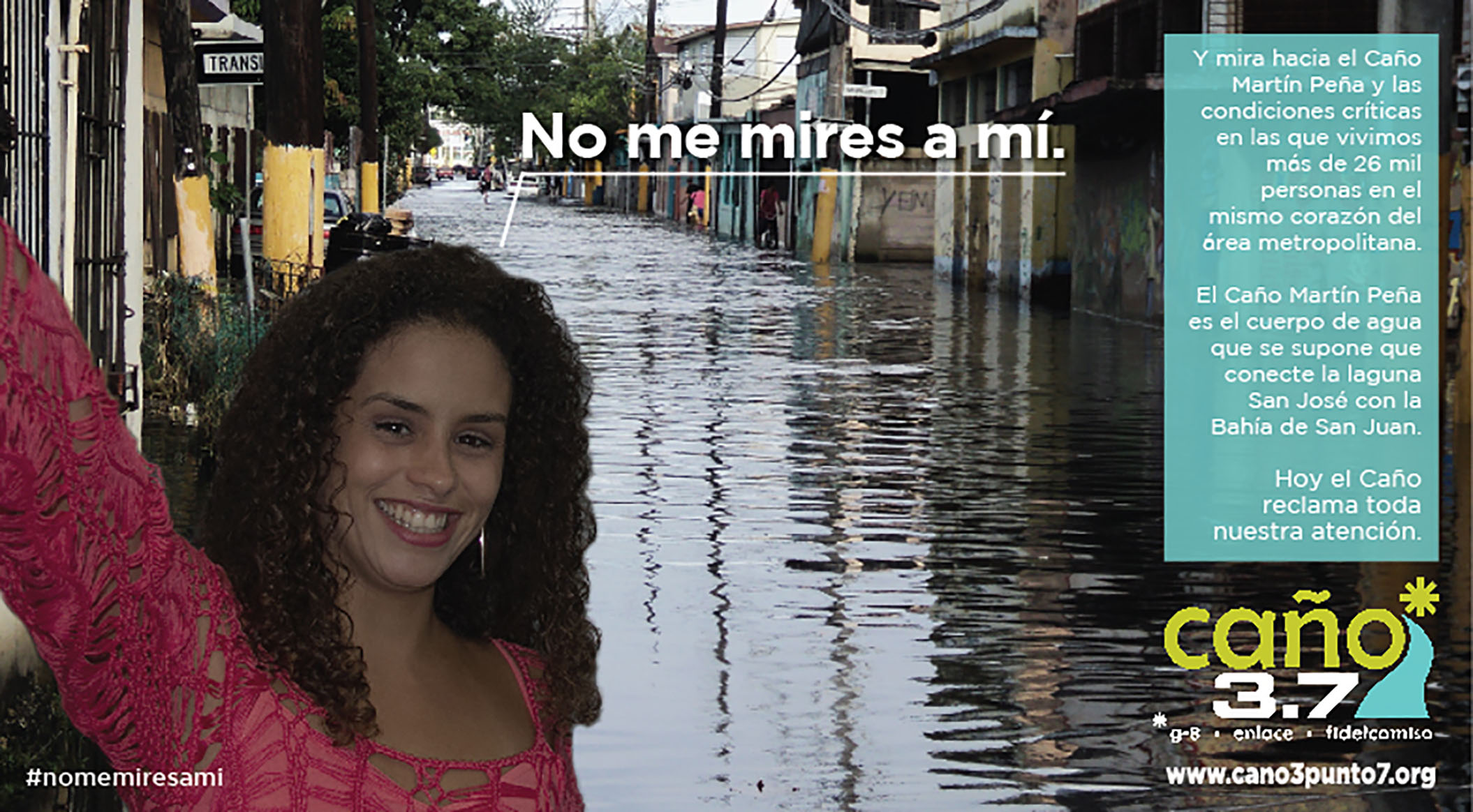
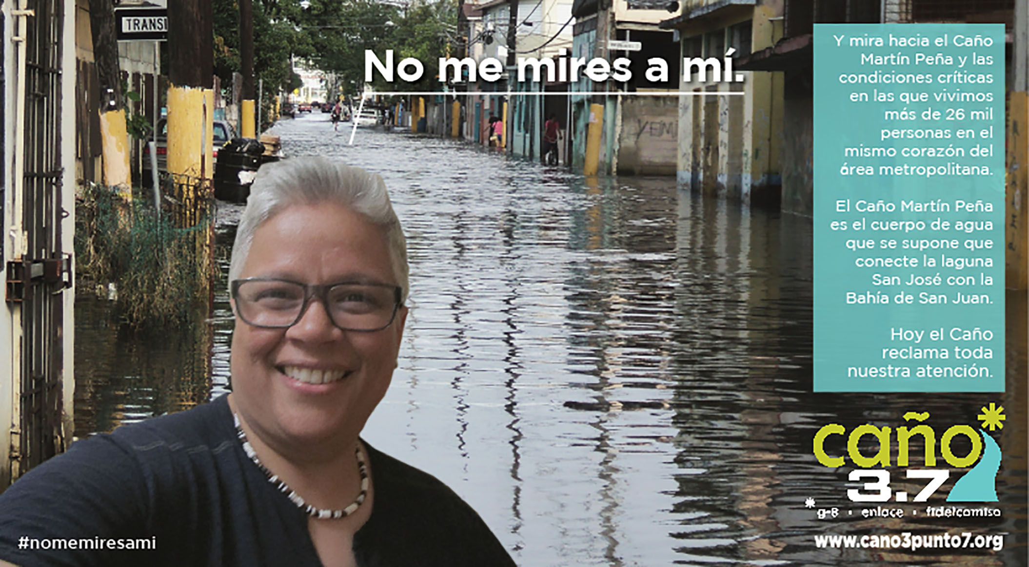
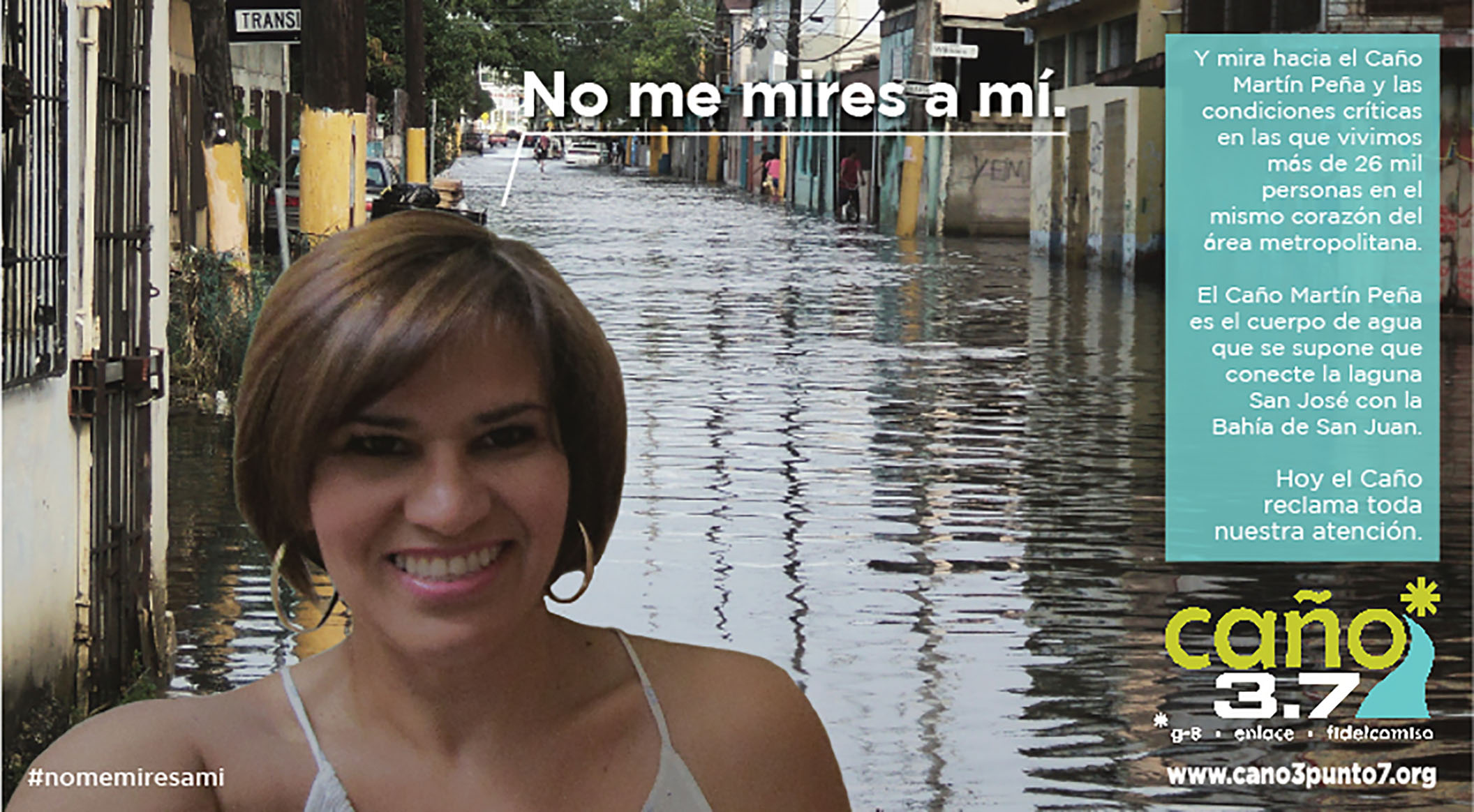
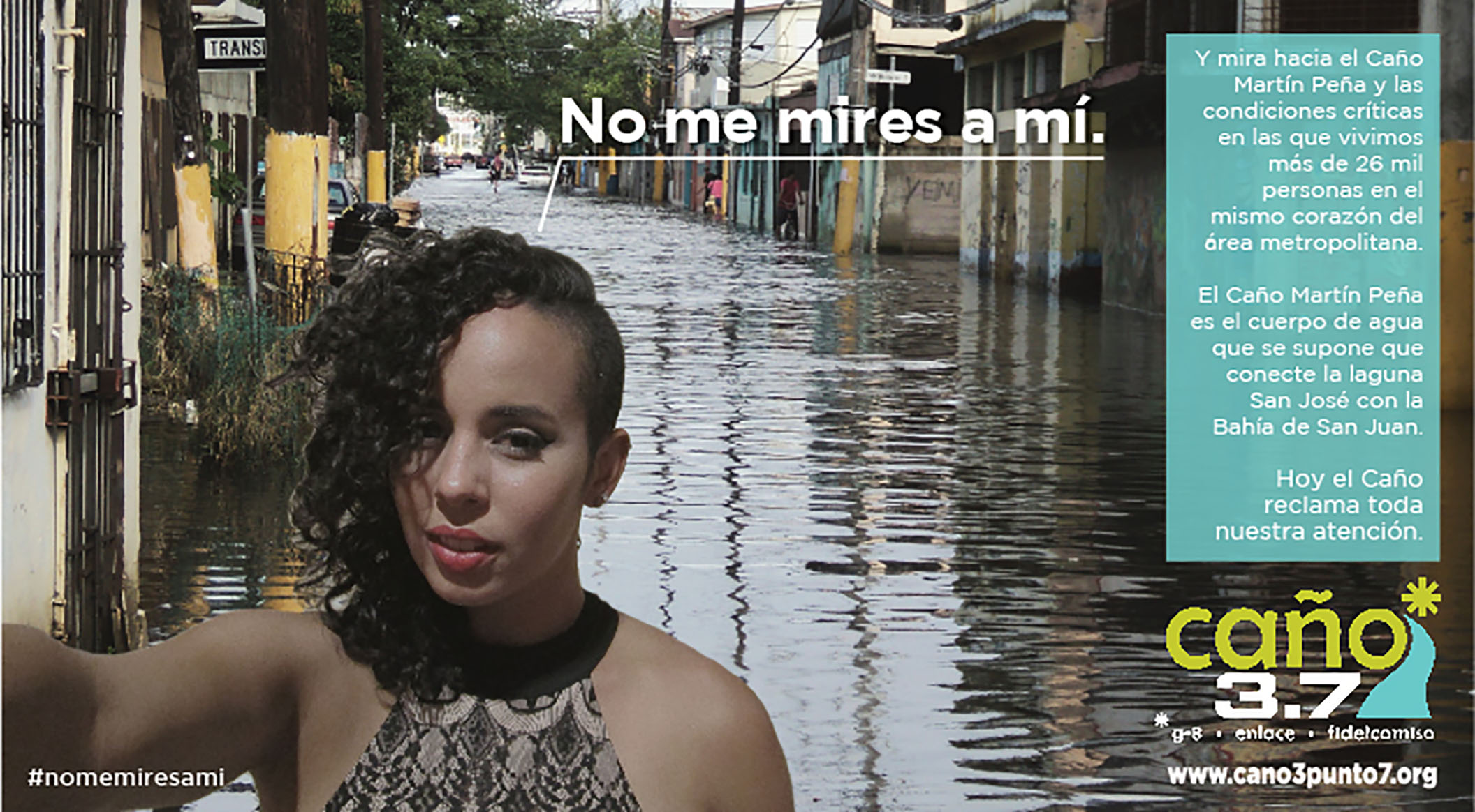
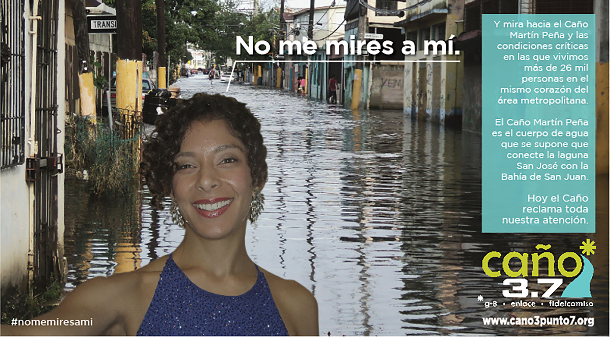
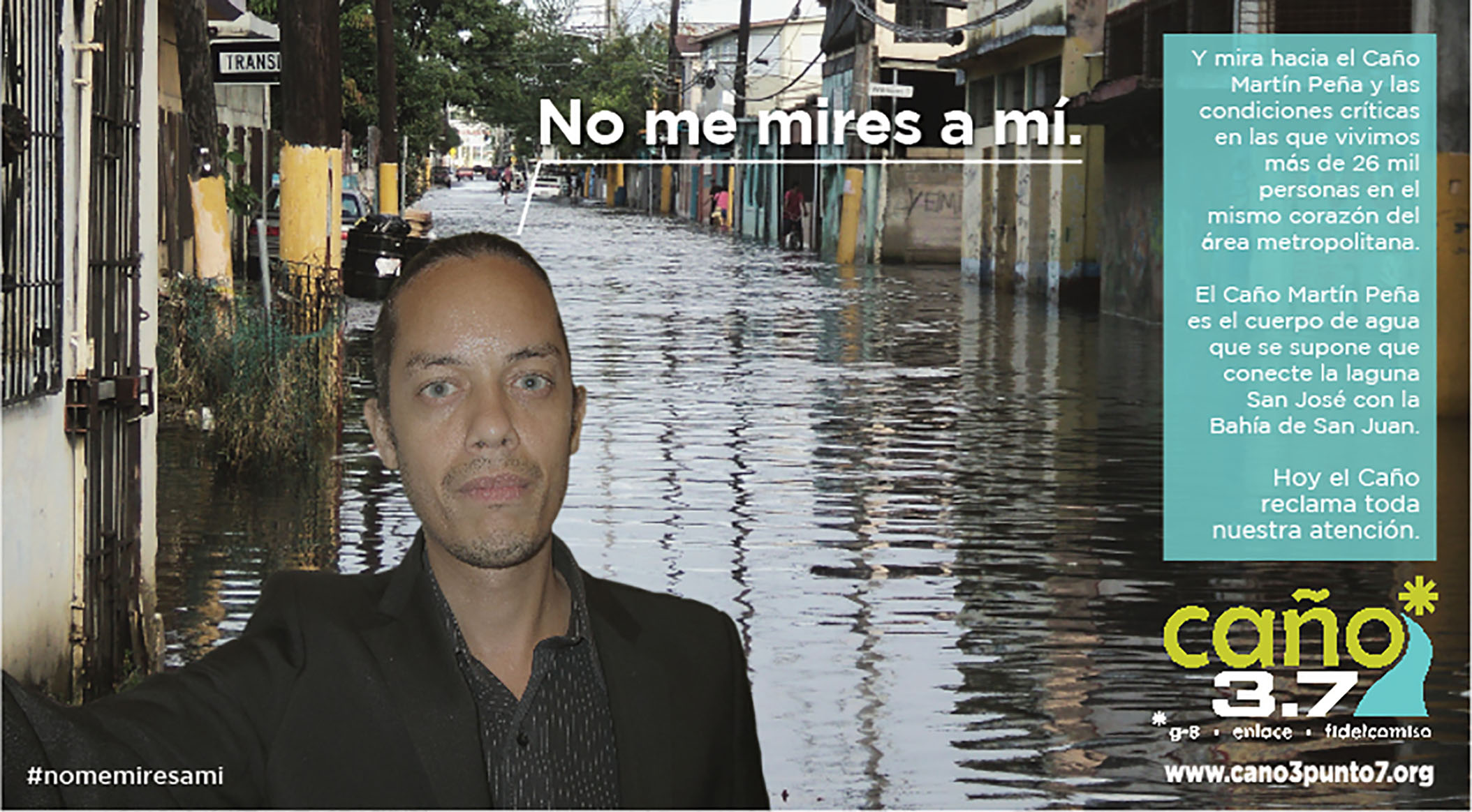
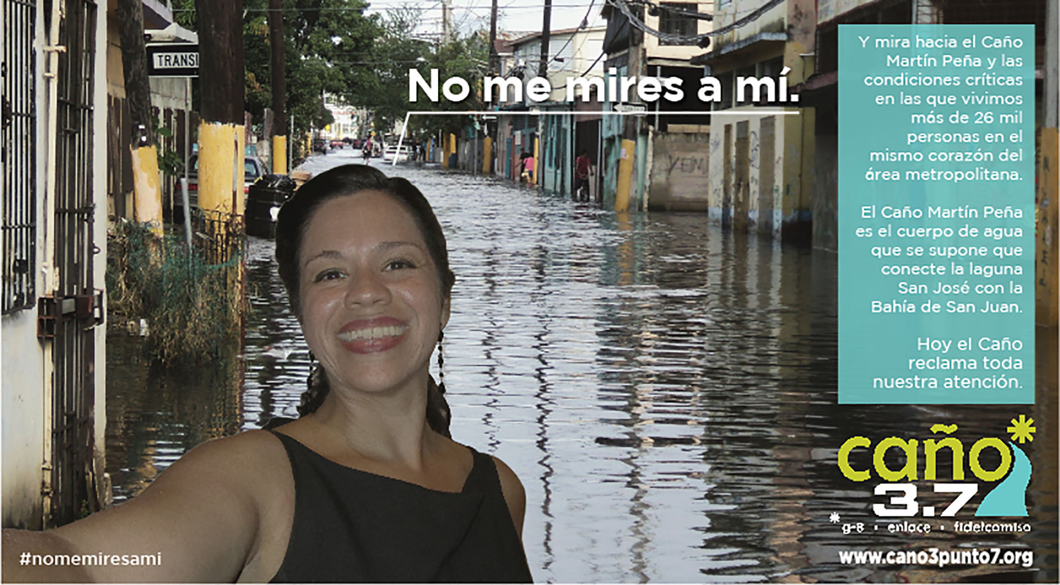
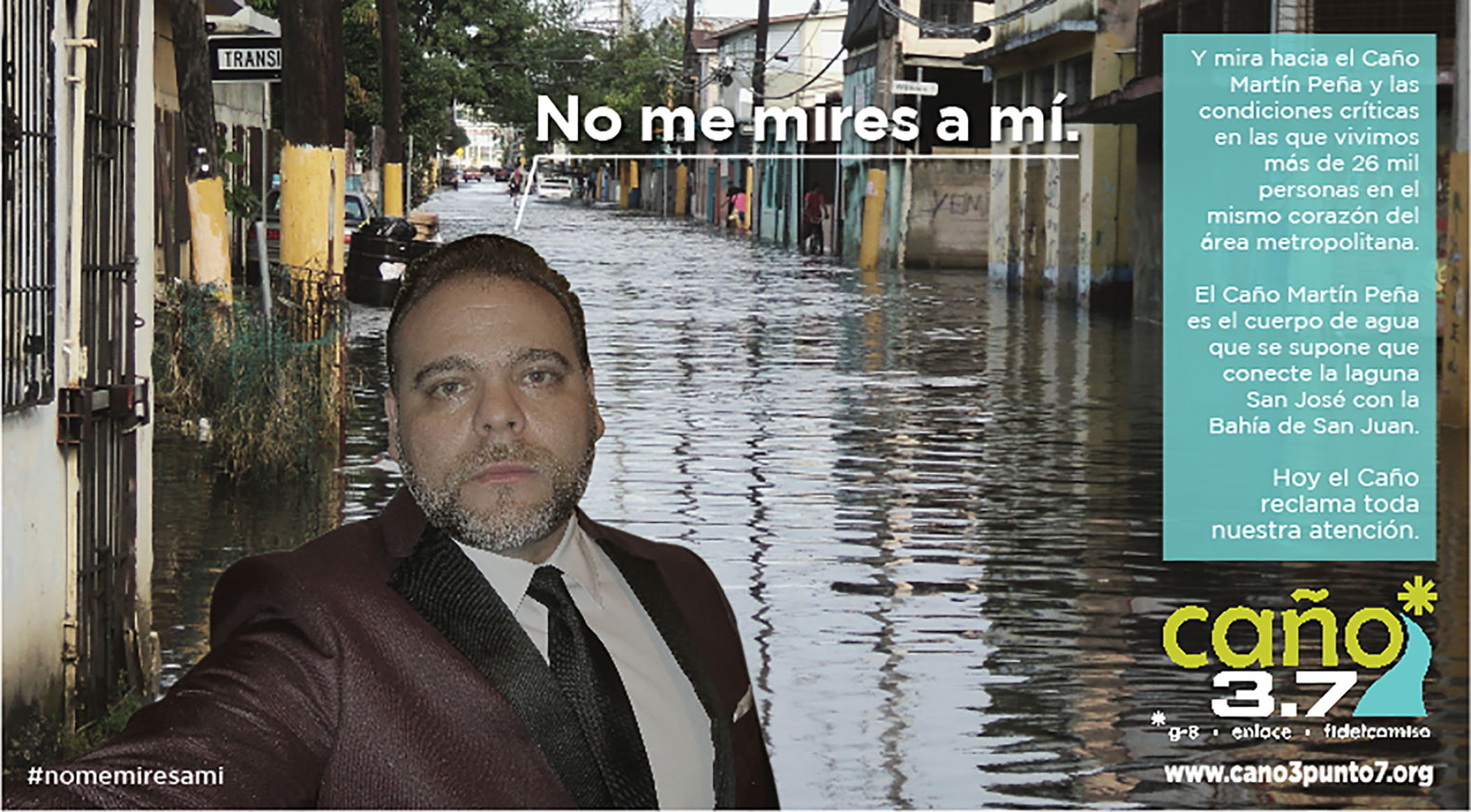
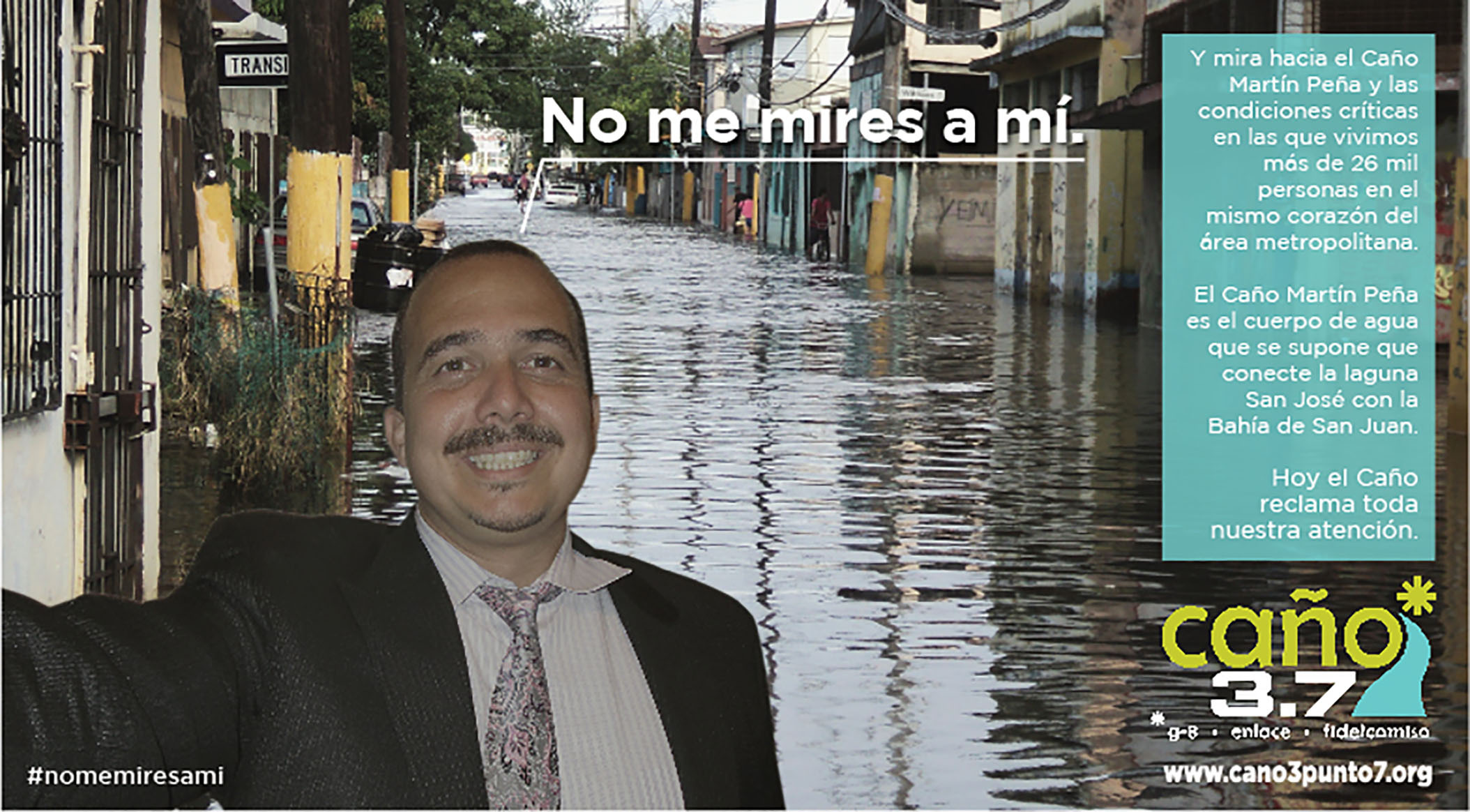
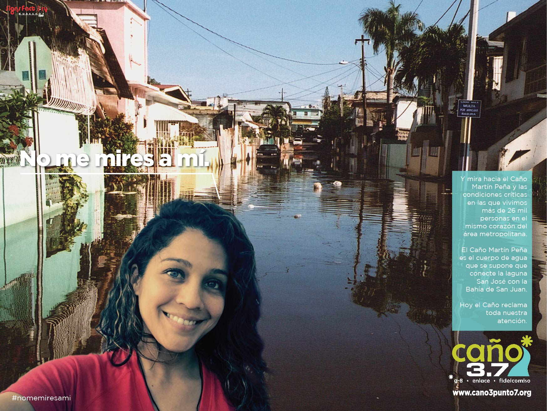
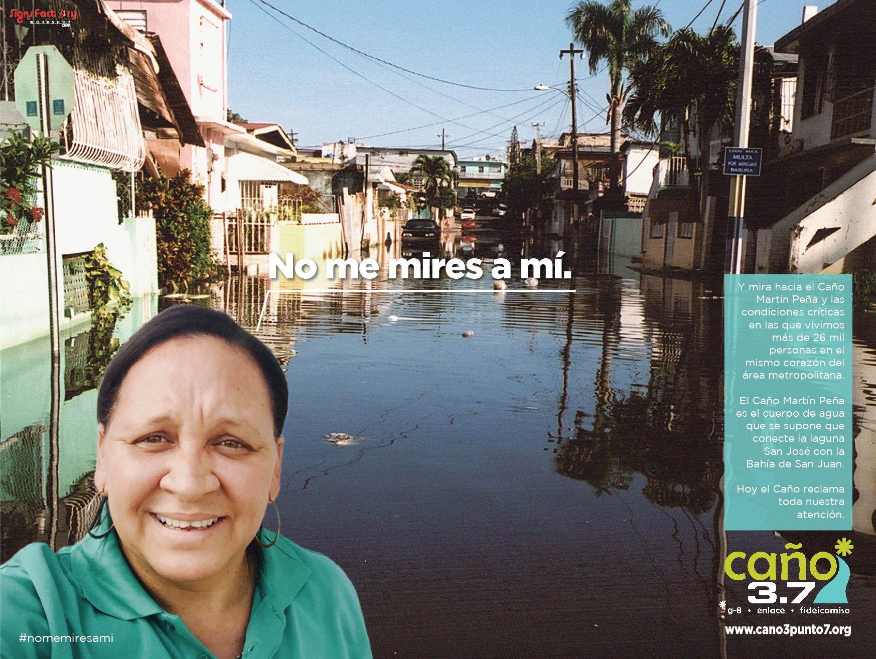
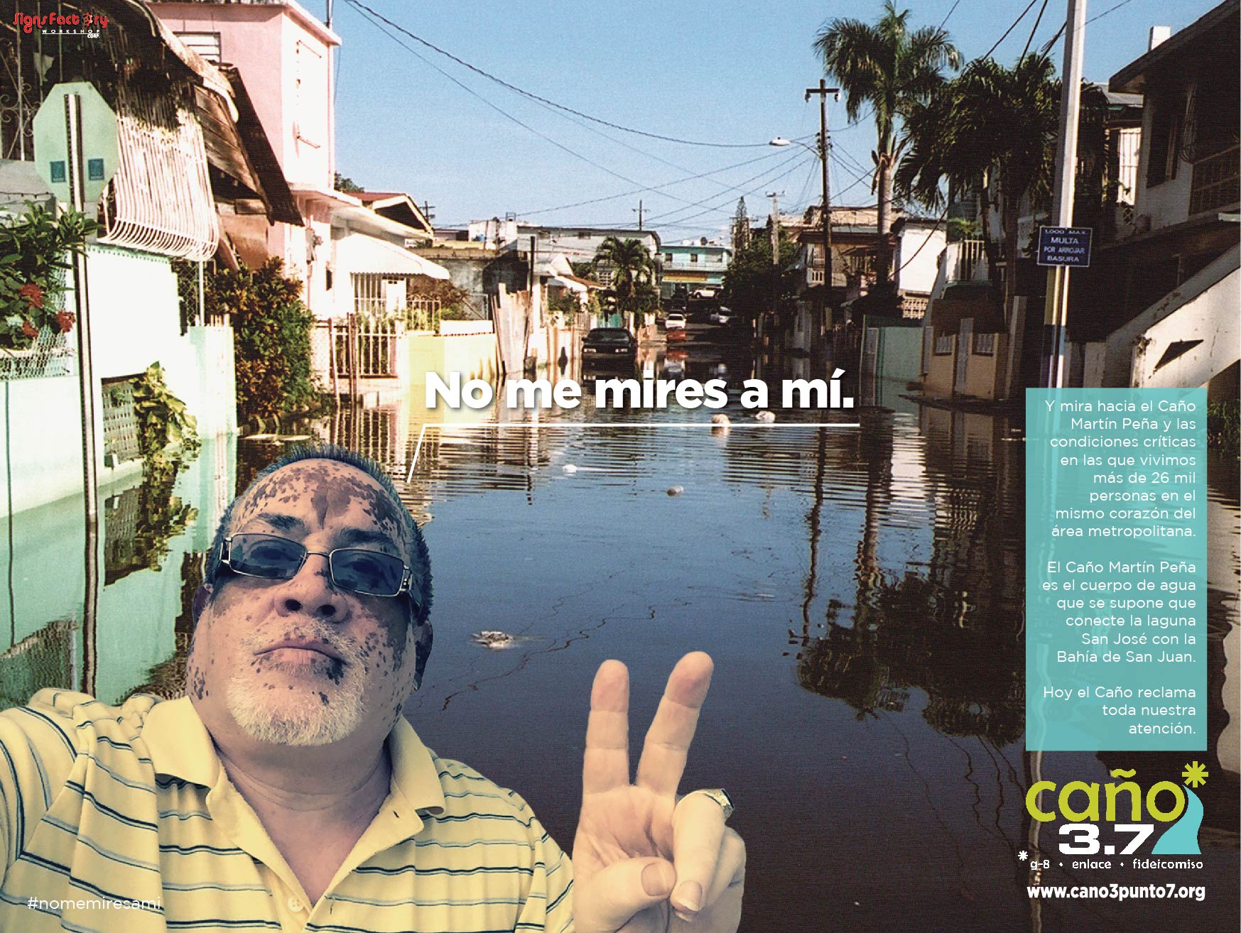
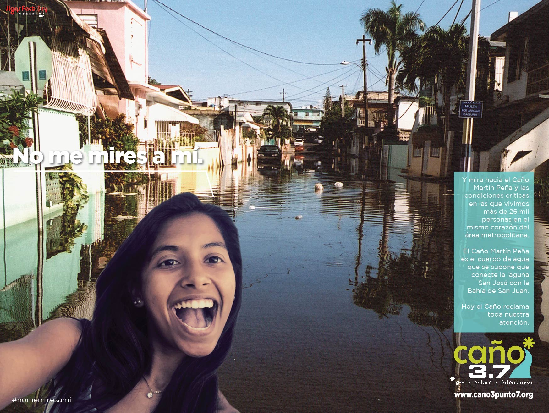
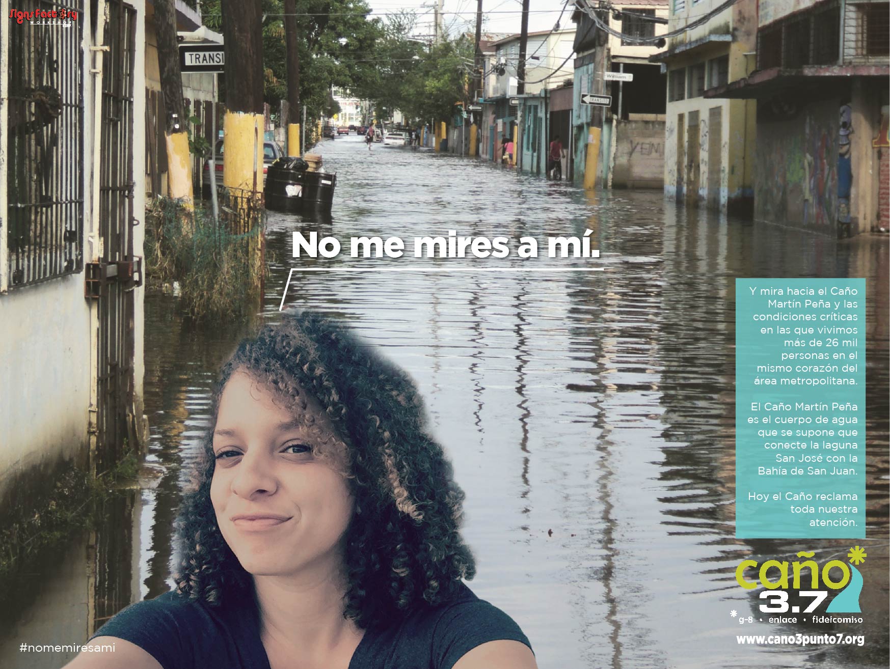
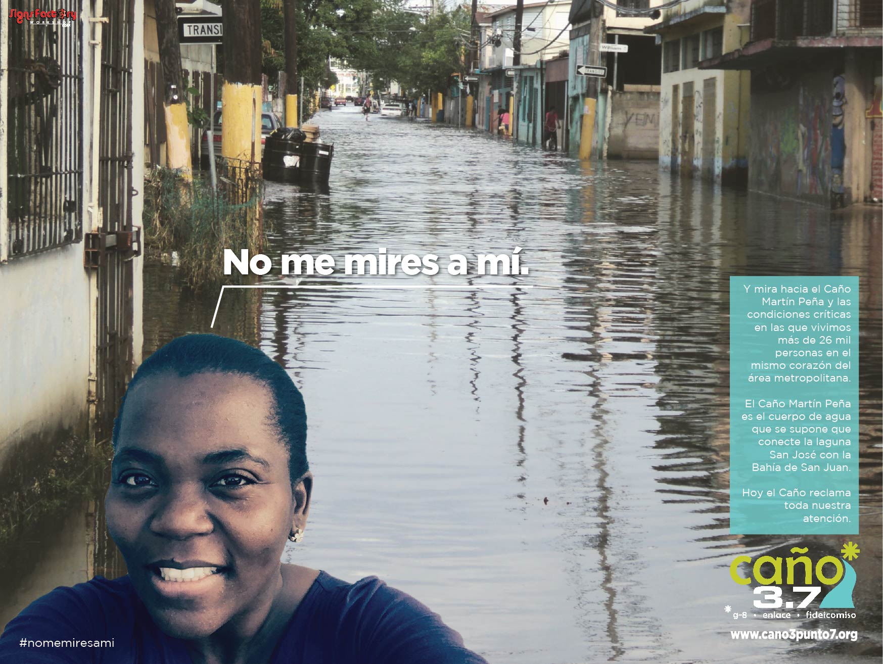
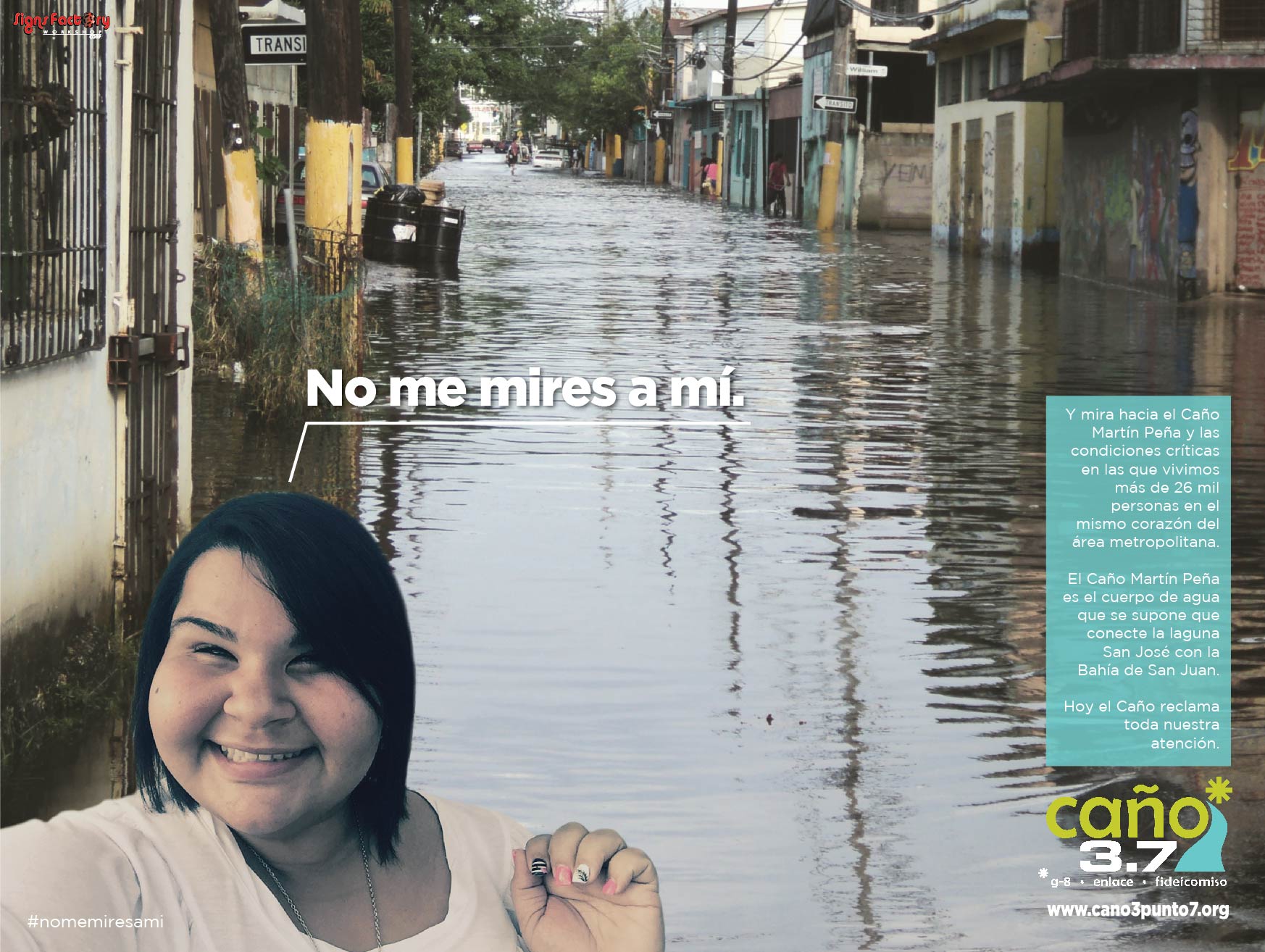
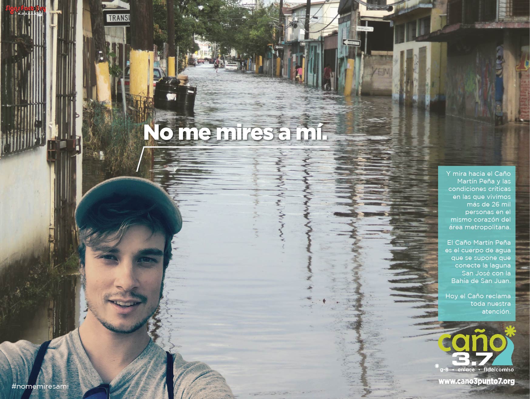
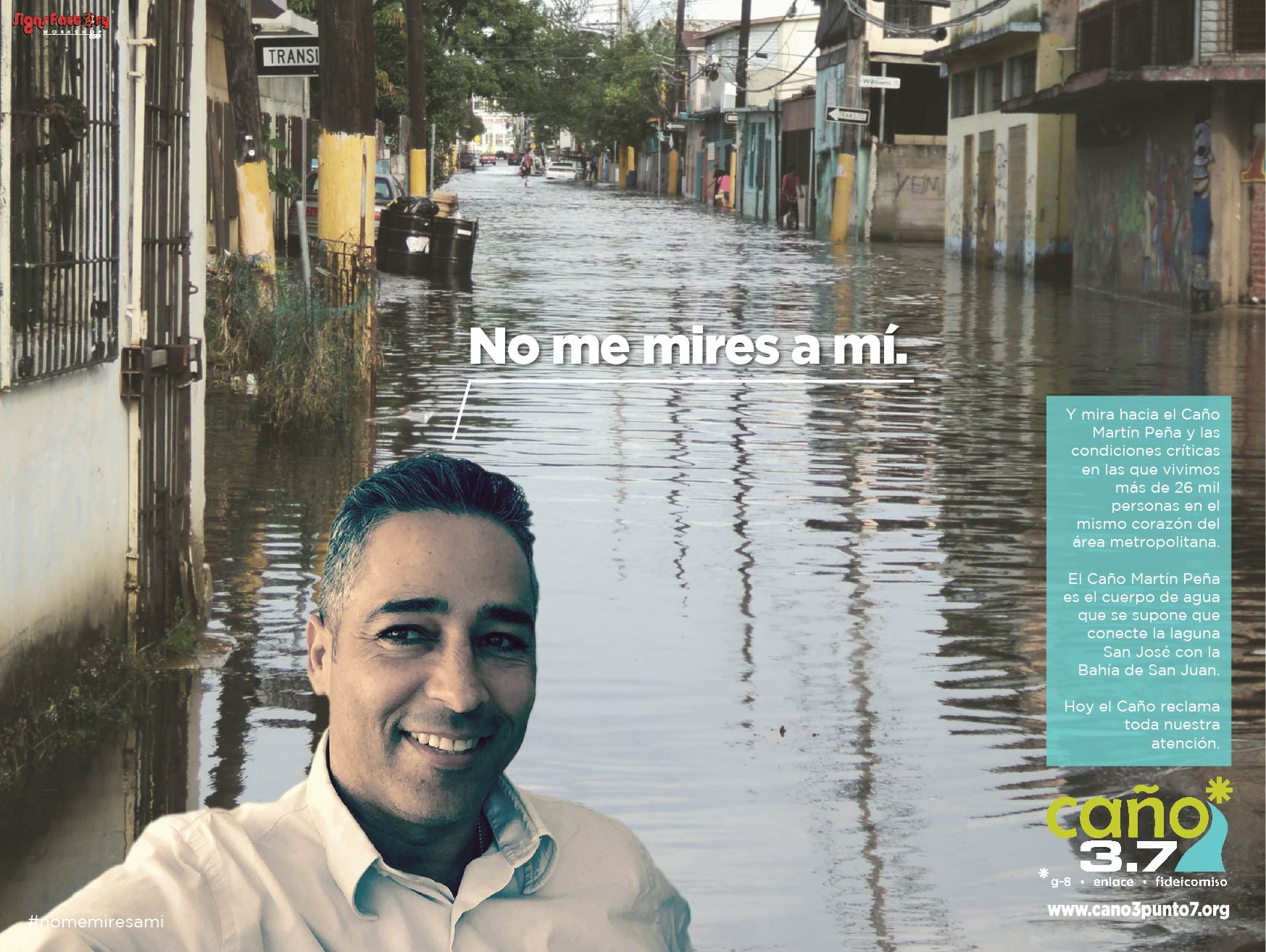
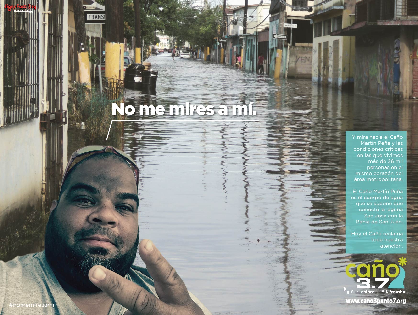
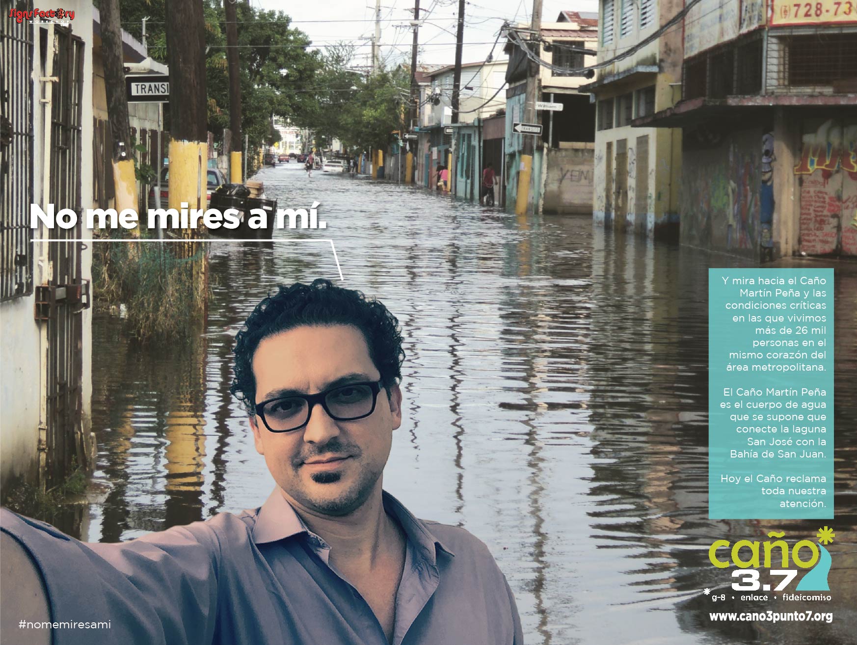
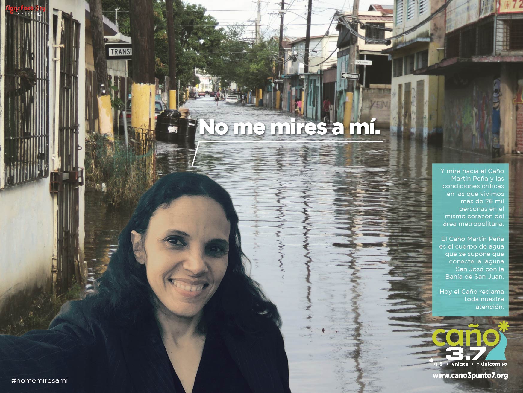
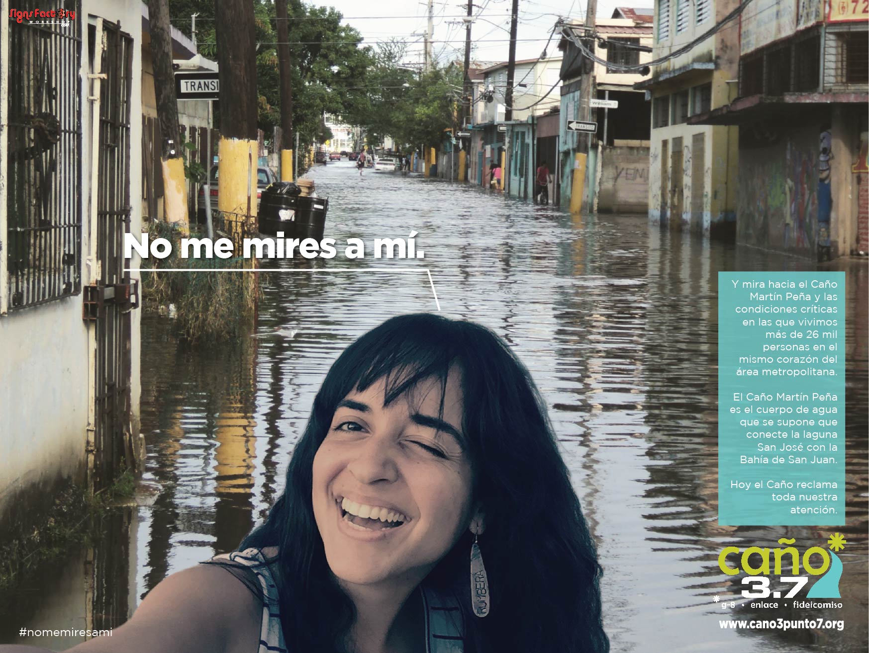
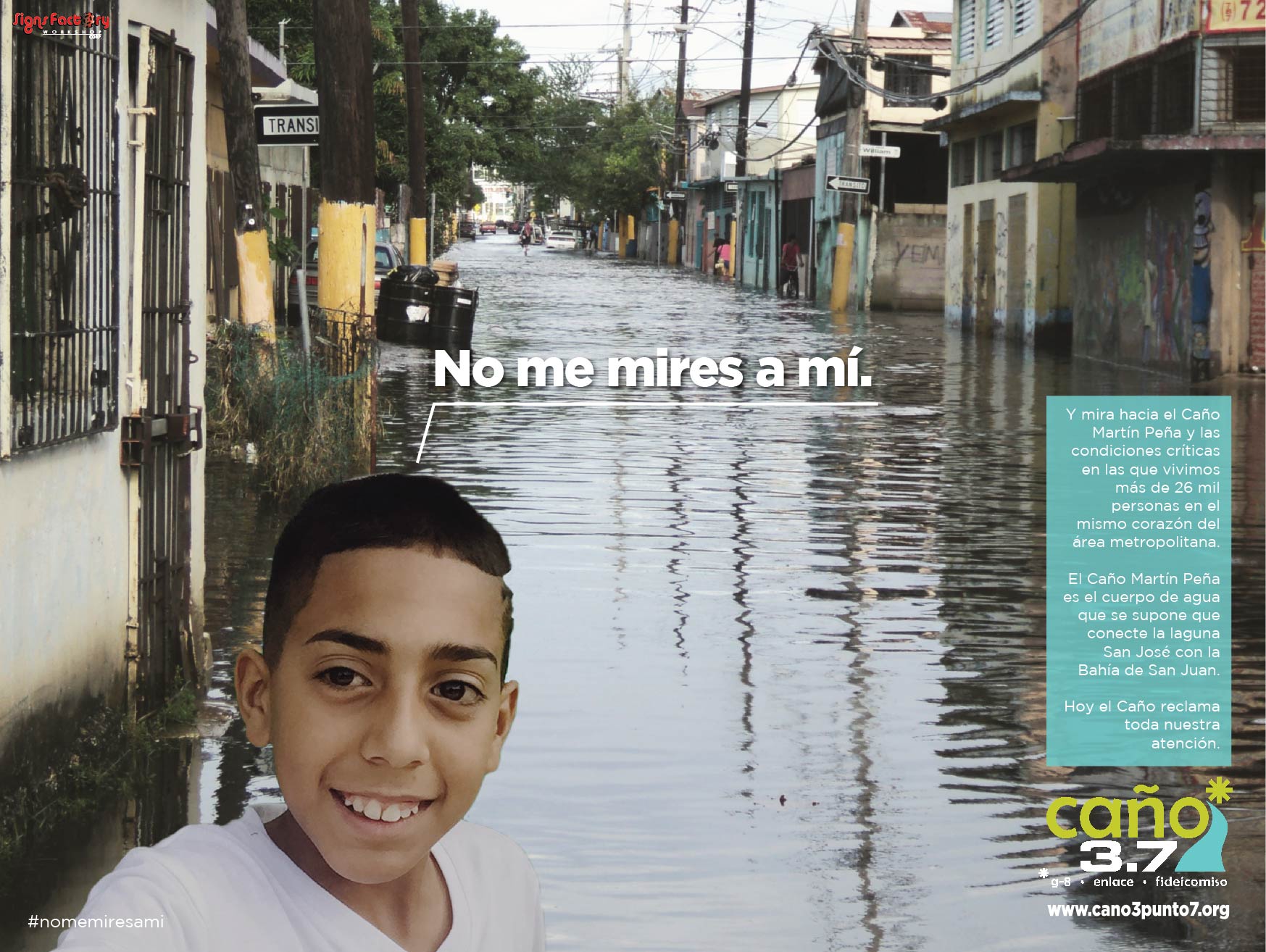
A selfie to look at El Caño.
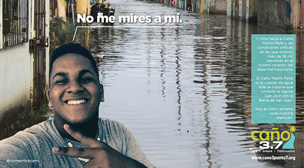
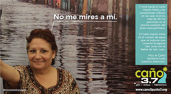
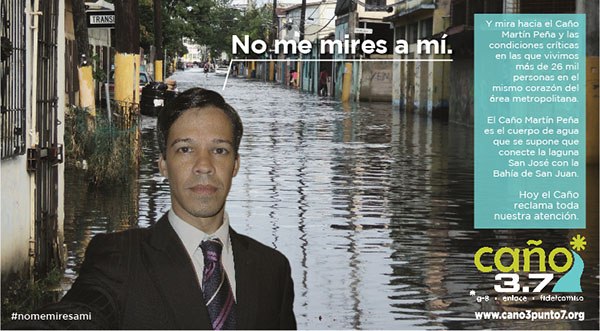
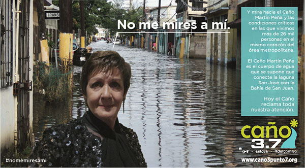
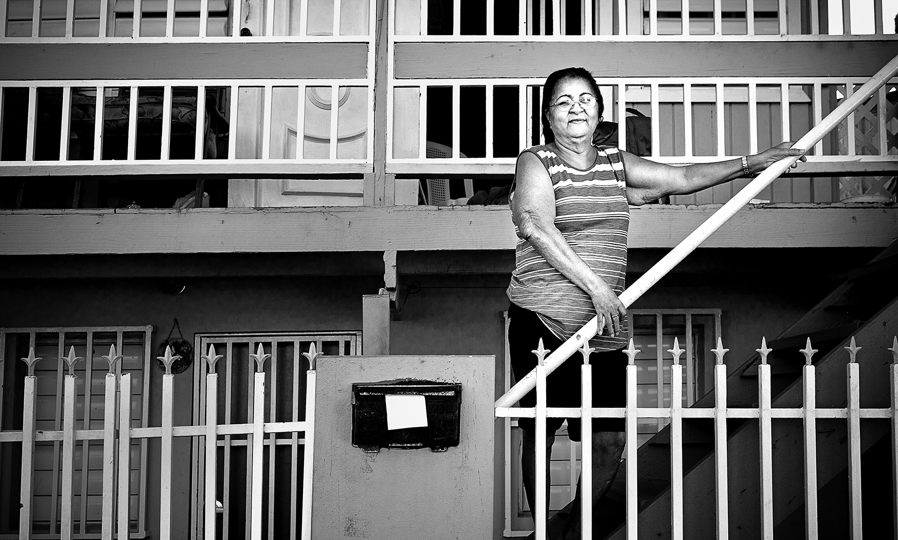
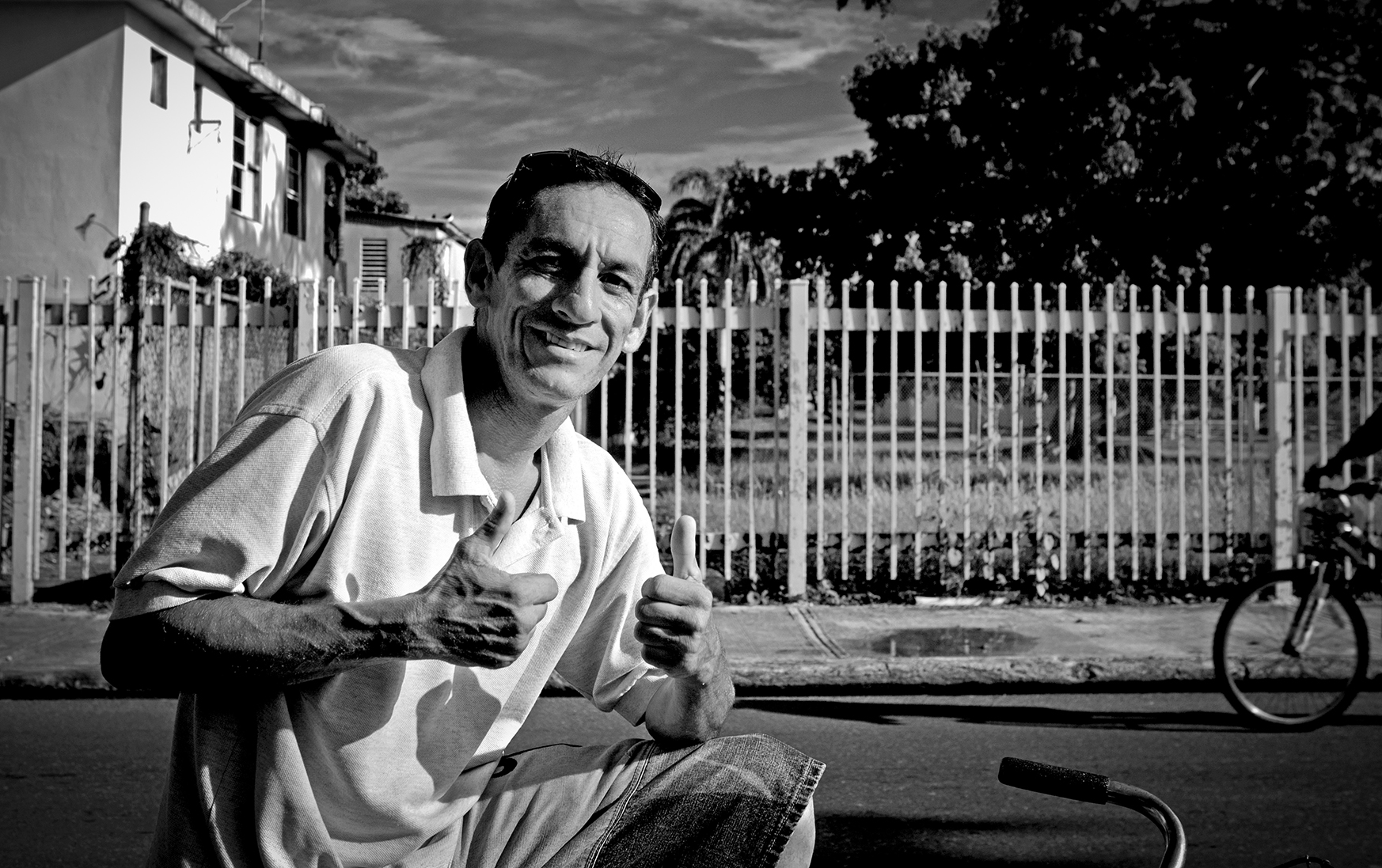
Don't look at me. Look towards El Caño Martín Peña and the critical conditions in which more than 26 thousand people live in the heart of the metropolitan area. Today, El Caño claims for our attention. |
LOOK TOWARDS EL CAÑO HERE
❯ http://www.martinpena.org/ ❯ Photos courtesy of Ernesto Robles, 2014 ❯ Photos courtesy of José Daniel González, 2014. ❯ Other photos ❯ Watch TV Ad of the campaign. |


|
|||||||
 |
 |
 |
 |
 |
 |
 |
 |
 |
 |
 |
 |
 |
 |
 |
 |
 |
 |
 |
 |
 |
 |
 |
 |
 |
 |
 |
 |
 |
 |
 |
 |
 |
 |
 |
 |
 |
 |
 |
 |
 |
 |
 |
 |
 |
 |
 |
 |
 |
 |
 |
 |
 |
 |
 |
 |
 |
 |
 |
 |
 |
 |
 |
 |
 |
 |
 |
 |
 |
 |
 |
 |
 |
 |
 |
 |
 |
 |
 |
 |
 |
 |
 |
 |
 |
 |
 |
 |
 |
 |
 |
 |
 |
 |
 |
 |
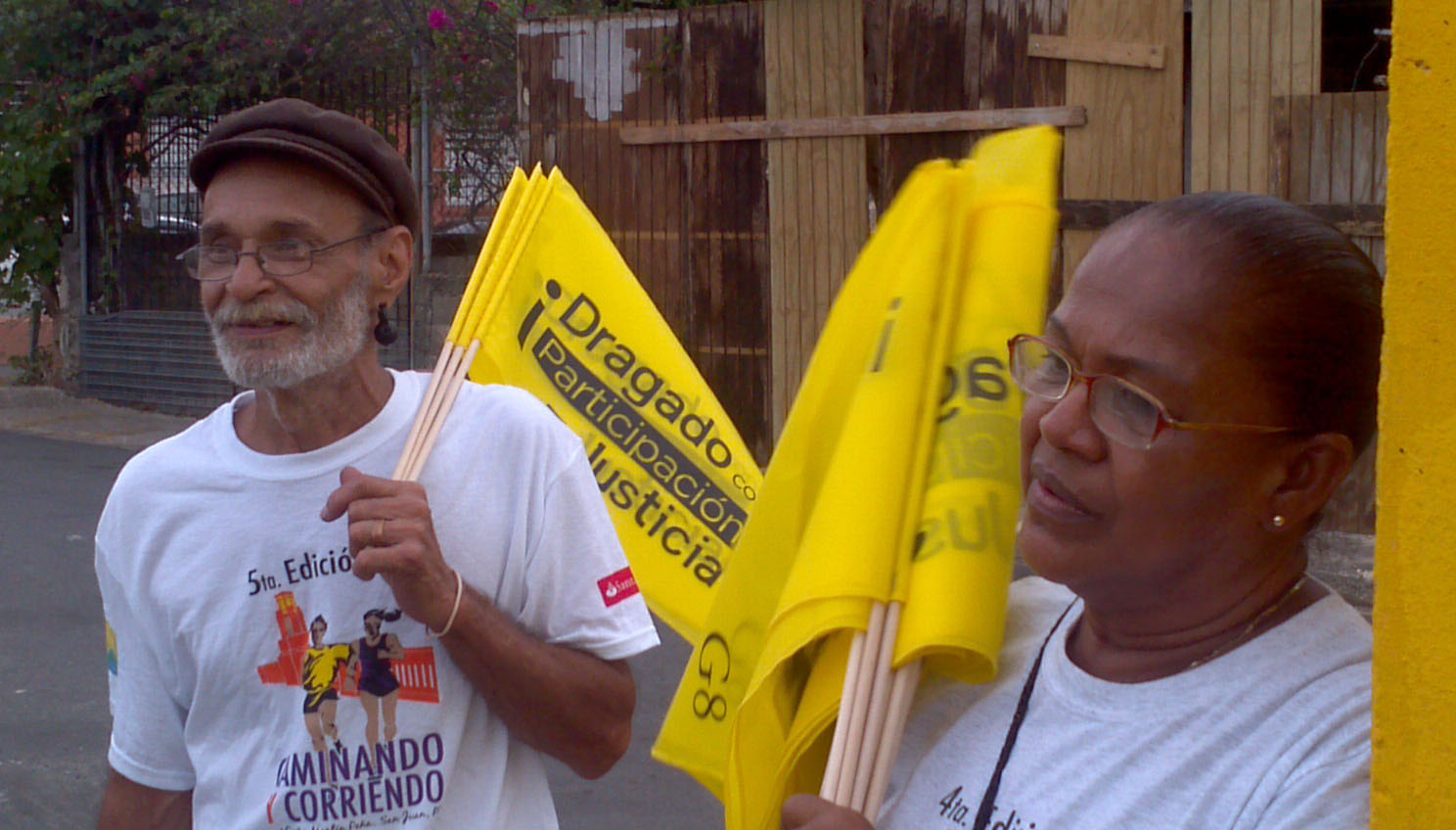
| Join the Caño 3.7 Campaign and take a selfie for El Caño 1. Take a selfie, facing the camera against a white background, and email it to: nomemiresami@martinpena.org 2. We will return your photo mounted on the campaign art so that you can share it with your contacts and help us get El Caño the attention it deserves. 3. It is important that you include the email address where you want to receive the picture. |
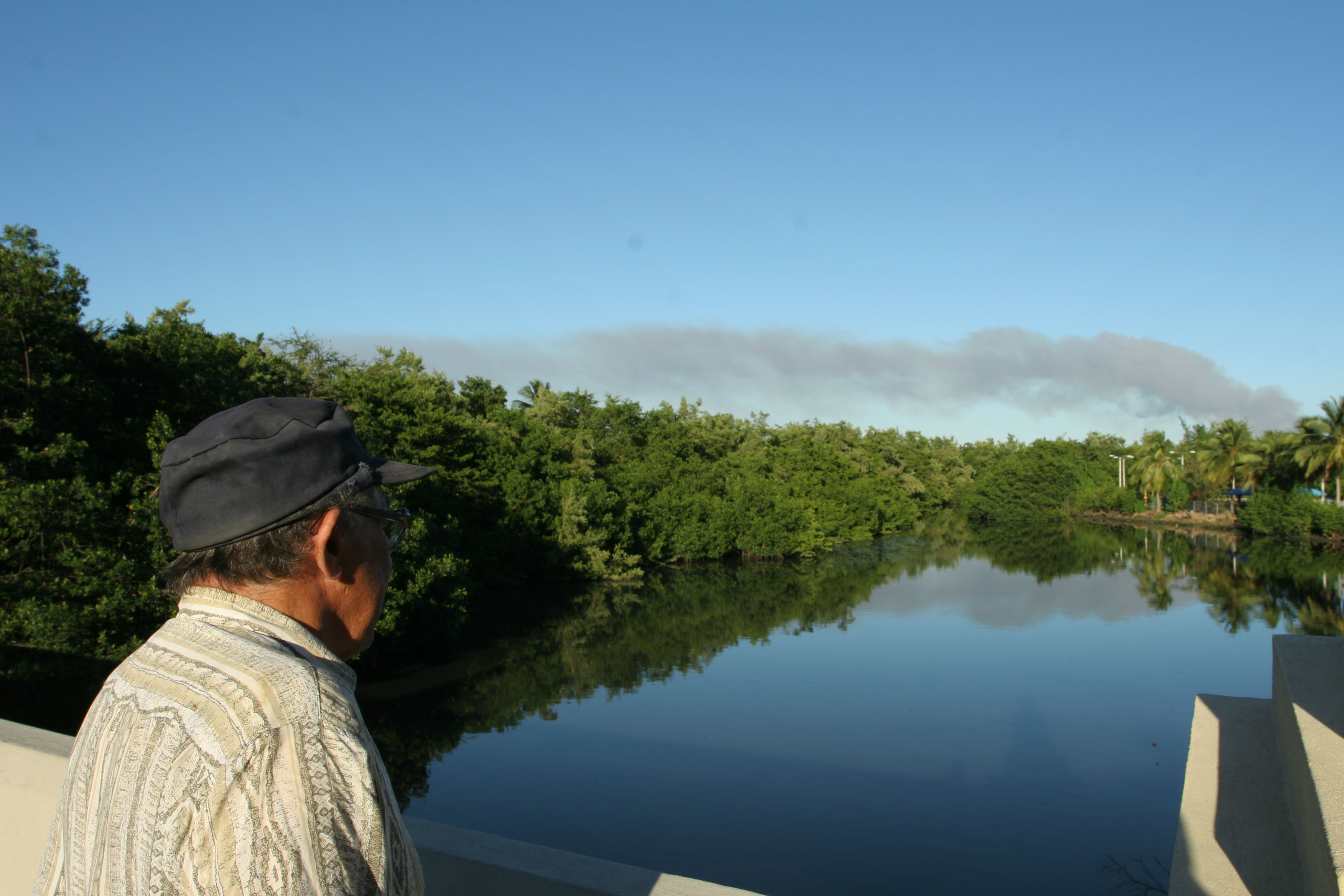
It's time to rescue what connects us.
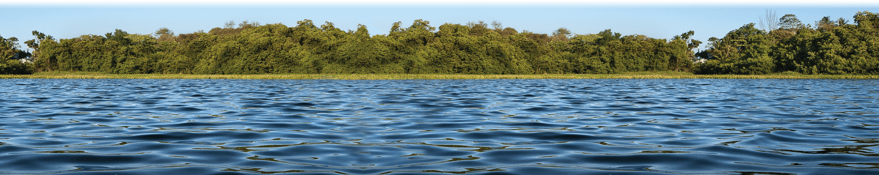
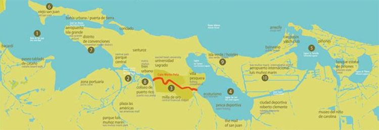
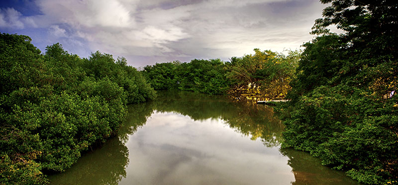
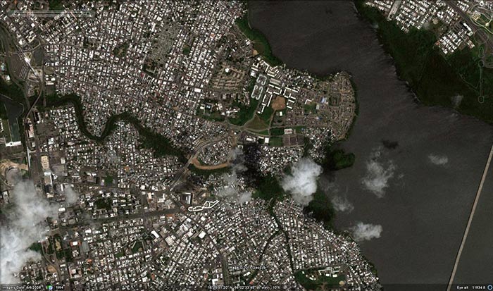
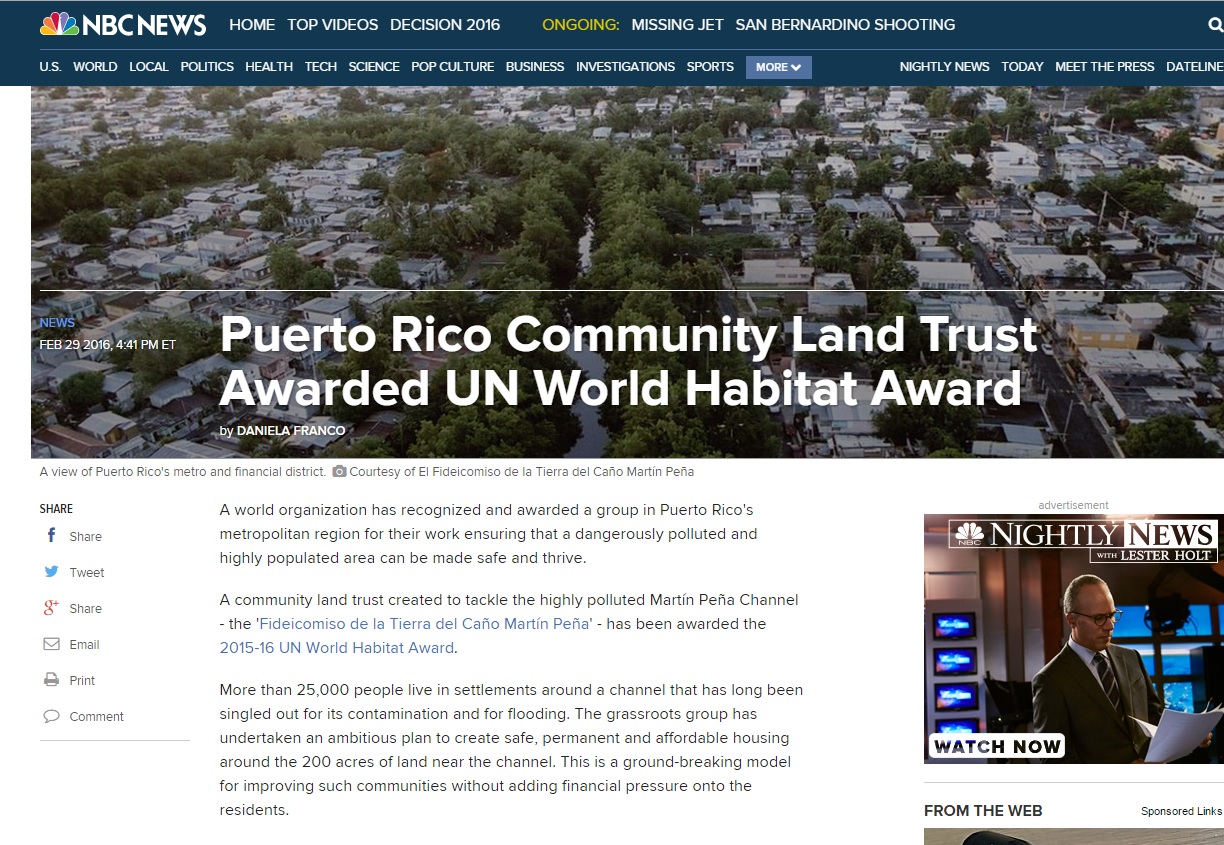
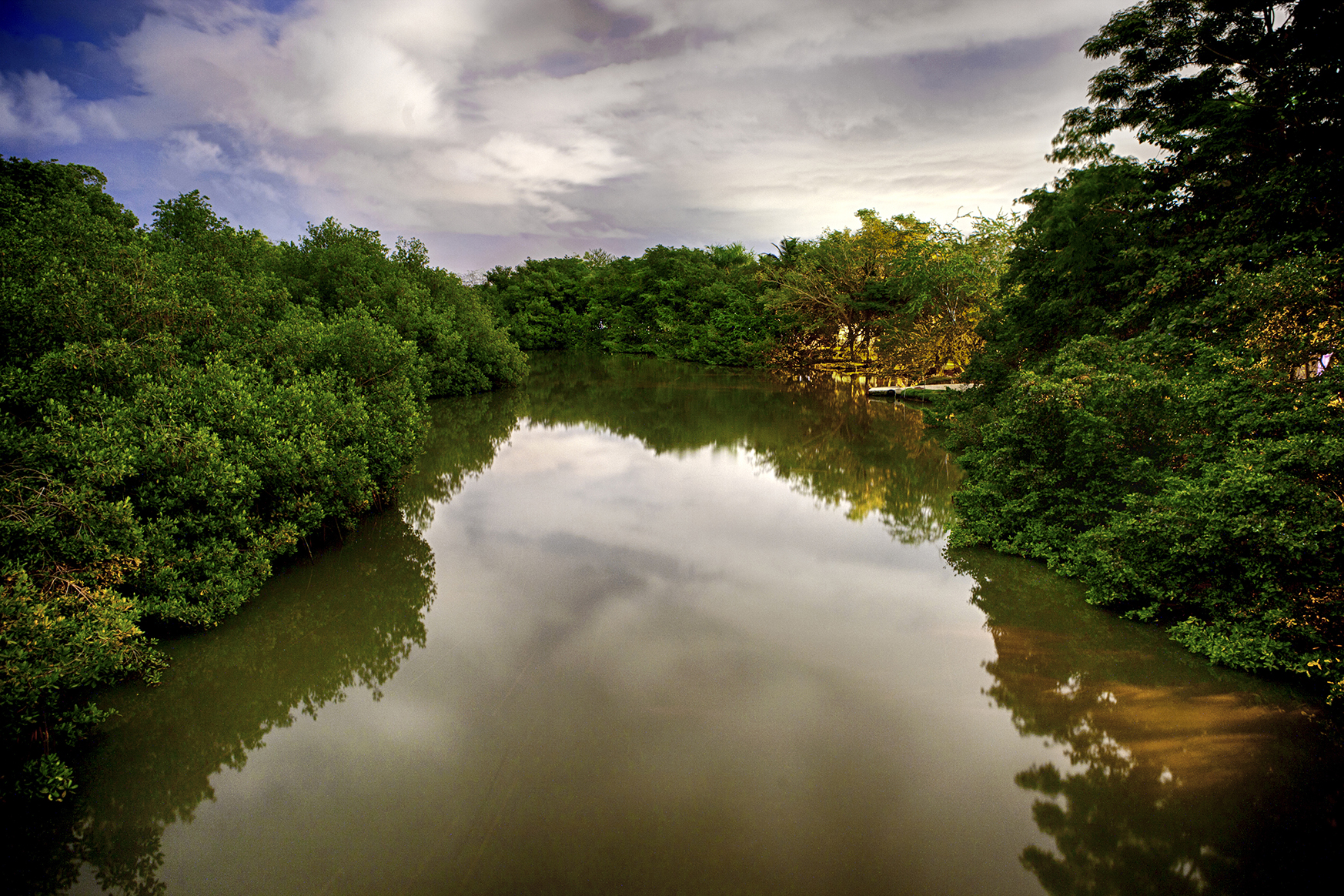
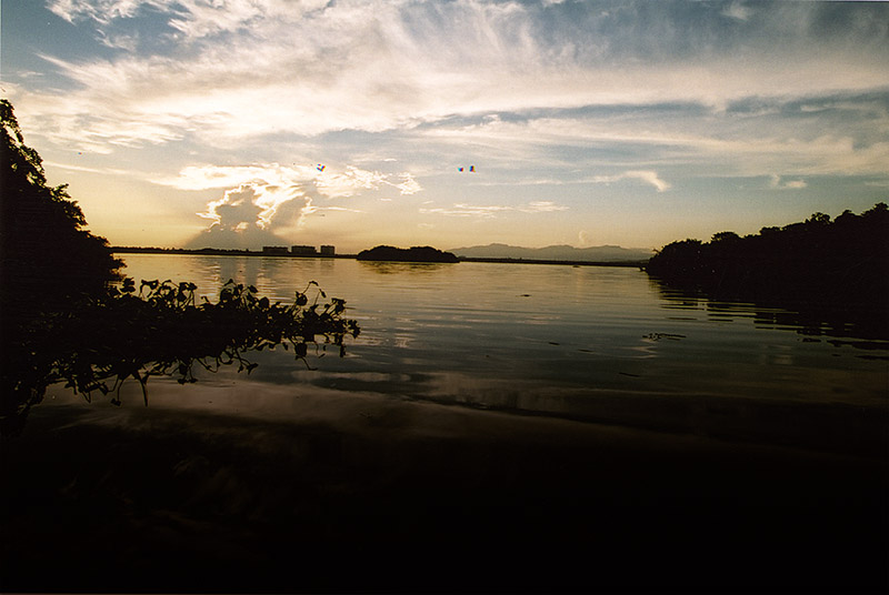
Caño Martín Peña, a 3.75-mile-long tidal channel, runs through the heart of the capital city. It connects the San José Lagoon with San Juan Bay, linking lagoons, wetlands, and canals in Piñones, Loíza, and Toa Baja, where rivers meet the sea. The channel is part of the San Juan Bay Estuary, one of 28 estuaries considered of national significance by the U.S. Environmental Protection Agency (EPA). Important natural, commercial, and tourist resources are located along the Estuary, such as the main seaport, airports, hotels, centuries-old communities, and urban centers.
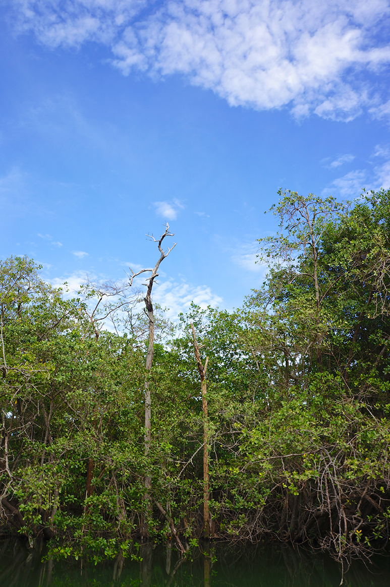
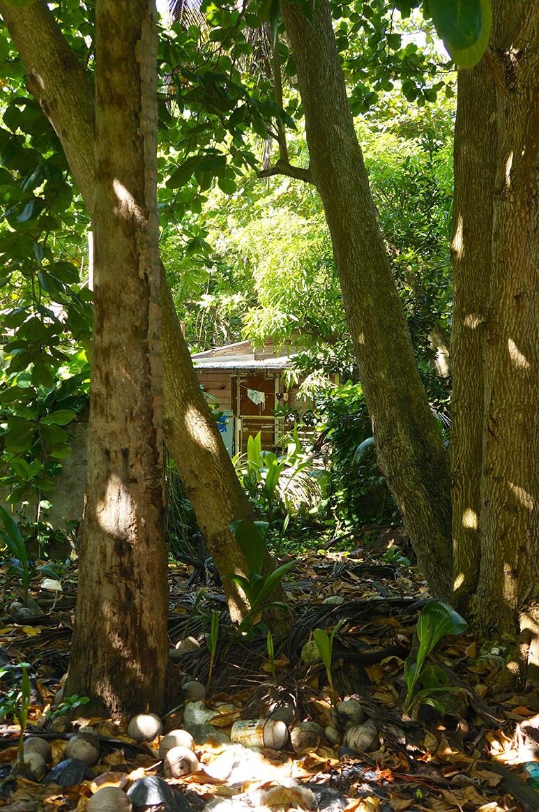
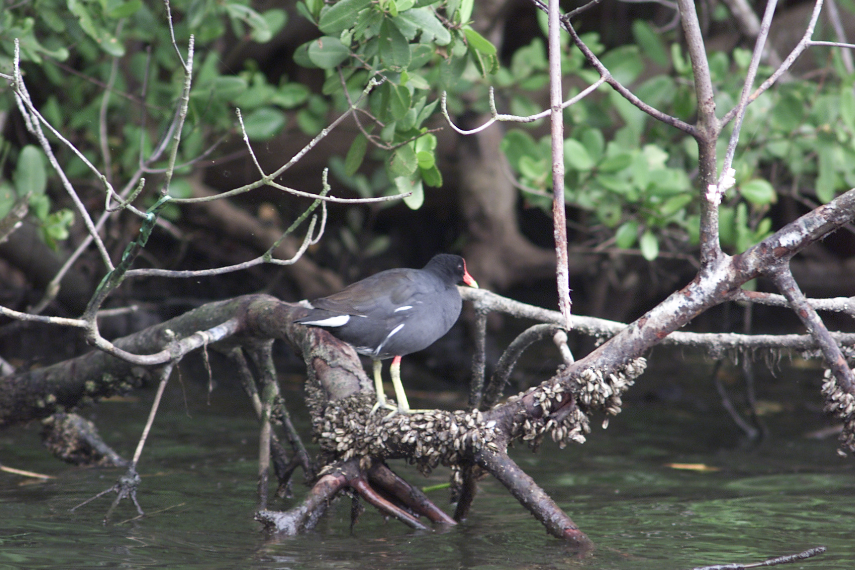
In the beginning of the 20th century, El Caño was a unique natural area, with dense mangrove forests and great biodiversity. Unable to support their families in the countryside, thousands of families were forced to relocate to the city in search of jobs, and began to fill in the wetlands along El Caño in order to have "land" on which to build their homes.
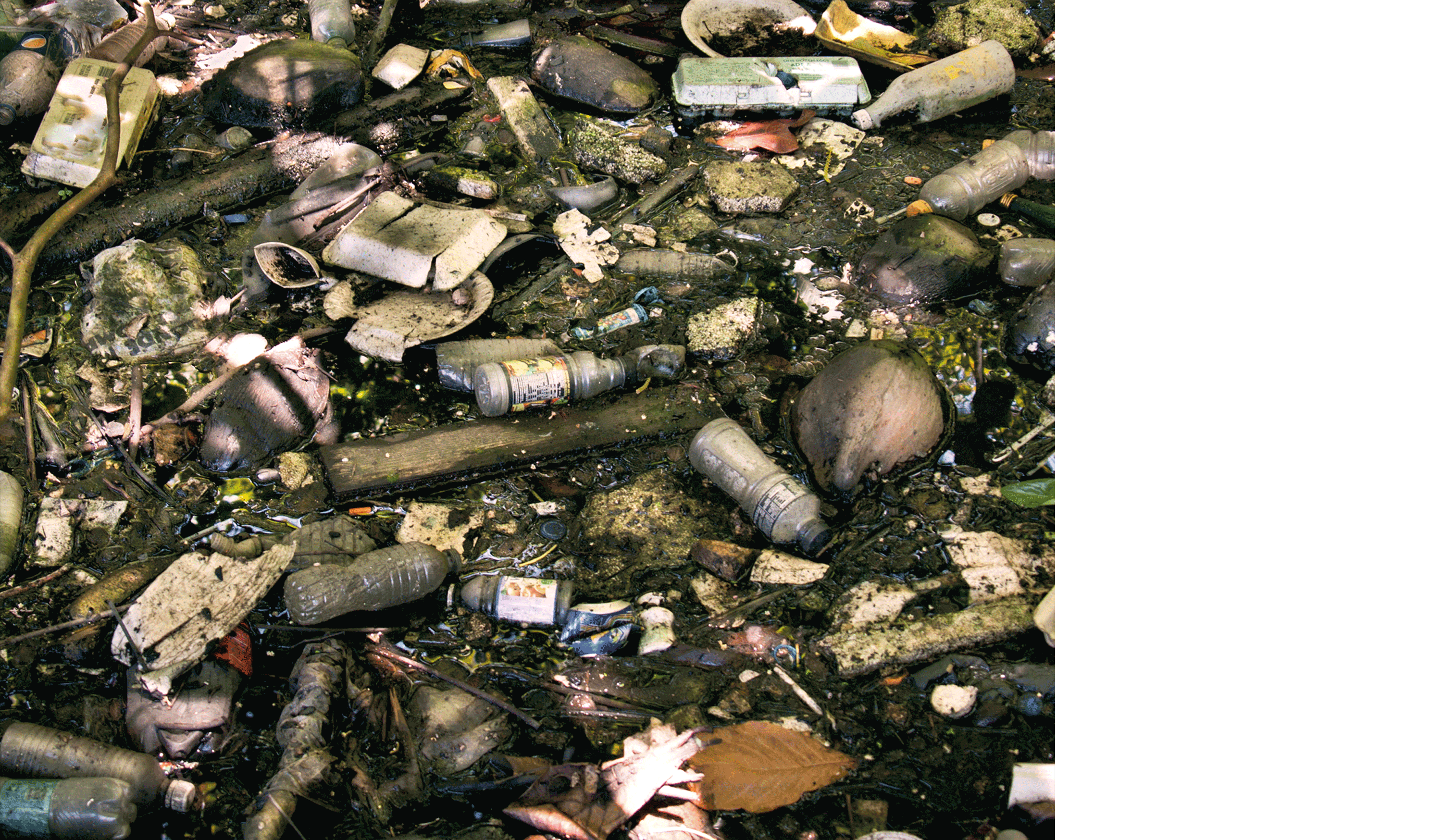
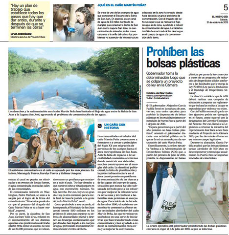
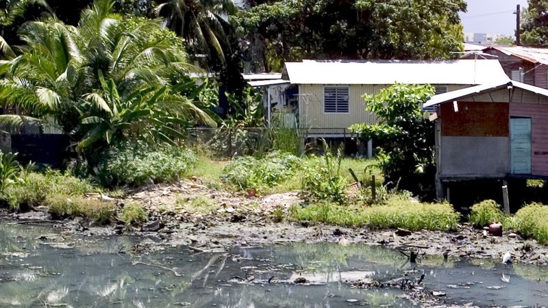
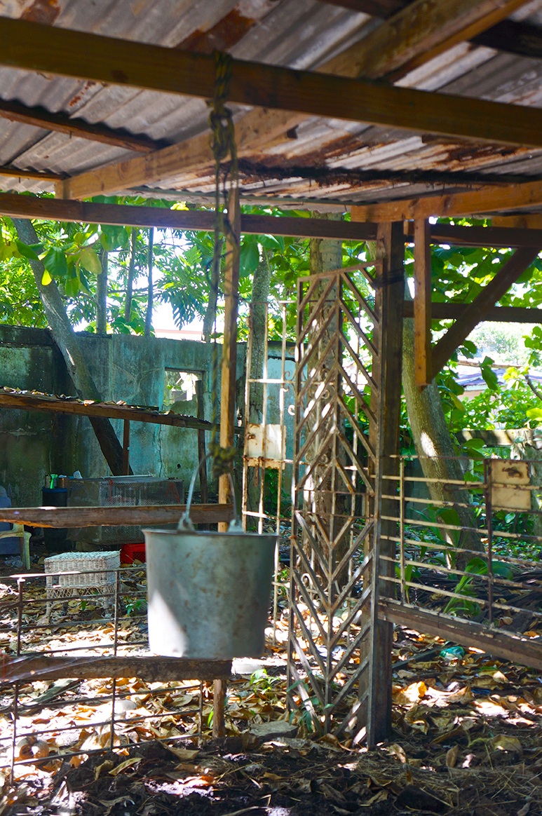
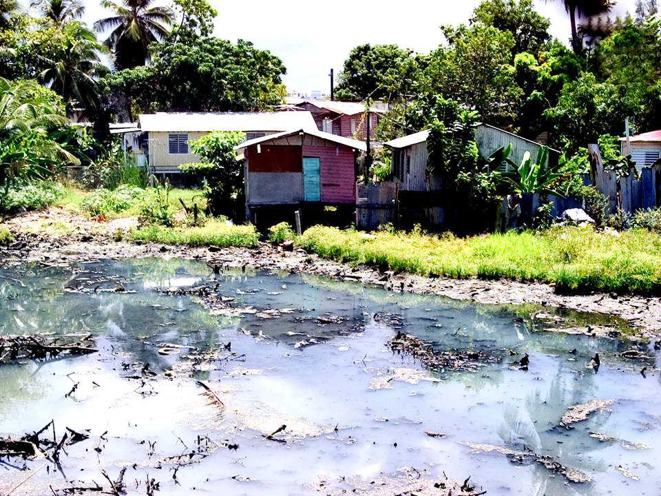
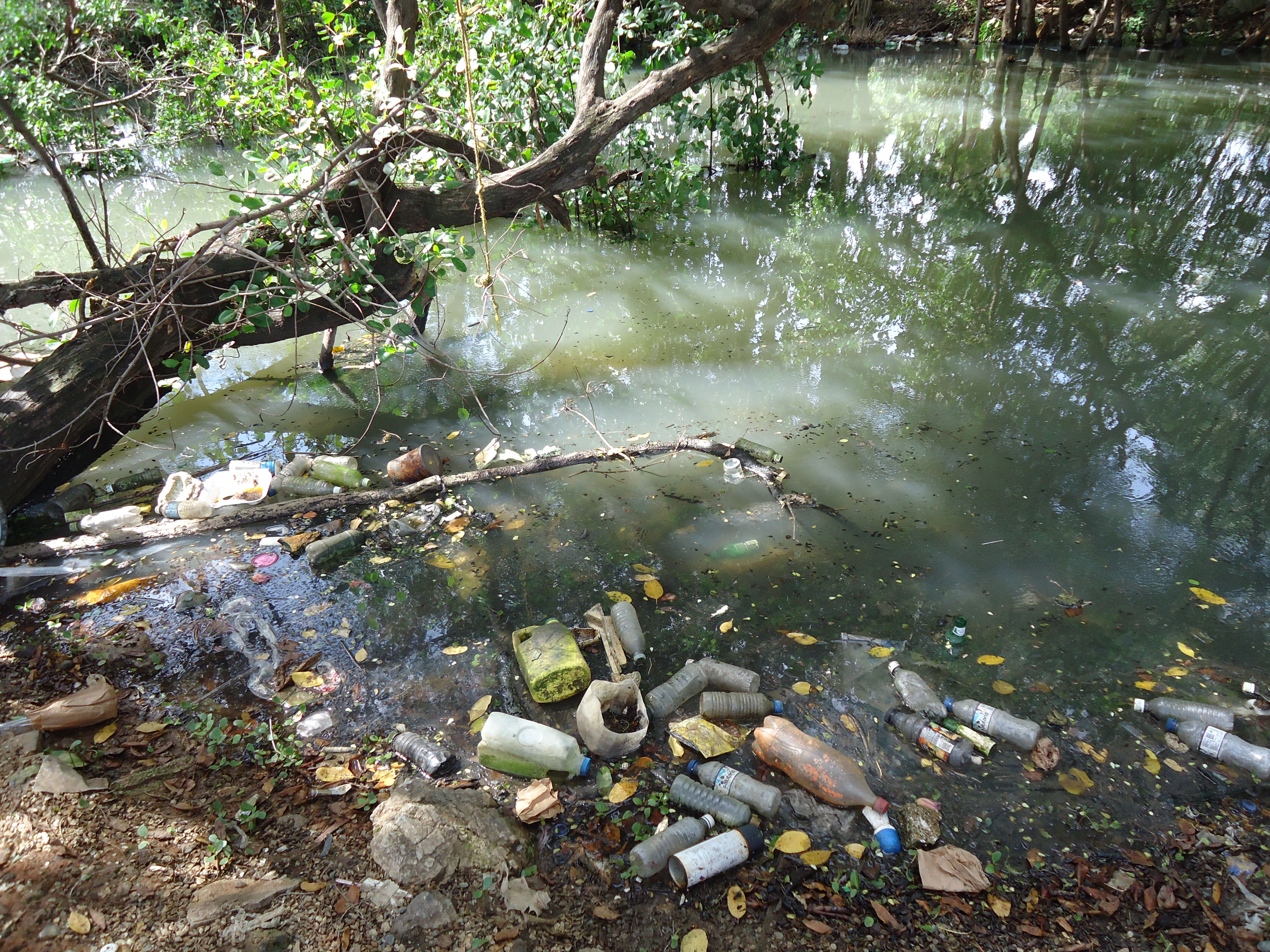
The historical process of informal settlement was encouraged by subsequent government administrations, but these did not provide a sewage system. Today, thousands of city homes and buildings discharge their sewage into the channel, which is plagued by high fecal coliform concentrations, garbage, and other pollutants.
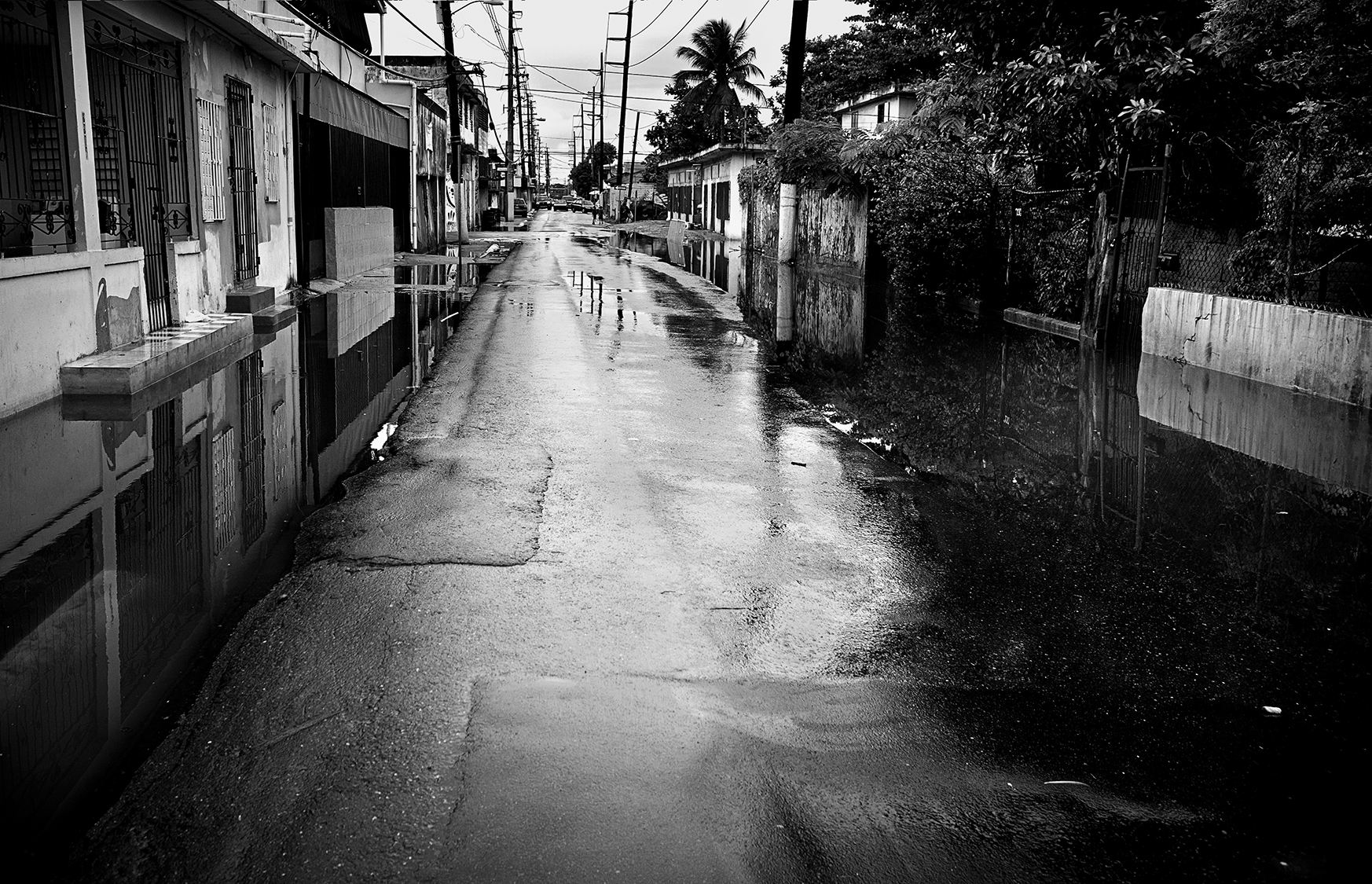
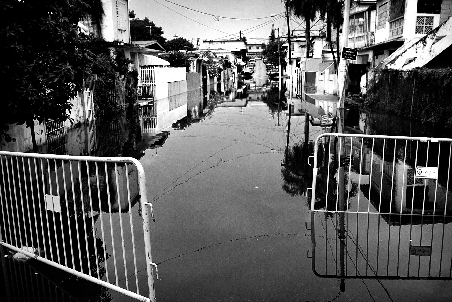
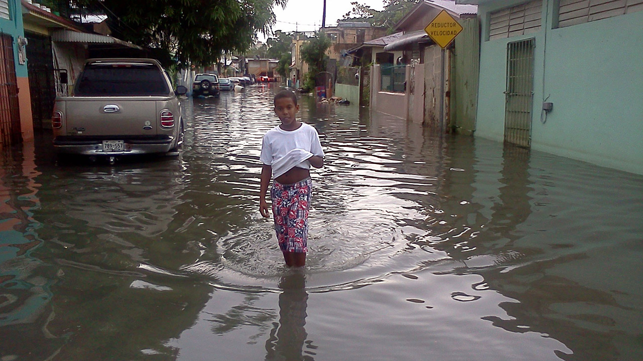
When it rains, El Caño overflows.
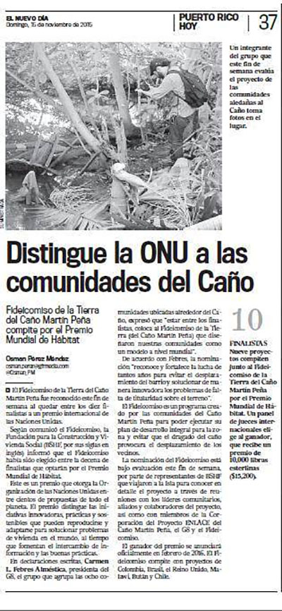
More parts of the city are at risk of flooding due to the clogging of the channel, which directly endangers the health of 26,000 residents in the eight communities along its path. Seventy percent of these families report flooding in their homes, streets, or schools, and are frequently forced to have direct contact with polluted waters, which cause gastrointestinal, skin, and respiratory ailments.
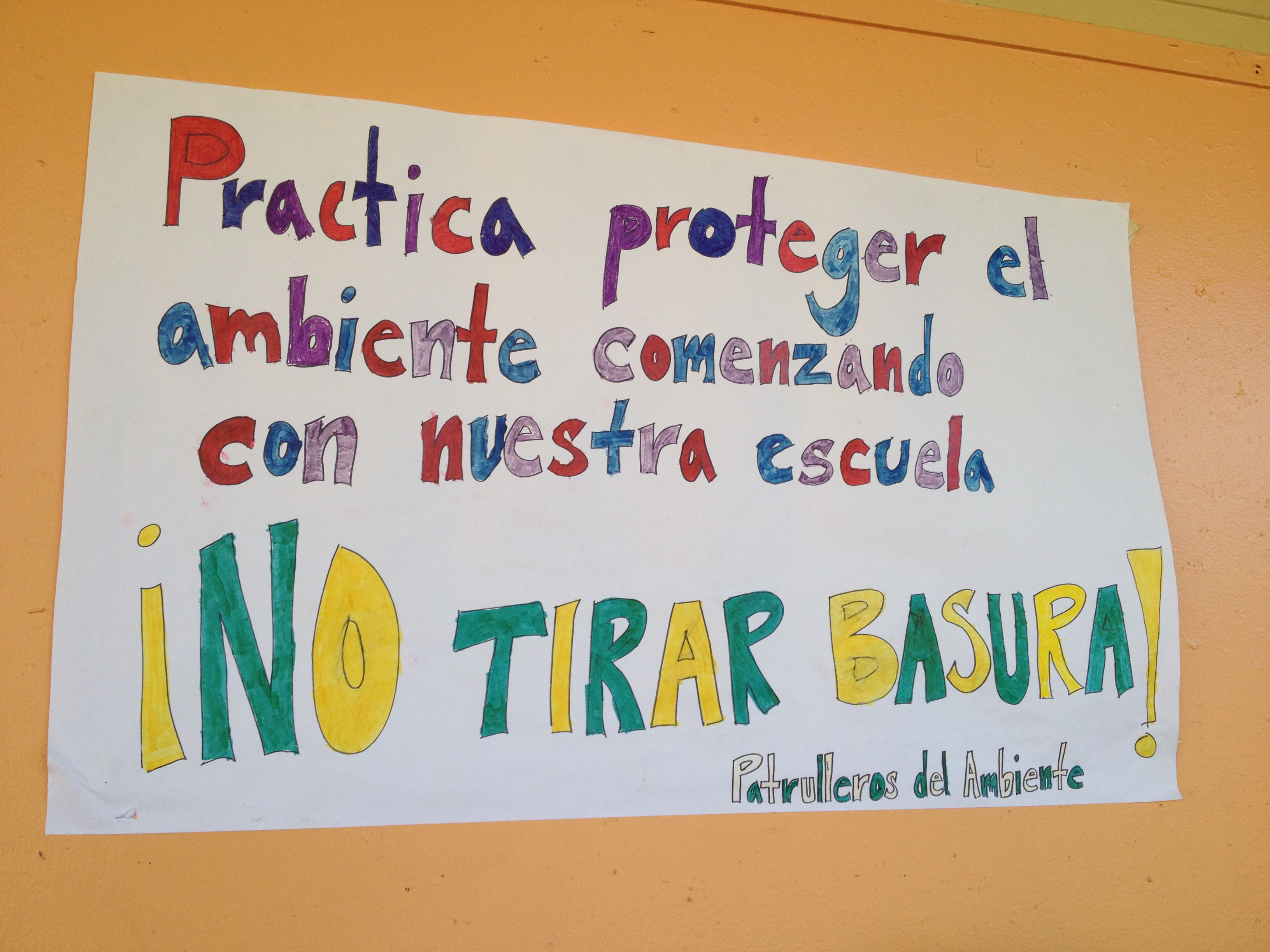
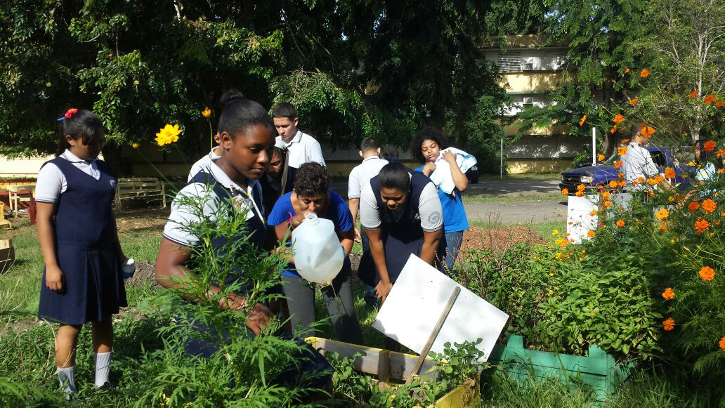
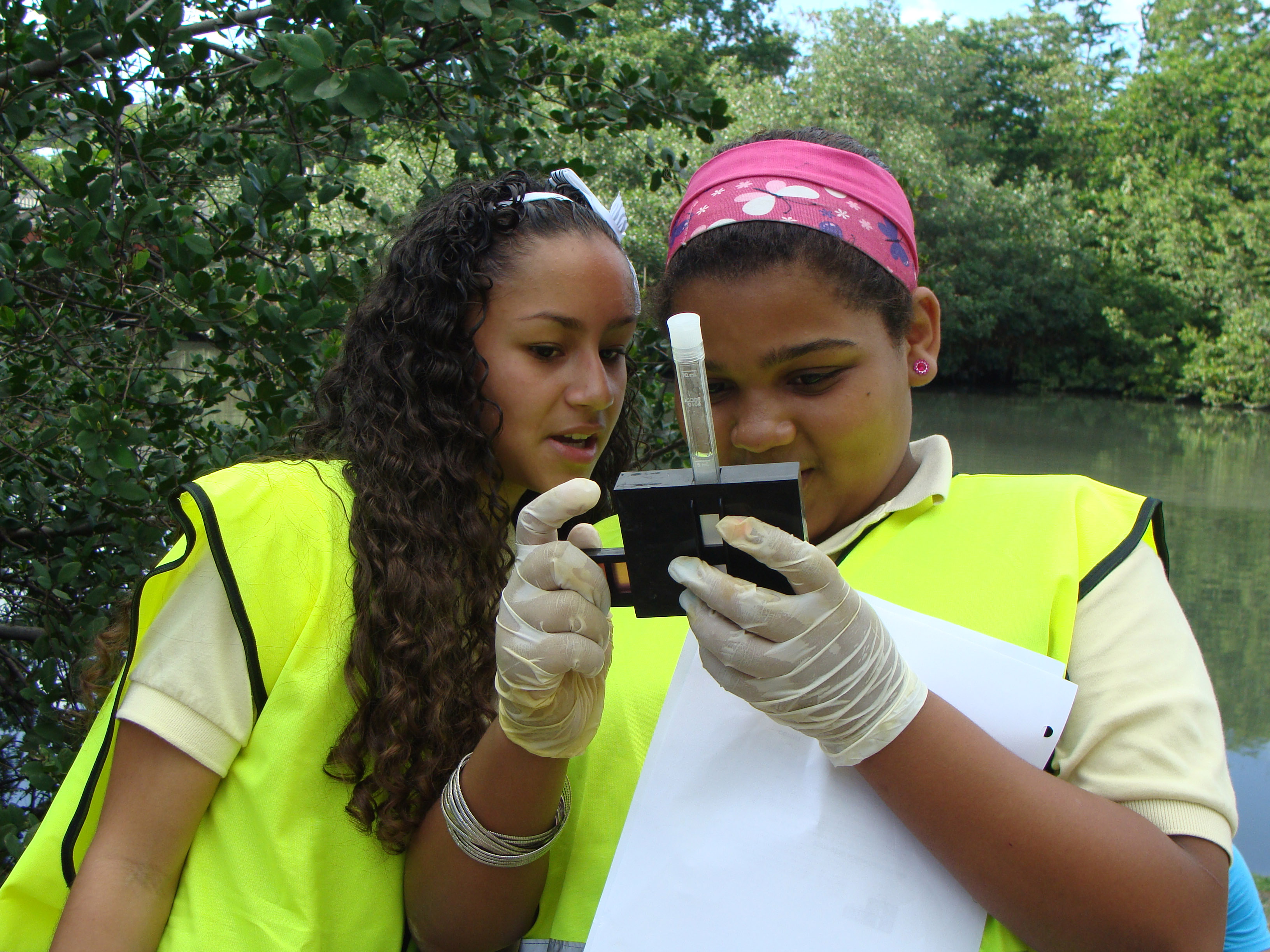
Citizen participation is the precept from which comprehensive, innovative solutions are set in motion for complex issues, thus fostering individual and collective action. The communities are protagonists, working tirelessly and joined together by a sense of solidarity and belonging.
Let it flow!
The restoration of Caño Martín Peña is a vital step for reconnecting the San Juan Bay Estuary, protecting vital infrastructure, and opening up new opportunities for Puerto Rico. It will provide a means for rediscovering the city and its diverse neighborhoods; for enjoying its waterways in kayaks or water taxis; and for promoting fishing and outdoors activities. It will create an additional ecological attraction for visitors, strengthen economic development, and improve life for all.
Join this environmental restoration and social transformation project, which is so important for our country.
|
The Caño Martín Peña ENLACE Project is the umbrella initiative encompassing the organizations that work together to bring about the dredging of the 3.75-mile Caño Martín Peña and the redevelopment of eight communities along its path, thereby helping to transform the city. |
|
G-8, Inc. |
❯ http://www.dragadomartinpena.org/ |
| |
The Group of Eight Communities Along the Caño Martín Peña, better known as G-8, is a nonprofit organization incorporated under the laws of the Commonwealth of Puerto Rico in June 28, 2004. Our organization consists of the leaders of the eight communities along the path of the Martín Peña waterway, thereby joining together the community-based, civic, and recreational organizations working in each of these communities. |
Our main purpose is to guarantee the perpetuity of these communities in accordance with the relocation processes proposed in the Comprehensive Development and Land Use Plan for the Caño Martín Peña Special Planning District. G-8, Inc. helped to create the law that recognizes community participation in the Caño Martín Peña District.
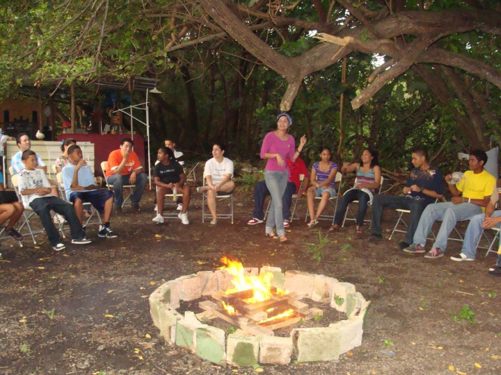
G-8 is composed of community leaders of the eight neighborhoods both north and south of the channel. These leaders are chosen in annual community assemblies. They serve voluntarily and their work revolves around every aspect of the many social projects developed under the ENLACE Project: from the struggle to dredge the channel to initiatives dealing with the serious health problems suffered by residents due to the condition of the waterway. Projects include programs for community children and teenagers, and business development.
 |
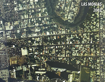 |
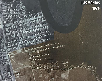
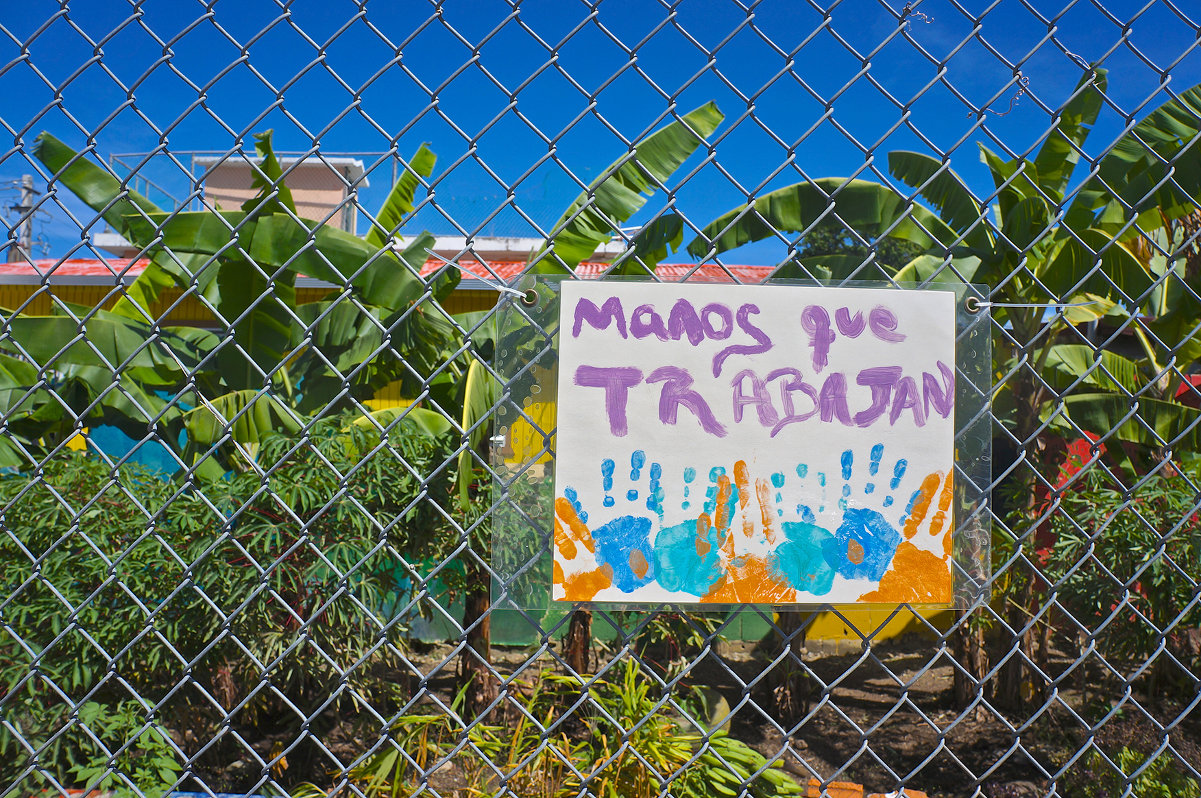
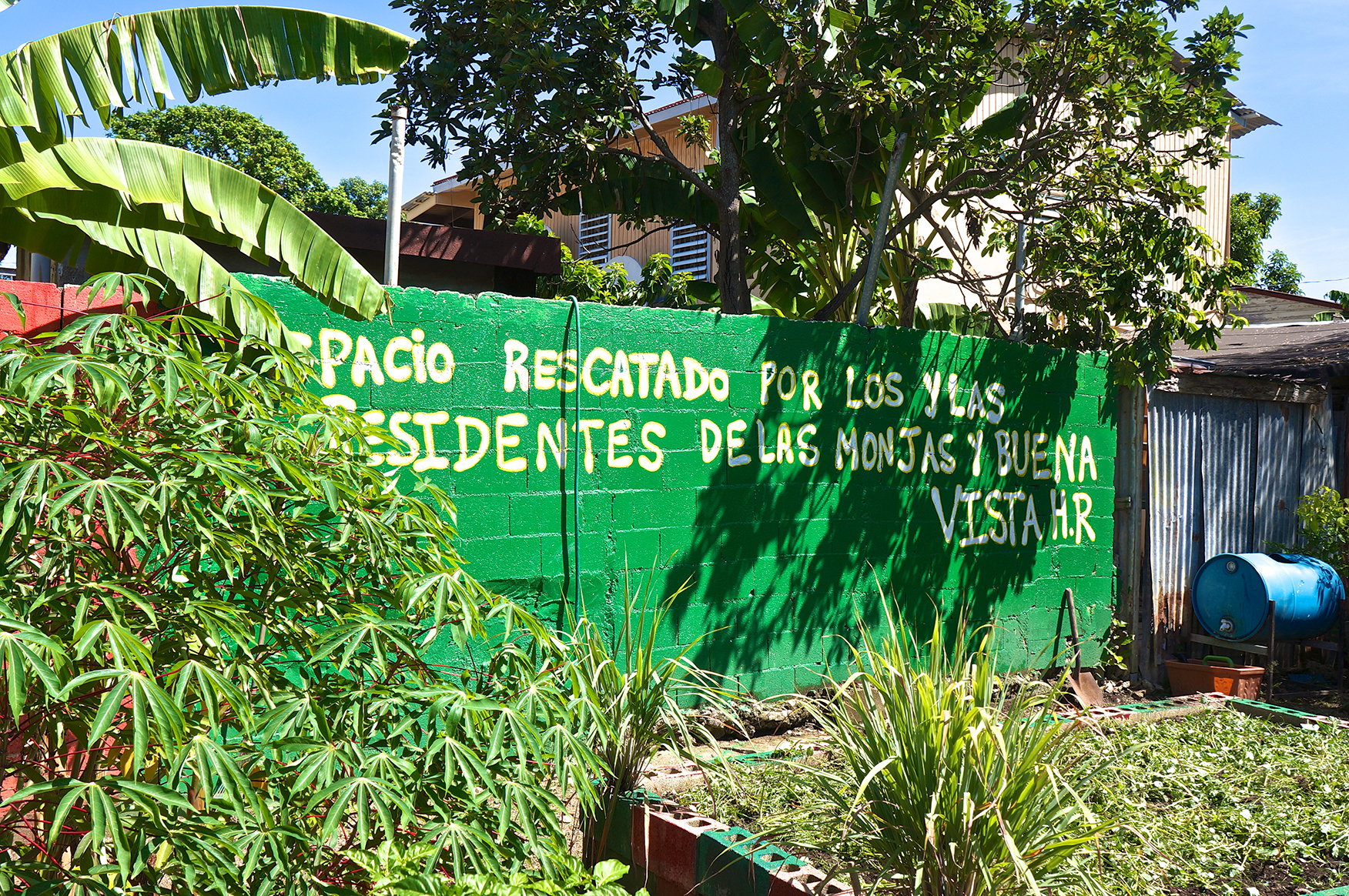
Located in Hato Rey, next to the financial district, Las Monjas is bordered to the north by Prudencio Rivera Street, on the south by Quisqueya Avenue, on the east by Pachín Marín Street, and on the west by Ponce de León Avenue. According to the Land Use Plan of the Municipality of San Juan, the first settlements of this community date back to 1714. Throughout history, however, its development was disorganized because from the beginning resident families were building structures on whatever land was available, without following a planned urban pattern.
Over the years, the community grew more dense and inward, enclosed inside its borders by the robust development of Hato Rey’s financial district. Inner alleys emerged in order to connect the backyards of homes, and additional houses were built there, resulting in a chaotic urban fabric. These alleys formed an unconventional landscape that resists documentation and has made it harder, not only to grant property titles to occupants, but also to provide basic public services. Same as Parada 27, Las Monjas neighbors Hato Rey’s Golden Mile and is bordered by two main roads: Ponce de León and Quisqueya Avenues. This privileged location, in turn, puts pressures on the community by raising the possibility of gentrification.
 |
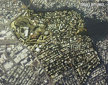 |
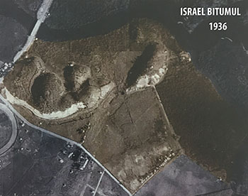
Israel was so named by Mita (founder of the Mita Congregation) herself, and is linked to Bitumul, a community named after a bituminous asphalt processing plant. This binomial lies in the Oriente neighborhood, in the Municipality of San Juan, and together they constitute one of the most populated communities in the District, only behind Barrio Obrero. This community is also one of the latest to be formed in the District. In the study made about the historical development of the communities along the Caño Martín Peña, the aerial registration of 1936 shows a non-operated area where it is still possible to see the mogotes that characterized that sector. By the 1950s the demolition of the mogotes featured in the 1936 pictures was almost complete. Both the marginal areas of the old quarries and the lands near the Caño were occupied by informal settlements, which even today characterize the sector.
 |
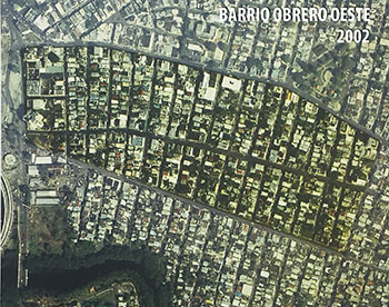 |
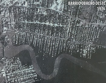
This town is located in a large bend of the Caño Martín Peña and has the shape of a peninsula. This community takes its name from the land that the Navy of the United States occupied in the sector. A railway that ran through Rexach Avenue connected Las Casas military camp. This informally settled community originated from the massive immigration of displaced rural workers, and makeshift shacks began lining up along streets extending southward from the original Barrio Obrero in the west.
The community has an excellent location, is bordered to the north by Rexach Avenue, to the south by the Caño, to the east by 15th Street, and to the west by Ponce de León Avenue.
 |
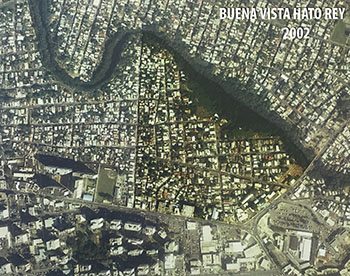 |
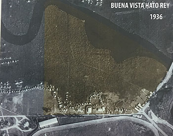
Located next to Hato Rey’s financial district, Buena Vista Hato Rey is bounded on the north by the Caño Martín Peña, on the south by Quisqueya Avenue, on the east by Barbosa Avenue, and on the west by Pachín Marín Street. In the 1936 Buena Vista Hato Rey aerial registration, some structures are already observed along what we know today as Quisqueya and Barbosa Avenues. However, it is not until the 1950 aerial photos—the period when the occupation of the Caño shores was booming—that the community appears settled for the first time. By 1962, it can be seen fully developed.
Buena Vista Hato Rey’s urban morphology shows traces of informal development, but it also has sectors that display an organized urban layout, mostly due to the rehabilitation projects carried out there in the 1970s. However, the existing conditions drawings give evidence of problems in the state of many structures.
Buena Vista Hato Rey is well located—the community serves as a meeting point between Barbosa and Quisqueya Avenues and is near another important highway: Franklin D. Roosevelt Avenue. It is bordered to the west by Las Monjas, and to the east by Israel-Bitumul. The potential of this community will be increased by projects such as the dredging of the waterway and the widening and realignment of Barbosa Avenue.
 |
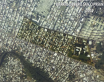 |
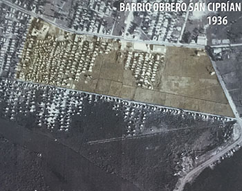
Despite being considered part of Barrio Obrero, this sector has a different origin. Far from being a planned community, the San Ciprián sector emerged from the parcelling of private estates and informal settlements of people displaced by Hurricane San Ciprián—which hit the island in 1932—, on land that was used as an animal cemetery. The eastern portion of San Ciprián, which is part of this community, was developed in a more organized way and largely includes infrastructure systems.
The community is bordered to the north by Borinquen Avenue, to the south by Rexach Avenue, to the east by Borinquen Avenue, and to the west by Cortijo Street.
 |
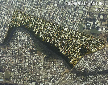 |
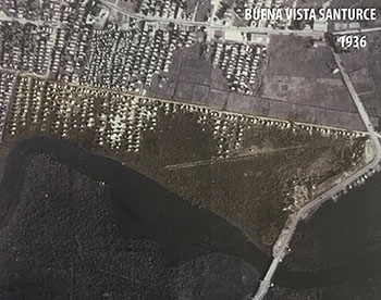
Buena Vista Santurce is the product of informal settlements established by hundreds of families who migrated from rural to urban areas in search of better living conditions, and occupied mangroves and swamps. Because of this, its infrastructure exhibits poor conditions, including a lack of sanitary sewers. The community is bordered to the north by Rexach Avenue, to the south by the Caño Martín Peña, to the east by 16th street, and to the west by Barbosa Avenue.
 |
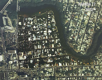 |
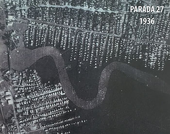
Parada 27 is one of the oldest communities in the District. Through the former Corporation for Housing and Urban Renewal (CRUV, by its Spanish acronym) and the residents’ cooperative, the co-owners of the structures obtained a title over the land. This development was complemented with infrastructure works.
The community is bordered to the north and to the east by the Caño Martín Peña, to the south by Prudencio Rivera Martínez street, and to the west by Ponce de León Avenue. At the intersection of Ponce de León Avenue and the Caño is the historic—and recently restored—Martín Peña Bridge.
The privileged location of Parada 27 is also the reason for its precariousness—its proximity to the Golden Mile financial zone, the Urban Train Hato Rey Station and the José Miguel Agrelot Coliseum makes it very vulnerable to market trends. One such indicator of development pressure is property value, which increased an annual 9% in the last decade, three times the growth in other District communities, except Barrio Obrero. This trend causes that large lots be used as ground parking spaces, meanwhile awaiting the possibility of changing uses and thus increase profitability for their owners.
 |
Before being settled in the early 20th century, the Cantera Peninsula was known as the Seboruco Estate, a land of unique beauty, with scattered mogotes fully covered in vegetation and surrounded by the Corozos and San José lagoons and the Caño Martín Peña.
The economic transformation that marked the beginning of that century caused a great migration from rural areas to San Juan, in search of better opportunities. So it was that the first slums in the Peninsula came to be formed, its inhabitants drawn to the jobs offered by Las Casas Military Camp during World War I. In later years, other sources of employment in the Peninsula continued to attract migrants, such as Las Casas Racetrack and a quarry (cantera) owned by the Rexach family.
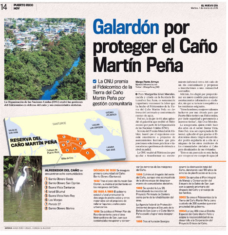
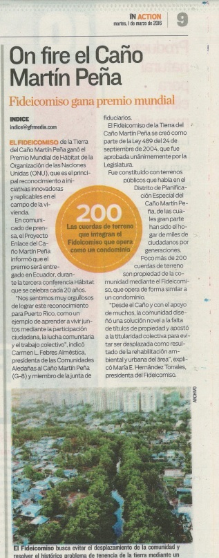
| The Community Land Trust (Fideicomiso de la Tierra) is the primary mechanism though which the eight communities surrounding Caño Martín Peña are overcoming poverty. It manages the approximately 200 acres of public lands in the Special Planning District area that were transferred by the government to the Enlace Project. Residents are proprietors of their housing units, which they may sell, rent, or mortgage; they collectively own the land itself. The Community Land Trust has solved the historical issue of lack of legal access to the land. It will enable reinvestment in the area when the value of the land increases with the dredging of the channel. The lack of land titles hindered, among other things, residents’ access to the loans and construction permits needed to improve their homes. The Community Land Trust is thus making development and access to safe and decent housing possible. |
| It also ensures the survival of the community by keeping market forces from displacing residents when the value of the land where their homes are located eventually increases, in an area situated in the heart of capital city, near the Hato Rey financial district and the Urban Train system. |
Once the work of the Enlace Project is completed, the Community Land Trust will continue to drive the comprehensive, sustainable development of the Caño Martín Peña Special Planning District. A unique model of social justice in Puerto Rico, it has already proven to be successful in the United States, where over 247 Community Land Trusts promote the revitalization of marginalized communities in order to ensure their permanence.
Declaración de Impacto Ambiental
|
Evaluación del Impacto a la Salud
|
Transforming a City |


Available:
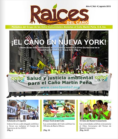 |
Raíces del Caño - august 2015 |